MyTopo
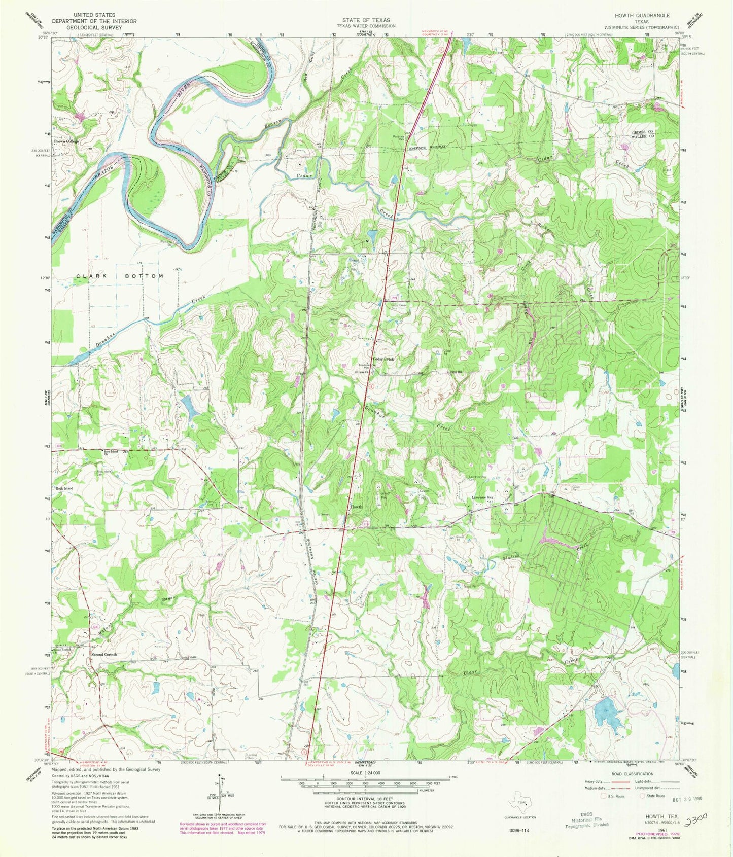
Classic USGS Howth Texas 7.5'x7.5' Topo Map
Couldn't load pickup availability
Historical USGS topographic quad map of Howth in the state of Texas. Typical map scale is 1:24,000, but may vary for certain years, if available. Print size: 24" x 27"
This quadrangle is in the following counties: Grimes, Waller, Washington.
The map contains contour lines, roads, rivers, towns, and lakes. Printed on high-quality waterproof paper with UV fade-resistant inks, and shipped rolled.
Contains the following named places: Beason Creek, Big Sandy Creek, Brown College, Cedar Creek, Cedar Creek Cemetery, Center Hill Church, Gladish Creek, Lawrence Key, Lawrence Key Cemetery, Red Gully, Rock Island Cemetery, Rock Island Church, Rocky Creek, Saint Luke Church, Salem Cemetery, Second Corinth Church, West Cemetery, Clark Bottom, Cedar Creek, Howth, Second Corinth, Los Robles Lake, Rolling Hills Dam, Rolling Hills Lake, Becker Lake Dam, Becker Lake, Rolling Hills, Weeski Ranch Airport