MyTopo
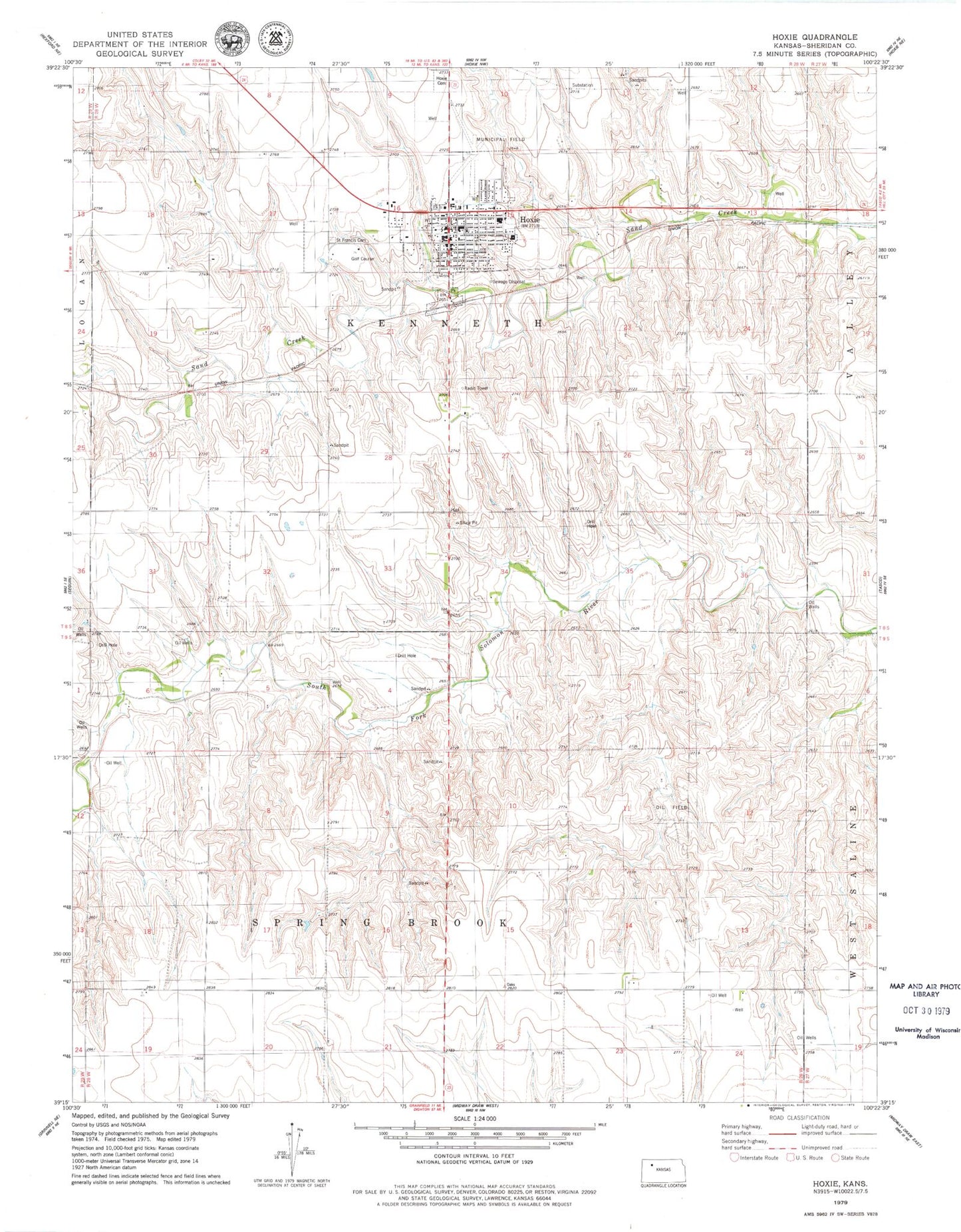
Classic USGS Hoxie Kansas 7.5'x7.5' Topo Map
Couldn't load pickup availability
Historical USGS topographic quad map of Hoxie in the state of Kansas. Map scale may vary for some years, but is generally around 1:24,000. Print size is approximately 24" x 27"
This quadrangle is in the following counties: Sheridan.
The map contains contour lines, roads, rivers, towns, and lakes. Printed on high-quality waterproof paper with UV fade-resistant inks, and shipped rolled.
Contains the following named places: City of Hoxie, First Presbyterian Church, Hi-Plains Co - Operative Association Grain Elevator Number 4, Hoxie, Hoxie Cemetery, Hoxie Christian Church, Hoxie Church of Christ, Hoxie Elementary School, Hoxie Golf Club, Hoxie Junior / Senior High School, Hoxie Police Department, Hoxie Post Office, Hoxie Wastewater Treatment Facility, Hoxie-Sheridan County Airport, Immanuel Lutheran Church, Living Word Fellowship Church, Mickey's Museum, Saint Francis Cabrini Catholic Church, Saint Francis Cemetery, Sheridan County, Sheridan County Courthouse, Sheridan County Emergency Medical Services, Sheridan County Hospital, Sheridan County Jail, Sheridan County Public Health Department, Sheridan County Public Library, Sheridan County Rural Fire District 1 Hoxie Station, Sheridan County Sheriff's Office, Township of Kenneth