MyTopo
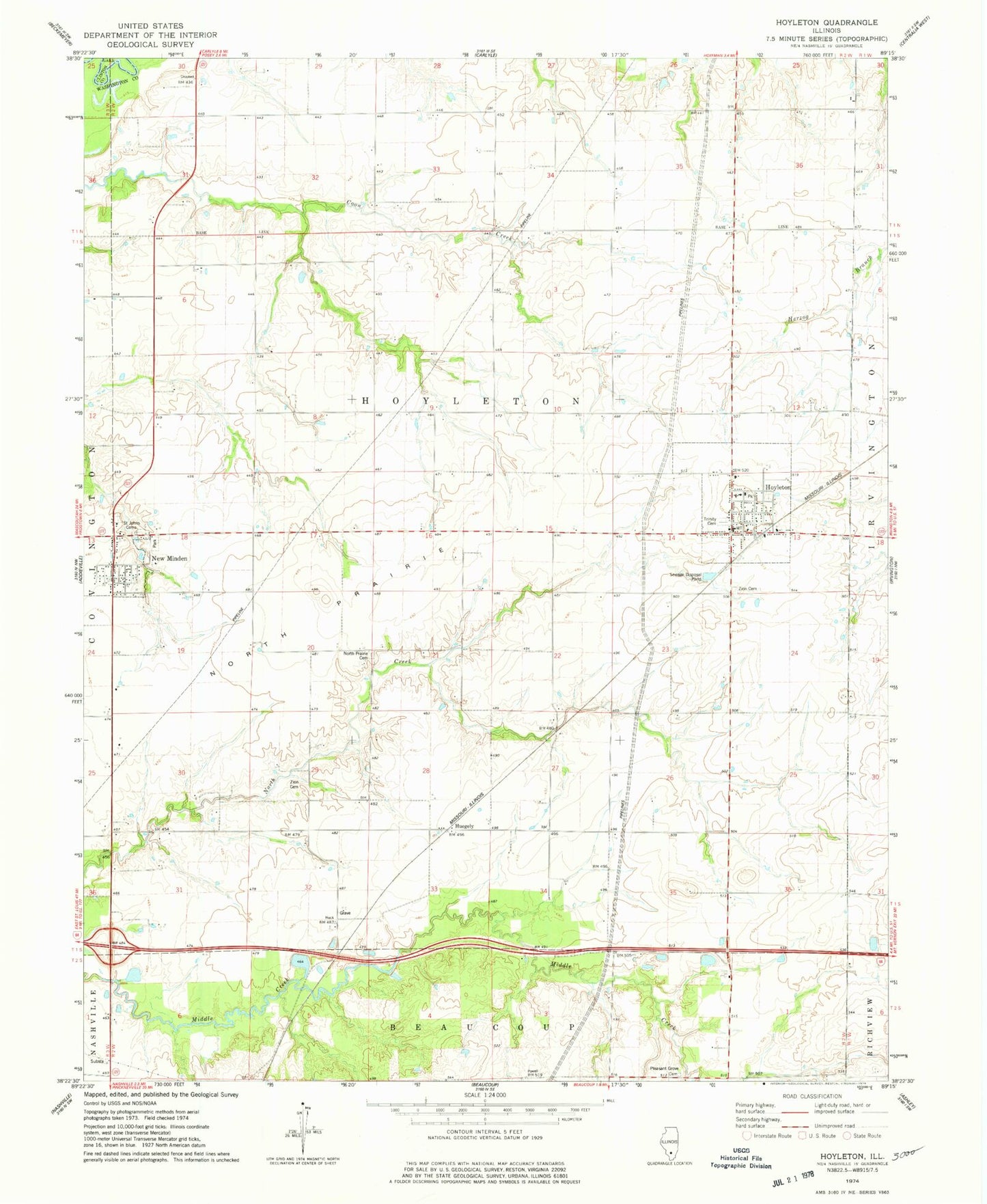
Classic USGS Hoyleton Illinois 7.5'x7.5' Topo Map
Couldn't load pickup availability
Historical USGS topographic quad map of Hoyleton in the state of Illinois. Map scale may vary for some years, but is generally around 1:24,000. Print size is approximately 24" x 27"
This quadrangle is in the following counties: Clinton, Washington.
The map contains contour lines, roads, rivers, towns, and lakes. Printed on high-quality waterproof paper with UV fade-resistant inks, and shipped rolled.
Contains the following named places: Cemetery, Elm Point School, Haun School, Hoyleton, Hoyleton Community Fire Protection District New Minden Station, Hoyleton Consolidated Elementary School, Hoyleton Fire Protection District, Hoyleton Post Office, Huegely, New Minden, North Prairie, North Prairie Cemetery, North Prairie Church, Pleasant Grove Cemetery, Pleasant Grove School, Saint Johns Cemetery, Saint Johns School, Sassafras School, Township of Hoyleton, Trinity Cemetery, Trinity Lutheran Church, Trinity Lutheran School, Unverfehrt Stock Farm, Village of Hoyleton, Village of New Minden, Walnut School, Zion Cemetery, Zion Evangelical United Church, ZIP Code: 62803