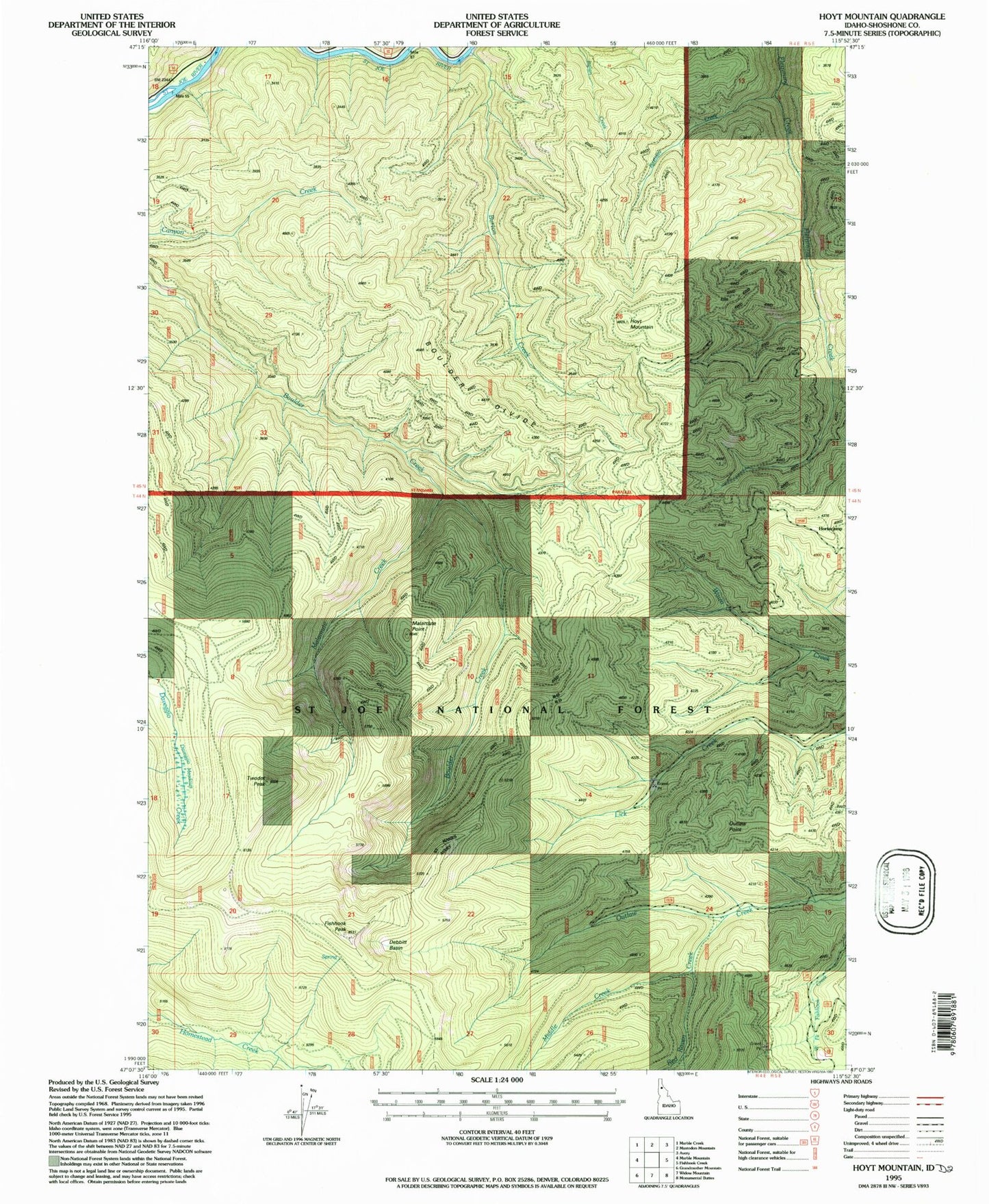
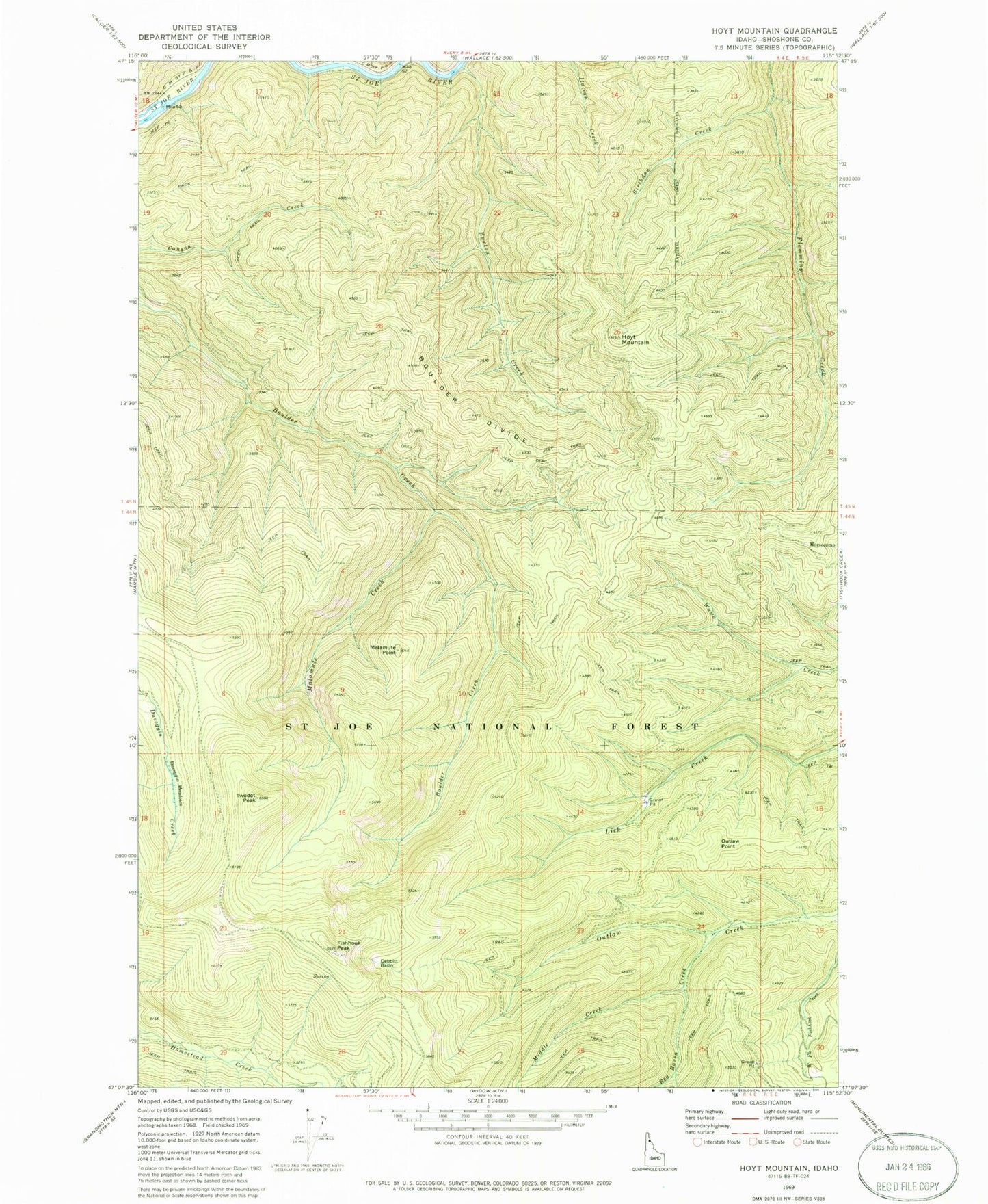
MyTopo
Classic USGS Hoyt Mountain Idaho 7.5'x7.5' Topo Map
Regular price
$16.95
Regular price
Sale price
$16.95
Unit price
per
Couldn't load pickup availability
Historical USGS topographic quad map of Hoyt Mountain in the state of Idaho. Map scale may vary for some years, but is generally around 1:24,000. Print size is approximately 24" x 27"
This quadrangle is in the following counties: Shoshone.
The map contains contour lines, roads, rivers, towns, and lakes. Printed on high-quality waterproof paper with UV fade-resistant inks, and shipped rolled.
Contains the following named places: Birthday Creek, Boulder Divide, Burton Creek, Daveggio Meadows, Debbitt Basin, Fishhook Peak, Horsecamp, Hoyt Mountain, Malamute Creek, Malamute Point, Middle Creek, Outlaw Point, Red Raven Creek, Saint Joe National Forest, Twodot Peak