MyTopo
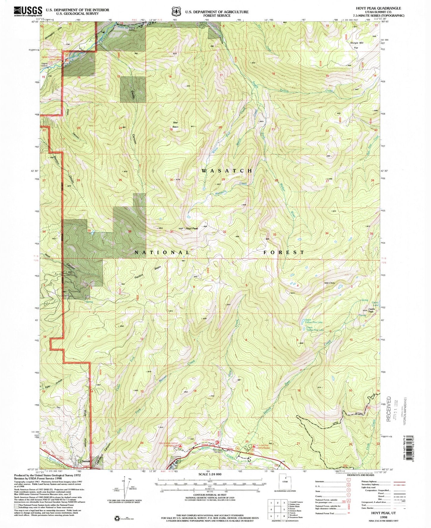
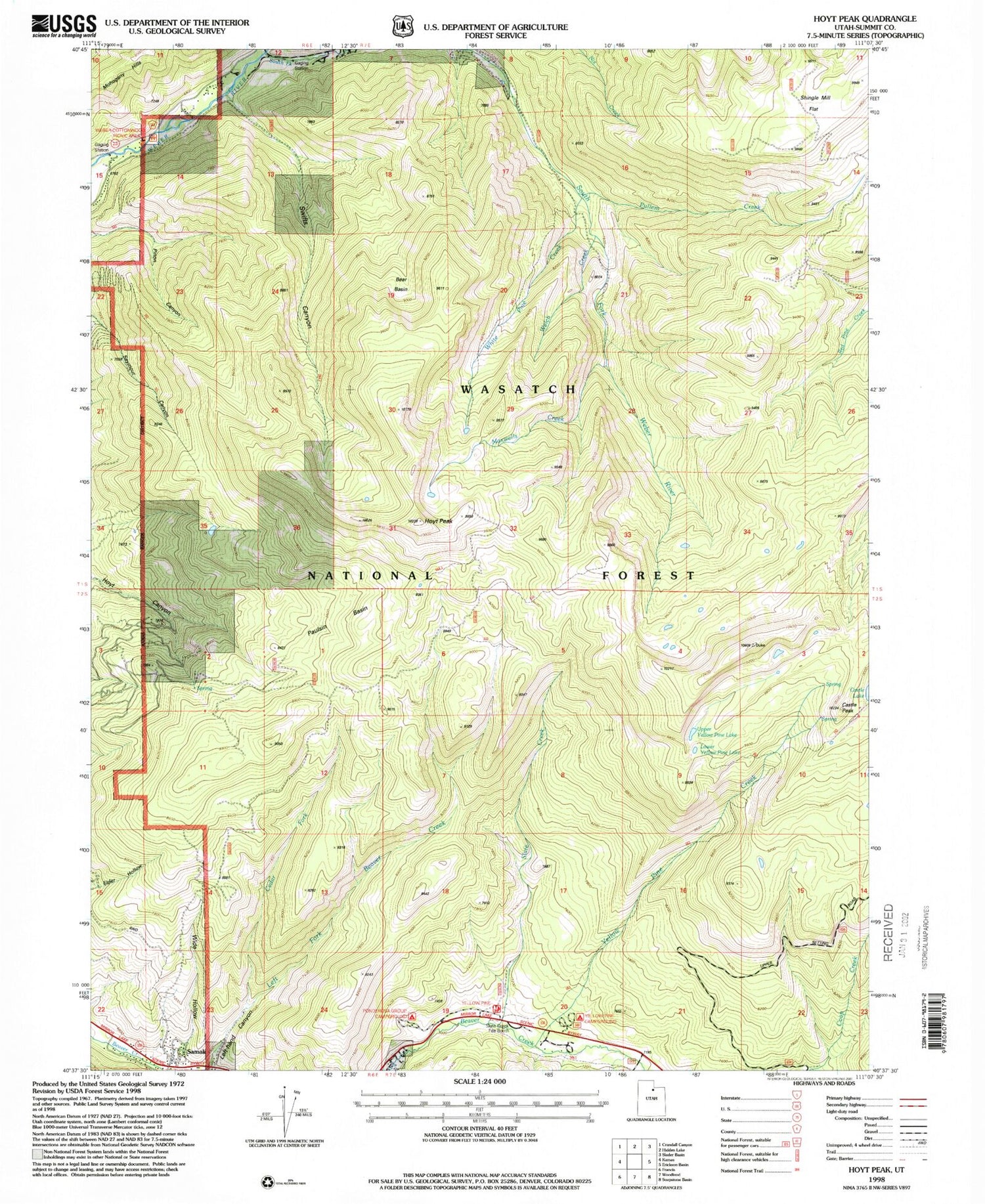
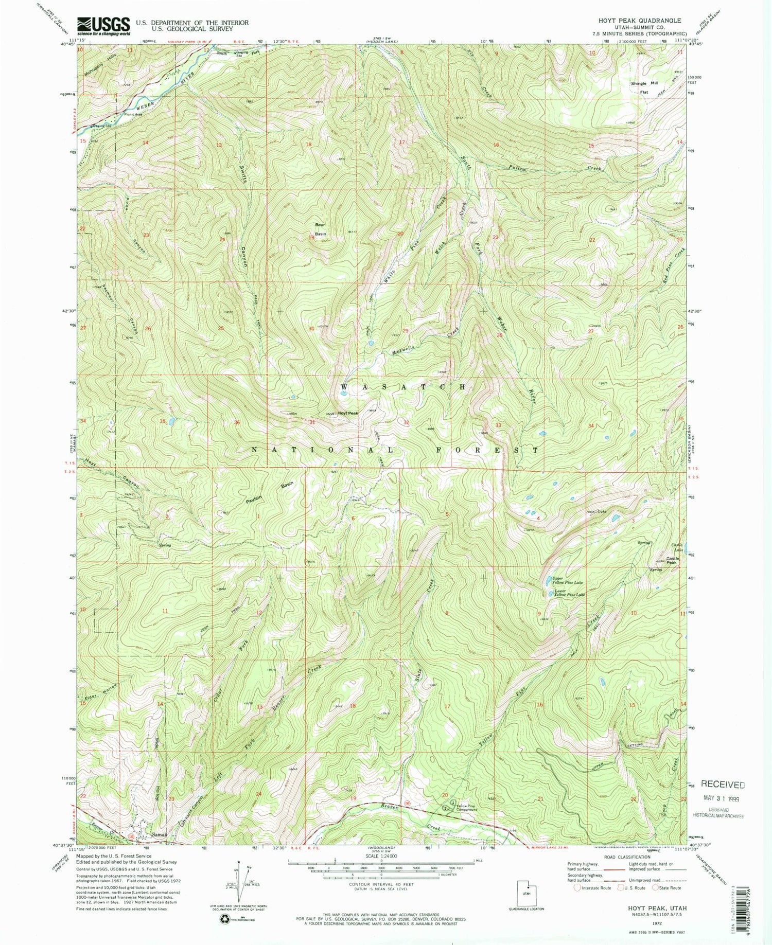
Classic USGS Hoyt Peak Utah 7.5'x7.5' Topo Map
Couldn't load pickup availability
Historical USGS topographic quad map of Hoyt Peak in the state of Utah. Typical map scale is 1:24,000, but may vary for certain years, if available. Print size: 24" x 27"
This quadrangle is in the following counties: Summit.
The map contains contour lines, roads, rivers, towns, and lakes. Printed on high-quality waterproof paper with UV fade-resistant inks, and shipped rolled.
Contains the following named places: Bear Basin, Castle Peak, Cedar Fork, Hoyt Peak, Left-hand Canyon, Lower Yellow Pine Lake, Maxwells Creek, Nobletts Creek, Paulsin Basin, Pullem Creek, Shingle Mill Flat, Slate Creek, South Fork Weber River, Swifts Canyon, Upper Yellow Pine Lake, Welch Creek, White Pine Creek, Wide Hollow, Yellow Pine Campground, Yellow Pine Creek, Wasatch National Forest, Castle Lake, Kamas Wildlife Management Area, Weber Cottonwood Recreation Site, Samak Census Designated Place