MyTopo
Classic USGS Hualalai Hawaii 7.5'x7.5' Topo Map
Couldn't load pickup availability
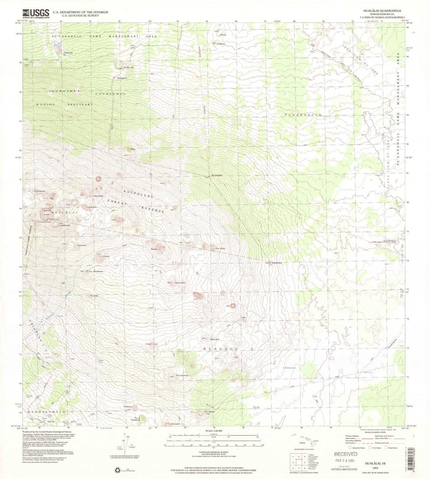
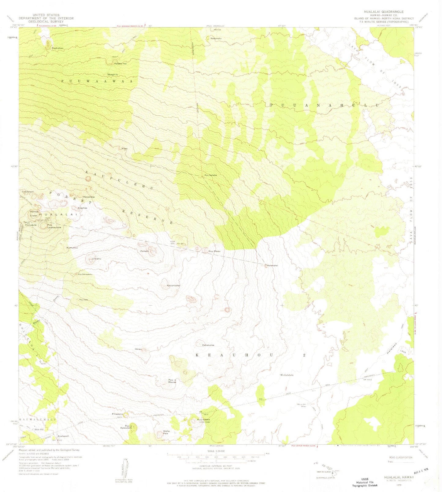
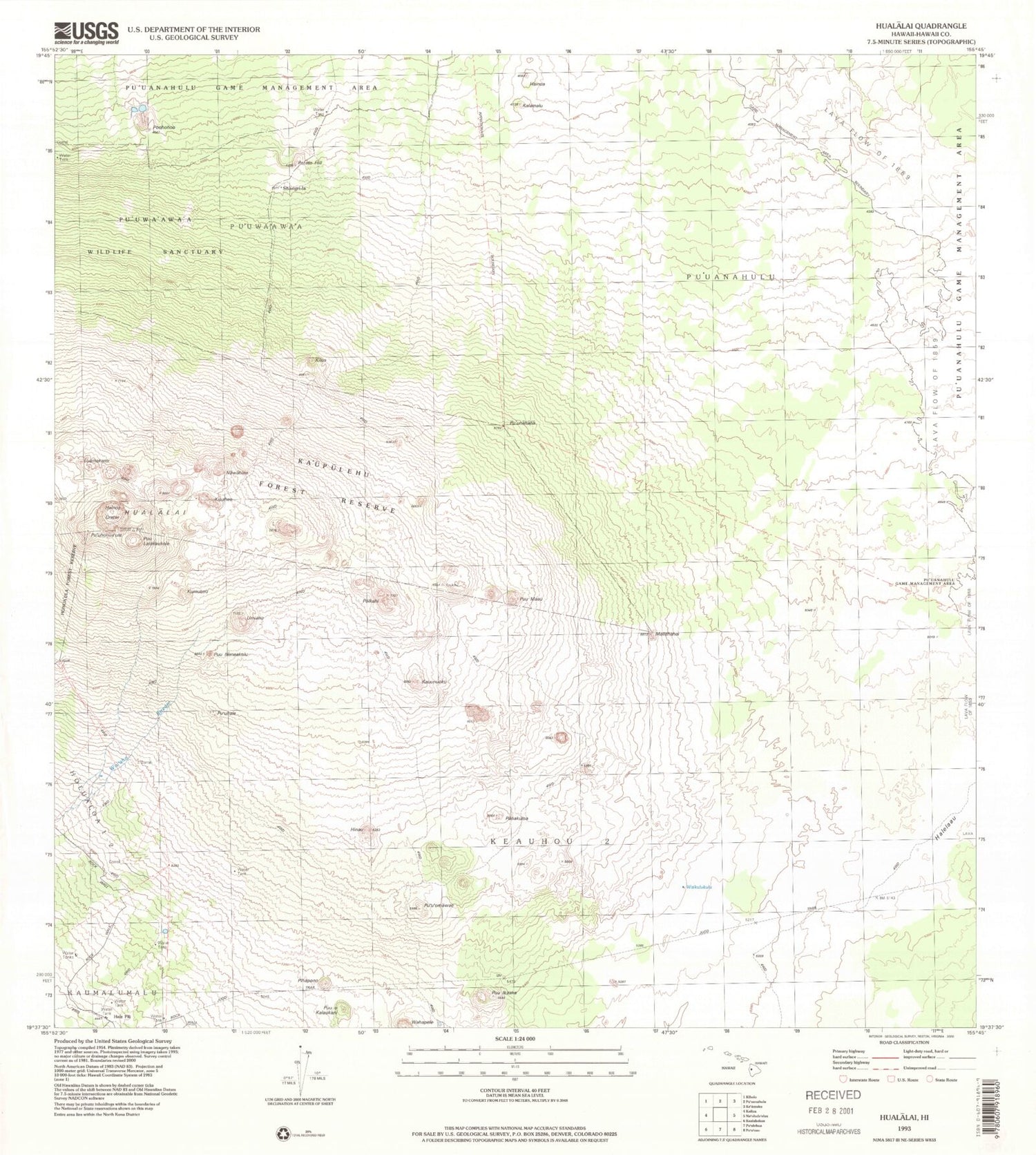
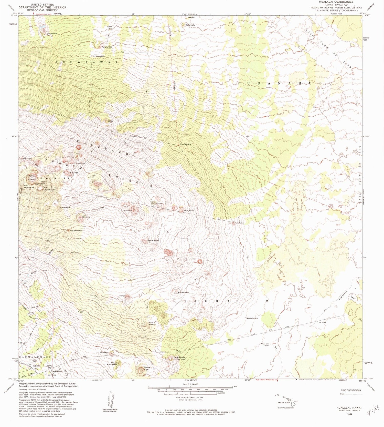
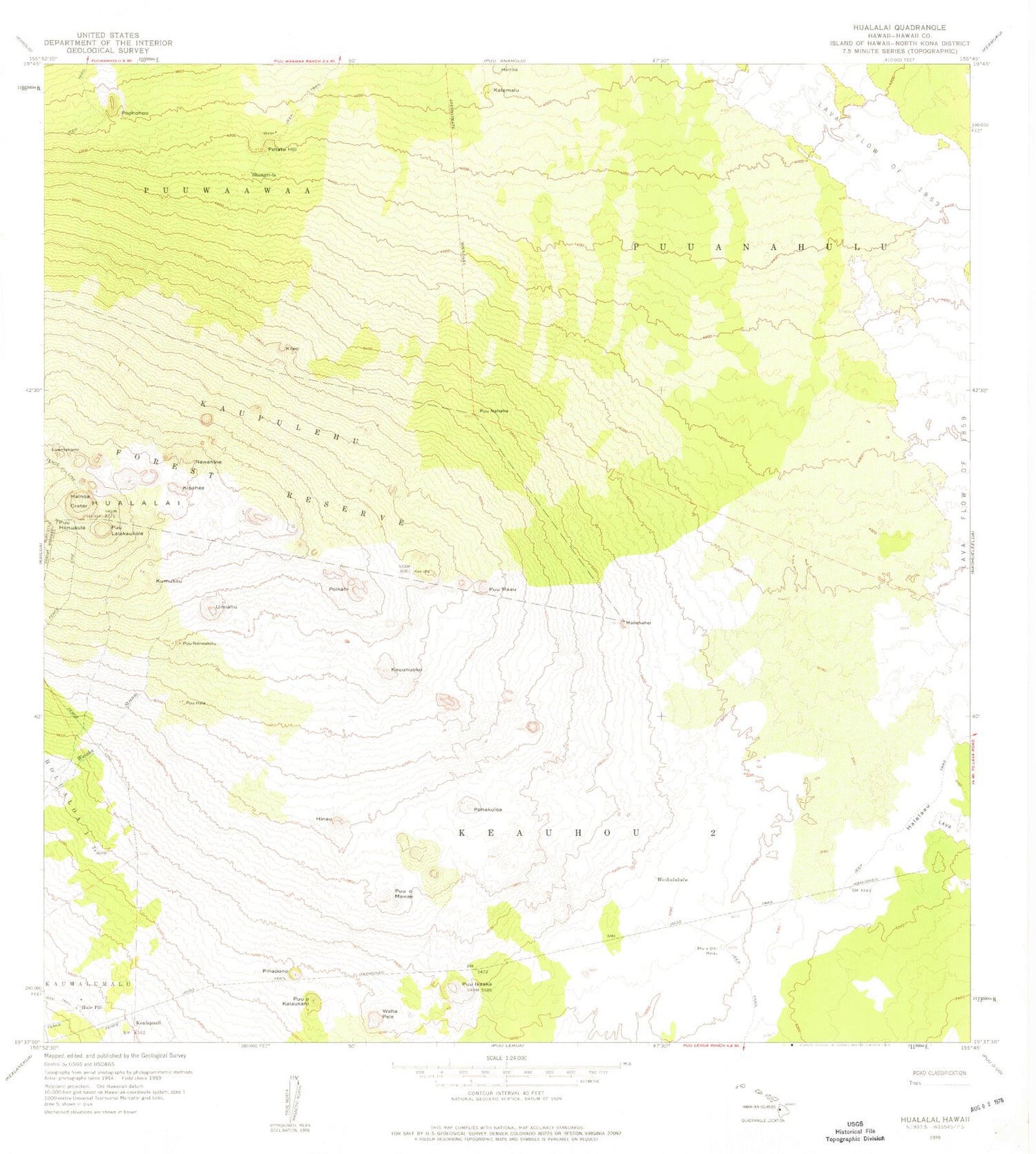
Historical USGS topographic quad map of Hualalai in the state of Hawaii. Map scale may vary for some years, but is generally around 1:24,000. Print size is approximately 24" x 27"
This quadrangle is in the following counties: Hawaii.
The map contains contour lines, roads, rivers, towns, and lakes. Printed on high-quality waterproof paper with UV fade-resistant inks, and shipped rolled.
Contains the following named places: Ahua'umi Heiau, Hainoa, Hainoa Crater, Hale Pili, Halelaau, Hinau, Hualalai, Kalamalu, Ka'upulehu Forest Reserve, Kauunuoku, Kileo, Kipahee, Kumukou, Luamakami, Mailehahei, Nawahine, North Kona District, Pihapono, Pohakuloa, Poikahi, Poohohoo, Potato Hill, Puu Ikaaka, Puu Lalakaukole, Puu Neneakolu, Puu o Kalaukani, Pu'uhale, Pu'uhonua'ula, Pu'ula'ala'au, Pu'uma'au, Pu'unahaha, Pu'u'omawae, Shangri-La, Umiahu, Wahapele, Waikulukulu