
MyTopo
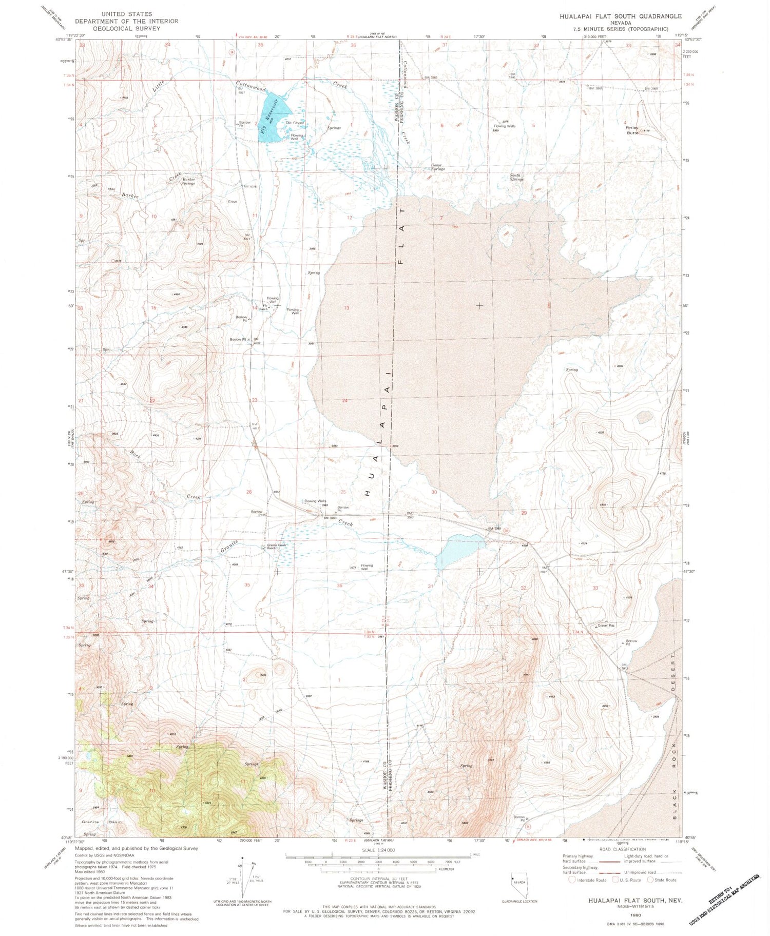
Classic USGS Hualapai Flat South Nevada 7.5'x7.5' Topo Map
Couldn't load pickup availability
Historical USGS topographic quad map of Hualapai Flat South in the state of Nevada. Map scale may vary for some years, but is generally around 1:24,000. Print size is approximately 24" x 27"
This quadrangle is in the following counties: Pershing, Washoe.
The map contains contour lines, roads, rivers, towns, and lakes. Printed on high-quality waterproof paper with UV fade-resistant inks, and shipped rolled.
Contains the following named places: Bar W Ranch, Barker, Barker Creek, Barker Springs, Cottonwood Creek, Cottonwood Springs, Finley Butte, Fly Ranch, Fly Reservoir, Fly Reservoir Dam, Goose Springs, Granite Creek, Granite Creek Ranch, Hot Springs, Hot Springs Post Office, Hualapai Flat, John Casey Steam Well, Little Cottonwood Creek, Red Mountain Creek, Rock Creek, South Springs, South Willow Creek, The Geyser, The Geyser Well, Wards, Wards Hot Spring


