MyTopo
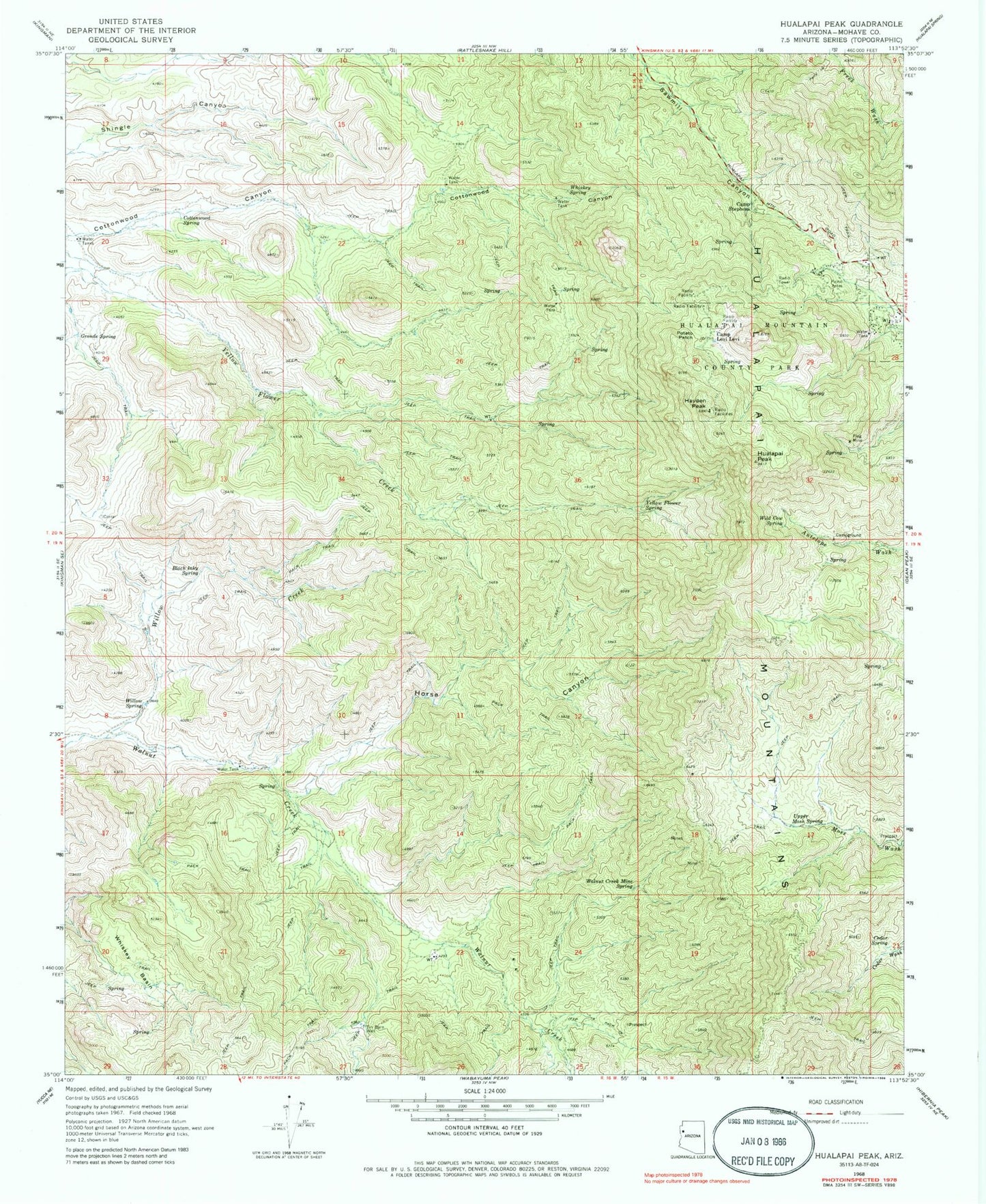
Classic USGS Hualapai Peak Arizona 7.5'x7.5' Topo Map
Couldn't load pickup availability
Historical USGS topographic quad map of Hualapai Peak in the state of Arizona. Typical map scale is 1:24,000, but may vary for certain years, if available. Print size: 24" x 27"
This quadrangle is in the following counties: Mohave.
The map contains contour lines, roads, rivers, towns, and lakes. Printed on high-quality waterproof paper with UV fade-resistant inks, and shipped rolled.
Contains the following named places: Black Inky Spring, Camp Levi Levi, Camp Stephens, Cedar Spring, Cottonwood Spring, Flag Mine, Grande Spring, Hayden Peak, Horse Canyon, Hualapai Mountain County Park, Hualapai Peak, Potato Patch, Tin Barn Well, Upper Moss Spring, Walnut Creek Mine Spring, Whiskey Basin, Whiskey Spring, Wild Cow Spring, Willow Creek, Willow Spring, Yellow Flower Spring, KGMN-FM (Kingman), KZZZ-FM (Kingman), Pine Lake Volunteer Fire Department