MyTopo
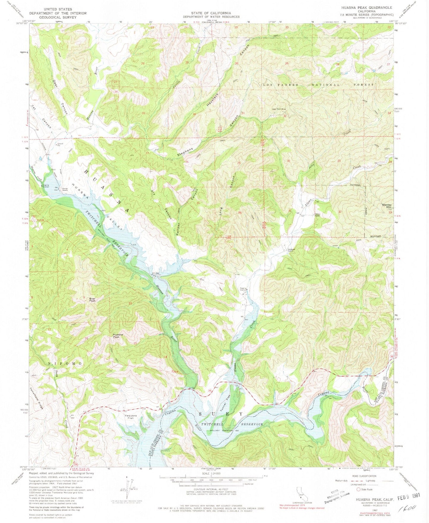
Classic USGS Huasna Peak California 7.5'x7.5' Topo Map
Couldn't load pickup availability
Historical USGS topographic quad map of Huasna Peak in the state of California. Map scale may vary for some years, but is generally around 1:24,000. Print size is approximately 24" x 27"
This quadrangle is in the following counties: San Luis Obispo, Santa Barbara.
The map contains contour lines, roads, rivers, towns, and lakes. Printed on high-quality waterproof paper with UV fade-resistant inks, and shipped rolled.
Contains the following named places: Adams Ranch, Alamo Creek, Boar Peak, Carrie Creek, Cat Canyon, Deer Canyon, Deer Trail Mine, Dry Canyon, Haystack Canyon, Huasna, Huasna Creek, Huasna Peak, Huasna River, Huasna Valley, Jollo Creek, Long Canyon, Oakley Ranch, Porter Ranch, Railpen Canyon, Stanley Mountain, Stephens Canyon, Swiekert Ranch, Sycamore Canyon, Tim O'Leary Canyon, Tunnel Flat, Vaquero Flat