MyTopo
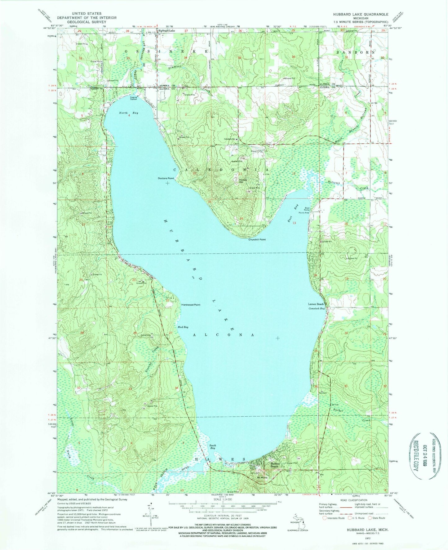
Classic USGS Hubbard Lake Michigan 7.5'x7.5' Topo Map
Couldn't load pickup availability
Historical USGS topographic quad map of Hubbard Lake in the state of Michigan. Typical map scale is 1:24,000, but may vary for certain years, if available. Print size: 24" x 27"
This quadrangle is in the following counties: Alcona, Alpena.
The map contains contour lines, roads, rivers, towns, and lakes. Printed on high-quality waterproof paper with UV fade-resistant inks, and shipped rolled.
Contains the following named places: Backus Beach, Caledonia School, Churchill Point, Comstock Bay, Doctors Point, East Bay, Hardwood Point, Hickey Hill, Hubbard Lake, Hubbard Lake, Larson Beach, Mount Maria, Mud Bay, North Bay, North Branch Holcomb Creek, Simmons Creek, South Bay, Stevens Creek, West Branch River, Holcomb Creek, Sucker Creek, WATZ-FM (Alpena), Township of Caledonia, Hubbard Lake, Hubbard Lake Census Designated Place, White Pine National Golf Course, Alcona Township Library, Hubbard Lake Fire Department, Hubbard Lake Post Office, Mount Maria Ski Area, South Shore Hubbard Lake Fire Department, Alcona Township Fire Department Station 2, Flowers Grave