MyTopo
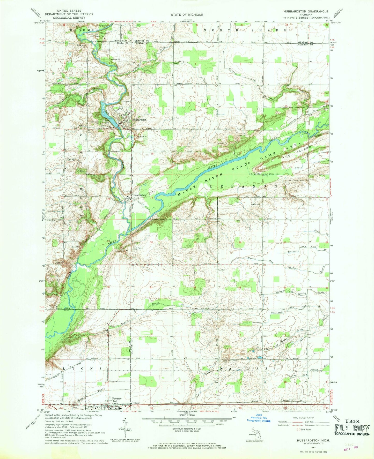
Classic USGS Hubbardston Michigan 7.5'x7.5' Topo Map
Couldn't load pickup availability
Historical USGS topographic quad map of Hubbardston in the state of Michigan. Map scale may vary for some years, but is generally around 1:24,000. Print size is approximately 24" x 27"
This quadrangle is in the following counties: Clinton, Gratiot, Ionia, Montcalm.
The map contains contour lines, roads, rivers, towns, and lakes. Printed on high-quality waterproof paper with UV fade-resistant inks, and shipped rolled.
Contains the following named places: Blue Pine Dairy, Bower Drain, Connor Drain, Connors and Sessions Drain, East Plains Cemetery, East Side Cemetery, Fifield Creek, Fish Creek, Fitzpatrick Farms, Hubbardston, Hubbardston - North Plains Fire Department, Hubbardston Post Office, Huckleberry Creek Golf Course, Maple River Campground, Matherton, Matherton Post Office, Most Holy Trinity Cemetery, Nichols Drain, Pewamo, Pewamo Cemetery, Pewamo Elementary School, Pewamo Fire and Rescue Department, Pewamo Post Office, Pewamo Station, Reynolds and Sessions Drain, Ruel Drain, Sage and Hafner Drain, Saint John the Baptist Cemetery Historical Marker, Saint John the Baptist Church Historical Marker, Saint Johns Cemetery, Saint Joseph's Church, Saint Joseph's Elementary School, Sharps Drain, Stewart and Kinley Drain, Stoughton Creek, Township of Lebanon, Village of Hubbardston, Village of Pewamo, Waters and Nash Drain, West Side Cemetery, Williams and Cook Drain, ZIP Code: 48845