MyTopo
Classic USGS Hubbardsville New York 7.5'x7.5' Topo Map
Couldn't load pickup availability
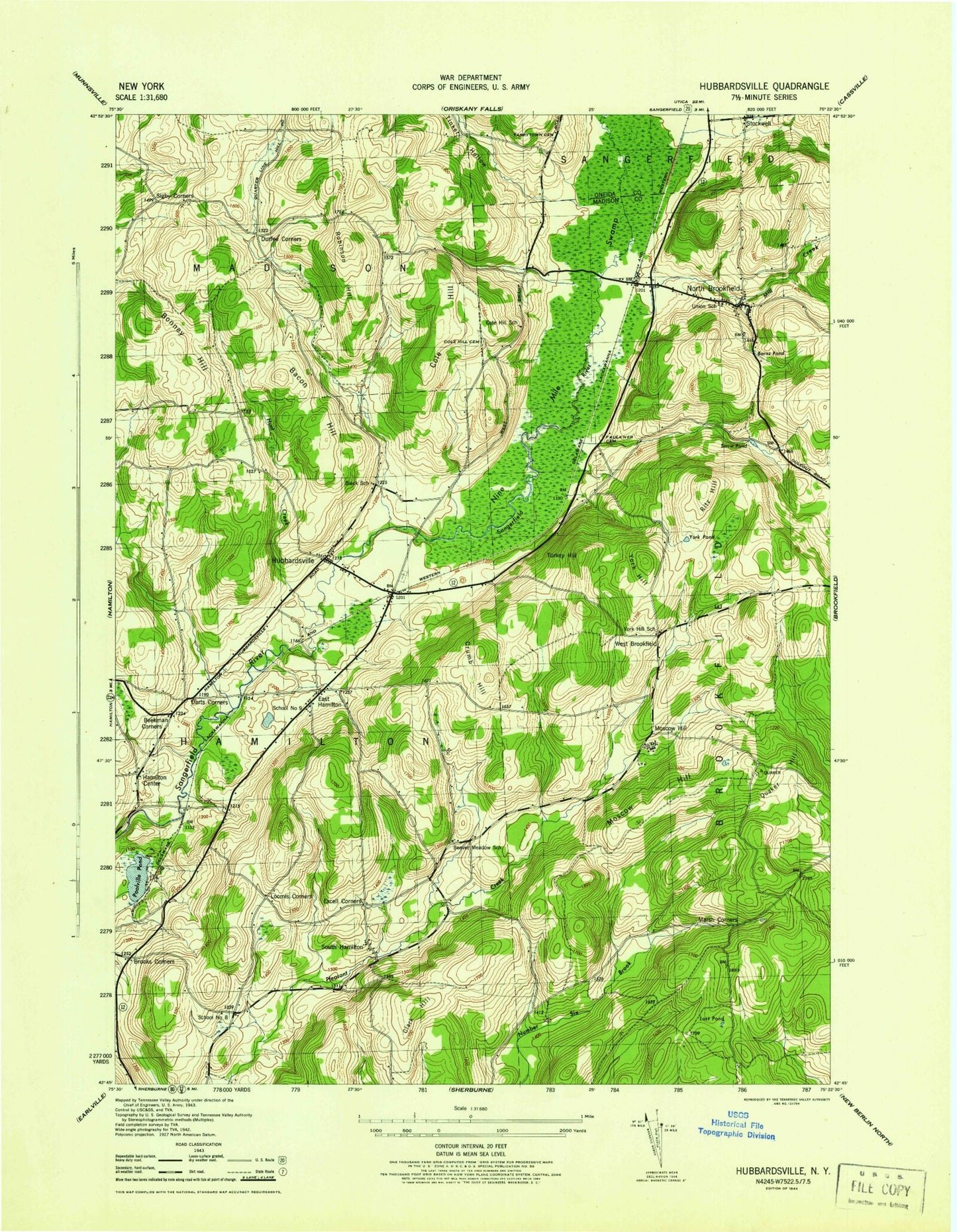
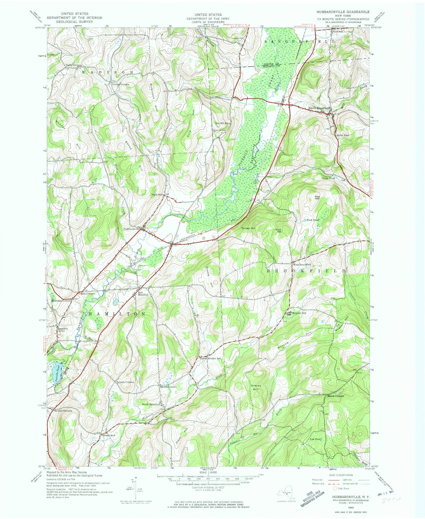
Historical USGS topographic quad map of Hubbardsville in the state of New York. Map scale may vary for some years, but is generally around 1:24,000. Print size is approximately 24" x 27"
This quadrangle is in the following counties: Madison, Oneida.
The map contains contour lines, roads, rivers, towns, and lakes. Printed on high-quality waterproof paper with UV fade-resistant inks, and shipped rolled.
Contains the following named places: Bacon Hill, Barns Pond, Beaver Meadow School, Beekman Corners, Bonney Hill, Brooks Corner, Clark Hill, Cole Hill, Cole Hill Cemetery, Cole Hill School, Crumb Hill, Darts Corners, Durfee Corners, East Hamilton, Excell Corners, Faulkner Cemetery, Graham Cemetery, Grassy Hill, Hamilton Center, Hamilton Center Cemetery, Hubbardsville, Hubbardsville Post Office, Hubbardsville Volunteer Fire Department, Hunt Creek, Loomis Corners, Lost Pond, Marsh Corners, Mill Creek, Moscow Hill, Ninemile Swamp, North Brookfield, North Brookfield Cemetery, North Brookfield Volunteer Fire Department, Poolville Pond, Quaker Hill, Quaker Hill Cemetery, Ritz Hill, Robinson Hill, Rocky Top Acres, School Number 8, School Number 9, Sigby Corners, Snow Pond, South Hamilton, Stockwell, Tarrytown Cemetery, Tinker Hollow, Town of Hamilton, Turkey Hill, Union School, West Brookfield, York Hill, York Pond, ZIP Codes: 13355, 13418