MyTopo
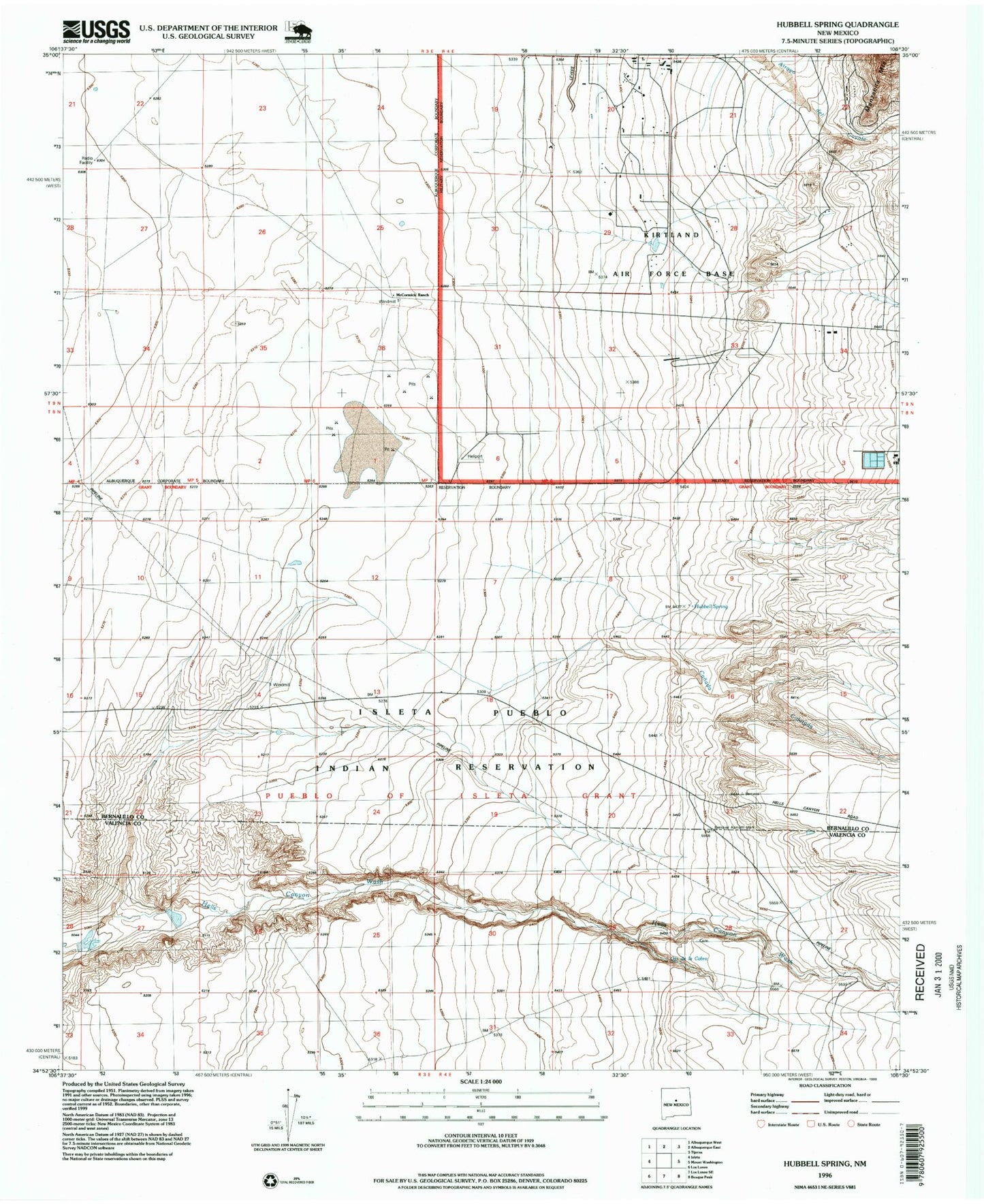
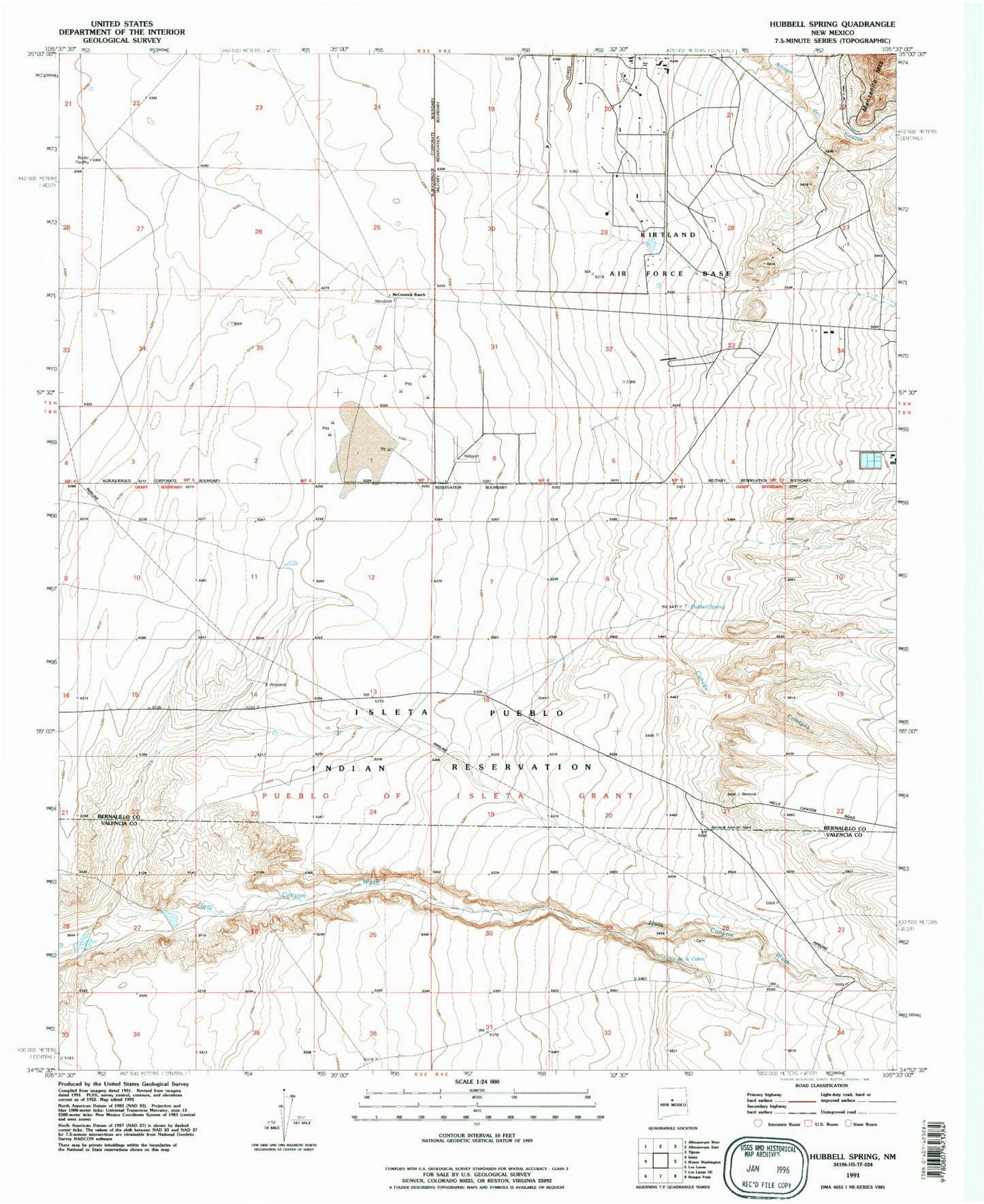
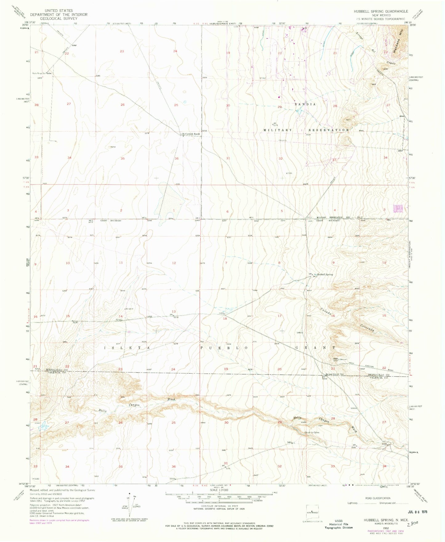
Classic USGS Hubbell Spring New Mexico 7.5'x7.5' Topo Map
Couldn't load pickup availability
Historical USGS topographic quad map of Hubbell Spring in the state of New Mexico. Map scale may vary for some years, but is generally around 1:24,000. Print size is approximately 24" x 27"
This quadrangle is in the following counties: Bernalillo, Valencia.
The map contains contour lines, roads, rivers, towns, and lakes. Printed on high-quality waterproof paper with UV fade-resistant inks, and shipped rolled.
Contains the following named places: Canada Colorada, Canon de Sanchez, Clear Water Spring, Hubbell Spring, ISL ECW 3 Water Well, Kirtland Air Force Base Department of Defense Fire Department Station 4, McCormick Ranch, Number 10 Water Well, Ojo de la Cabra, Treatment Plant Water Well, ZIP Code: 87105