MyTopo
Classic USGS Huckabay Texas 7.5'x7.5' Topo Map
Couldn't load pickup availability
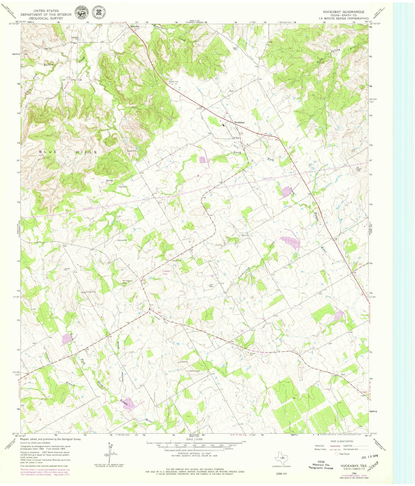
Historical USGS topographic quad map of Huckabay in the state of Texas. Map scale may vary for some years, but is generally around 1:24,000. Print size is approximately 24" x 27"
This quadrangle is in the following counties: Erath.
The map contains contour lines, roads, rivers, towns, and lakes. Printed on high-quality waterproof paper with UV fade-resistant inks, and shipped rolled.
Contains the following named places: Council Branch, Ed Shadle Airport, Hannibal, Hannibal Cemetery, Huckabay, Huckabay Census Designated Place, Huckabay Volunteer Fire Department, J and J Beyer Dairy Dam Number 1, J and J Beyer Dairy Dam Number 2, J and J Beyer Pond Number 1, J and J Dairy Pond Number 2, Mount Pleasant Cemetery, Mount Pleasant Dairy Dam, Mount Pleasant Dairy Pond, Scarborough Creek, Soil Conservation Service Site 1 Dam, Soil Conservation Service Site 1 Reservoir, Soil Conservation Service Site 2 Dam, Soil Conservation Service Site 2 Reservoir, Soil Conservation Service Site 3 Dam, Soil Conservation Service Site 3 Reservoir, Soil Conservation Service Site 4 Dam, Soil Conservation Service Site 4 Reservoir, Soil Conservation Service Site 8 Dam, Soil Conservation Service Site 8 Reservoir, Soil Conservation Service Site 9 Dam, Soil Conservation Service Site 9 Reservoir, South Fork Barton Creek, Wood Hollow