MyTopo
Classic USGS Huckleberry Mountain Idaho 7.5'x7.5' Topo Map
Regular price
$16.95
Regular price
Sale price
$16.95
Unit price
per
Couldn't load pickup availability
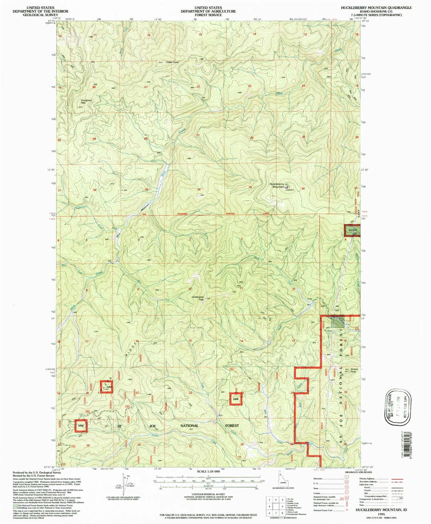
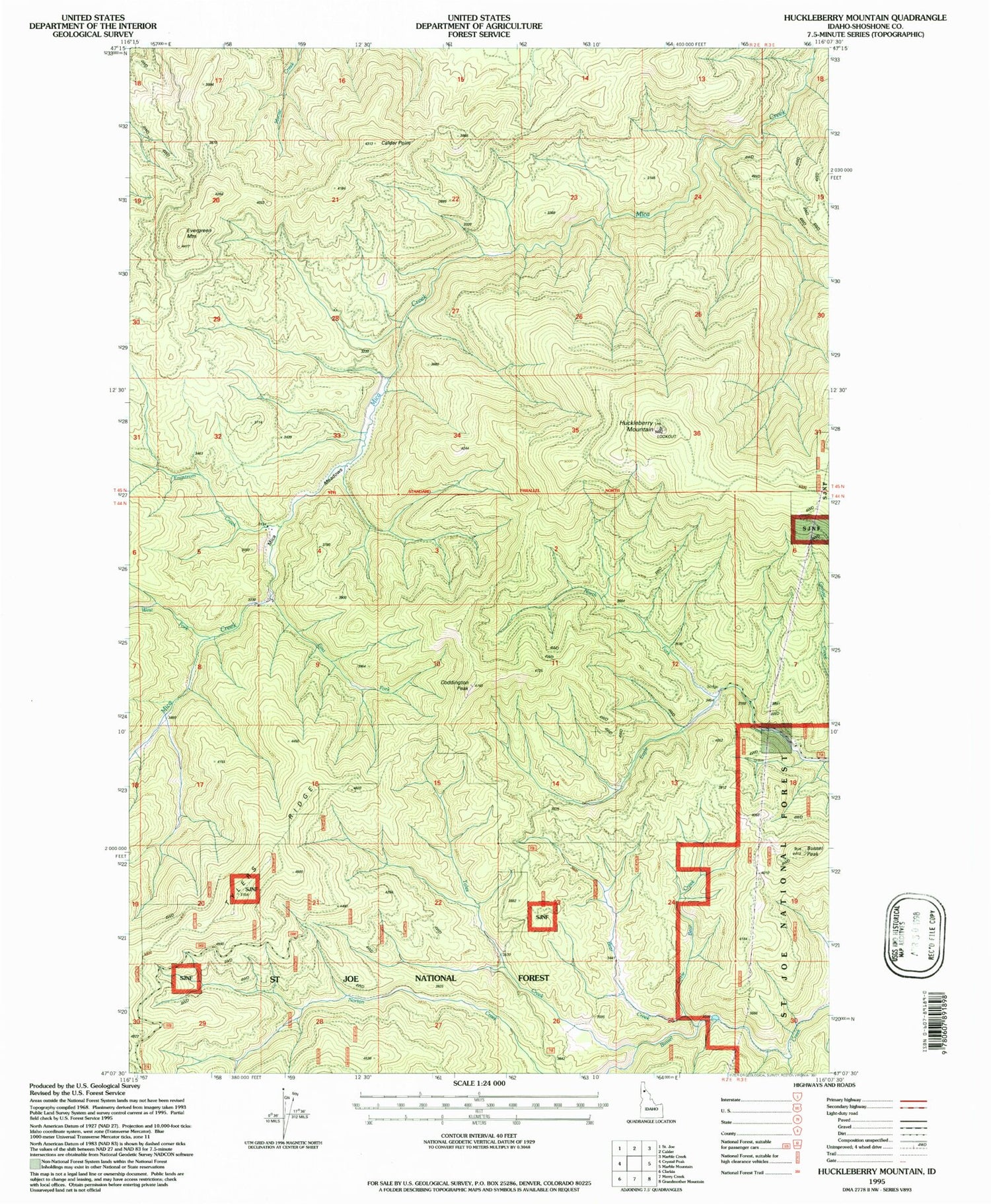
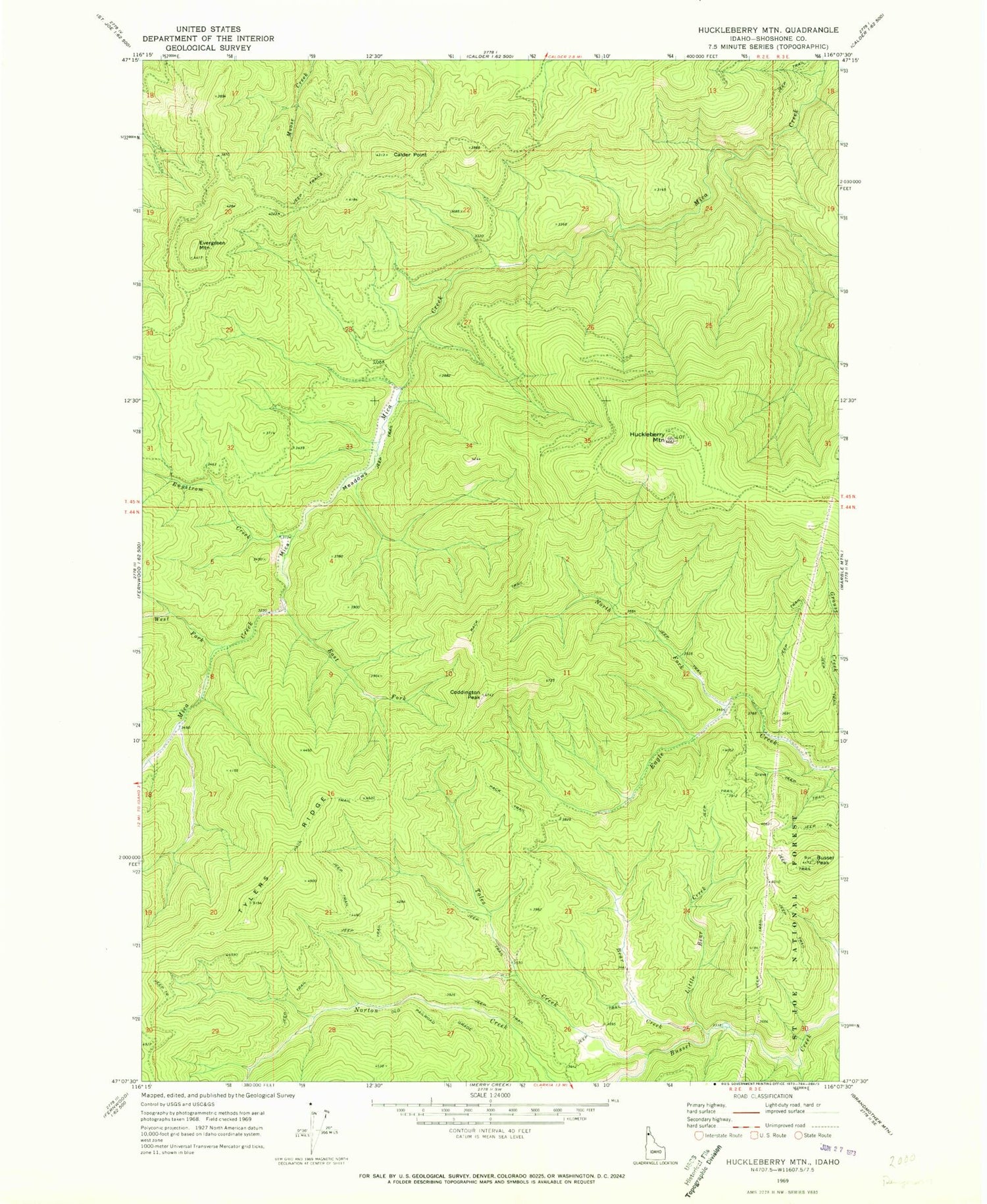
Historical USGS topographic quad map of Huckleberry Mountain in the state of Idaho. Map scale may vary for some years, but is generally around 1:24,000. Print size is approximately 24" x 27"
This quadrangle is in the following counties: Shoshone.
The map contains contour lines, roads, rivers, towns, and lakes. Printed on high-quality waterproof paper with UV fade-resistant inks, and shipped rolled.
Contains the following named places: Bear Creek, Bussel Peak, Calder Point, Coddington Peak, East Fork Mica Creek, Engstrom Creek, Evergreen Mountain, Huckleberry Mountain, Little Bear Creek, Mica Meadows, North Fork Eagle Creek, Toles Creek, Tylers Ridge, West Fork Mica Creek