MyTopo
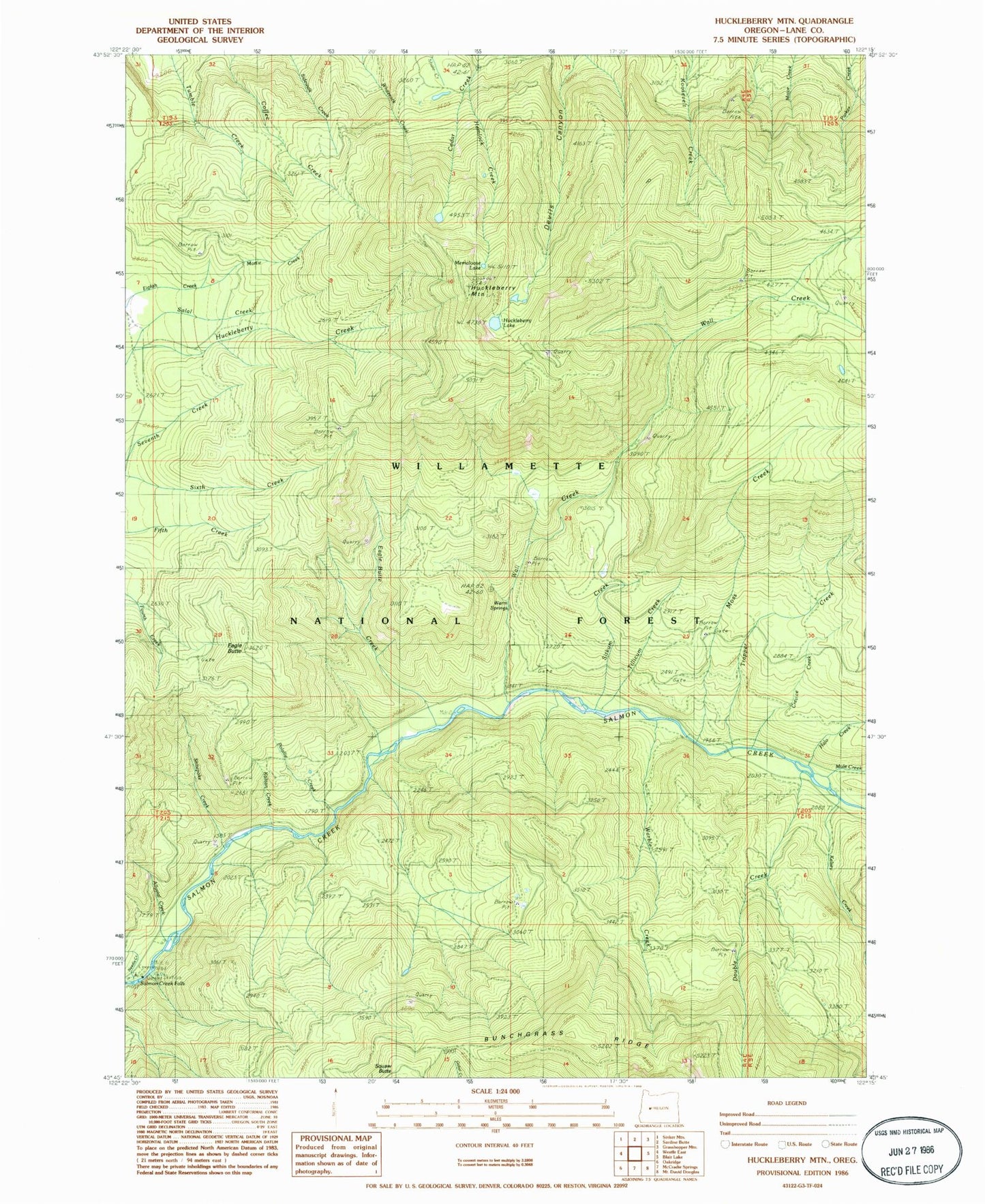
Classic USGS Huckleberry Mountain Oregon 7.5'x7.5' Topo Map
Couldn't load pickup availability
Historical USGS topographic quad map of Huckleberry Mountain in the state of Oregon. Map scale may vary for some years, but is generally around 1:24,000. Print size is approximately 24" x 27"
This quadrangle is in the following counties: Lane.
The map contains contour lines, roads, rivers, towns, and lakes. Printed on high-quality waterproof paper with UV fade-resistant inks, and shipped rolled.
Contains the following named places: Alluvial Creek, Black Creek, Crevice Creek, Dead Mountain Trail, Double Creek, Eagle Butte, Eagle Butte Creek, Halo Creek, Hemlock Creek, Horsehead Creek, Huckleberry Lake, Huckleberry Mountain, Kalitan Creek, Kelsey Creek, Martie Creek, Martie Creek Guard Station, Memaloose Lake, Moss Creek, Needle Creek, Polallie Creek, Roosevelt Way, Salmon Creek Falls Recreation Site, Salmon Falls, Salt Creek Falls, Shitepoke Creek, Shitepoke Trail, Sitkum Creek, Stag Shelter, Tillicum Creek, Trapper Creek, Wall Creek, Warble Creek, Warm Springs