MyTopo
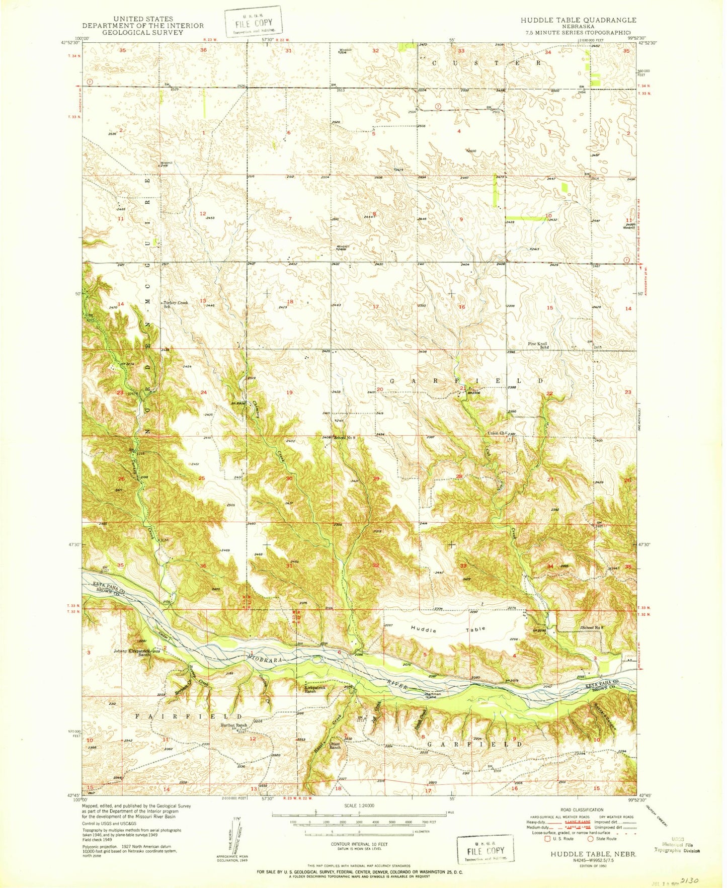
Classic USGS Huddle Table Nebraska 7.5'x7.5' Topo Map
Couldn't load pickup availability
Historical USGS topographic quad map of Huddle Table in the state of Nebraska. Map scale may vary for some years, but is generally around 1:24,000. Print size is approximately 24" x 27"
This quadrangle is in the following counties: Brown, Keya Paha.
The map contains contour lines, roads, rivers, towns, and lakes. Printed on high-quality waterproof paper with UV fade-resistant inks, and shipped rolled.
Contains the following named places: Barney Creek, Batchelder Dam, Batchelder Reservoir, Bronson Creek, Buzzard Canyon, Cedar Island, Chase Ranch, Chimney Creek, Cub Creek, Cub Creek Dam, Cub Creek Reservoir, Garden Creek, Hartman Island, Hazel Creek, Huddle Table, Hurlbut Ranch, Jeff Creek, Johnny Kirkpatrick Ranch, Kirkpatrick Ranch, Niobrara Wild and Scenic River, Pine Knoll School, School Number 8, School Number 9, Smith Creek, Turkey Creek, Turkey Creek School, Union Church