
MyTopo
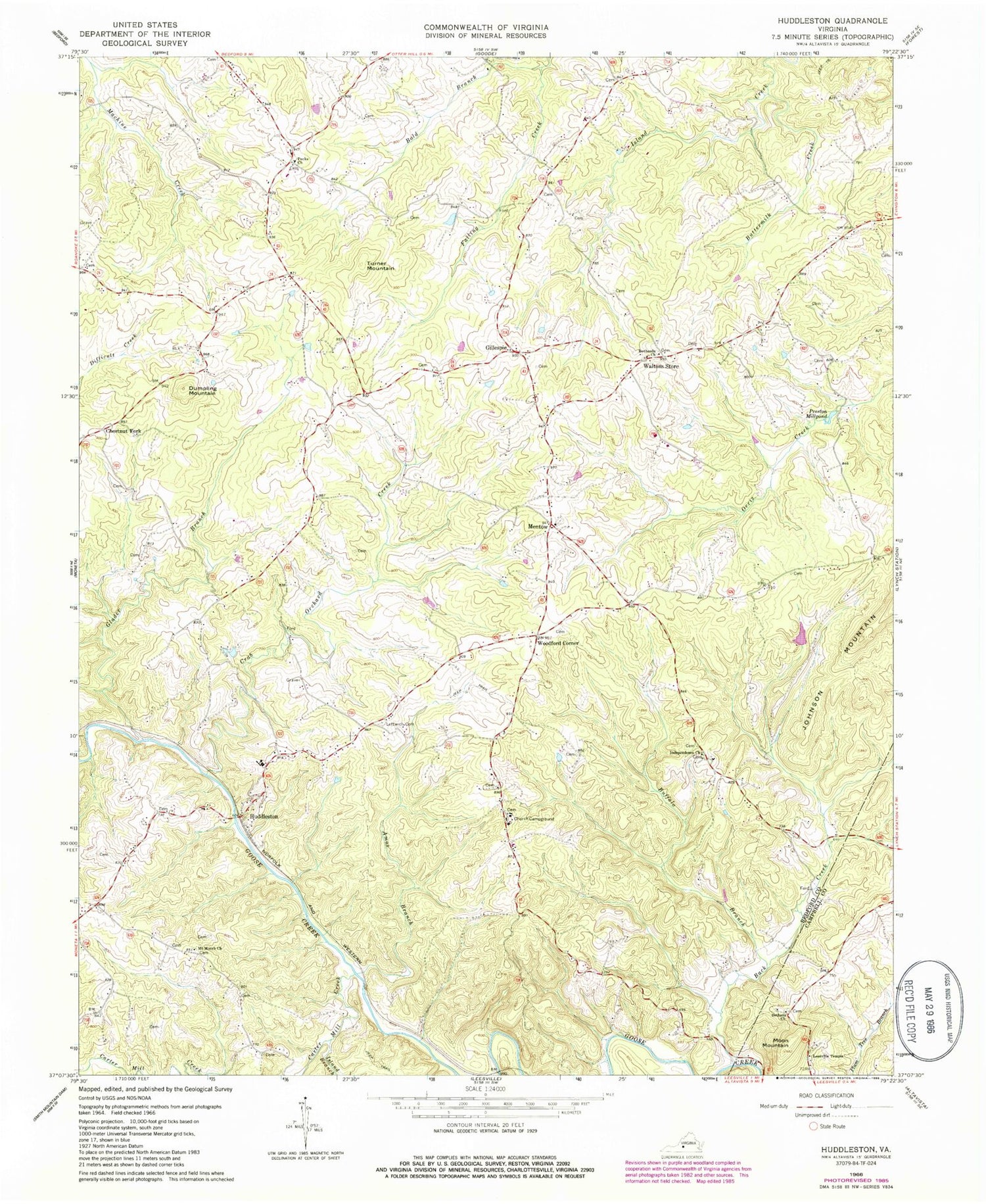
Classic USGS Huddleston Virginia 7.5'x7.5' Topo Map
Couldn't load pickup availability
Historical USGS topographic quad map of Huddleston in the state of Virginia. Map scale may vary for some years, but is generally around 1:24,000. Print size is approximately 24" x 27"
This quadrangle is in the following counties: Bedford, Campbell.
The map contains contour lines, roads, rivers, towns, and lakes. Printed on high-quality waterproof paper with UV fade-resistant inks, and shipped rolled.
Contains the following named places: Altavista Life Saving Crew, Altavista Police Department, Altavista Volunteer Fire Department, Amos Branch, Back Creek, Bethany Church, Bethany Memorial Cemetery, Bethesda Church, Bold Branch, Buffalo Branch, Buttermilk Creek, Carter Mill Creek, Chestnut Fork, Church Campground, Church of God, Crab Orchard Creek, Creasy School, District 3, Dumpling Mountain, Gillespie, Glader Branch, Huddleston, Huddleston Elementary School, Huddleston Fire Department Station 2, Huddleston Fire Department Station 4, Huddleston Life Saving and First Aid Crew, Huddleston Volunteer Fire Department Company 7, Independence Church, Island Branch, Leesville Temple, Leftwich Cemetery, Leftwich Church, Mentow, Moon Mountain, Mount Horeb Church, Pecks Church, Preston Millpond, Stony Fork, Turner Mountain, Waltons Store, Woodford Corner, ZIP Code: 24104


