MyTopo
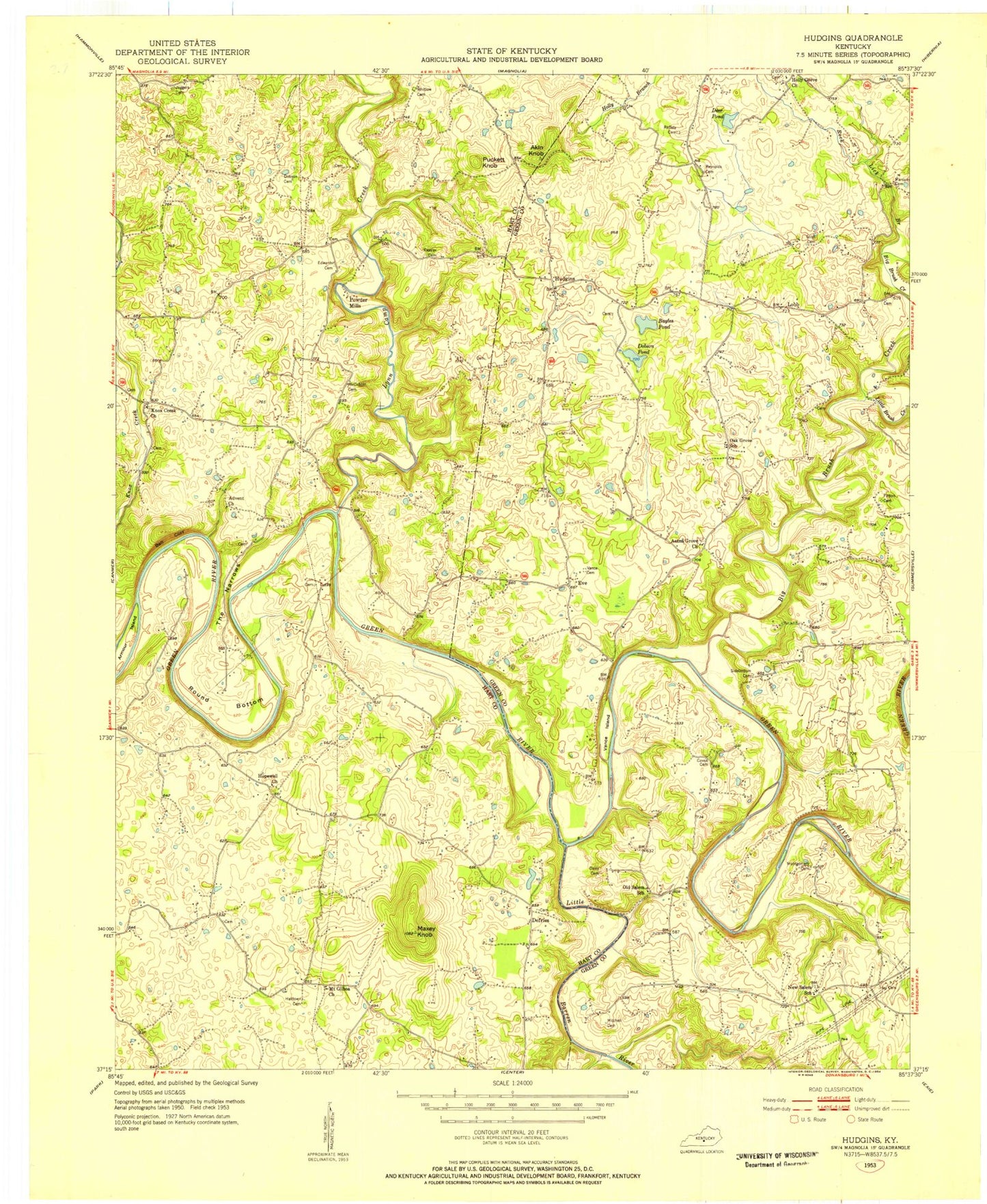
Classic USGS Hudgins Kentucky 7.5'x7.5' Topo Map
Couldn't load pickup availability
Historical USGS topographic quad map of Hudgins in the state of Kentucky. Map scale may vary for some years, but is generally around 1:24,000. Print size is approximately 24" x 27"
This quadrangle is in the following counties: Green, Hart.
The map contains contour lines, roads, rivers, towns, and lakes. Printed on high-quality waterproof paper with UV fade-resistant inks, and shipped rolled.
Contains the following named places: Aetna Grove Church, Akin Cemetery, Akin Knob, Armour Island, Bayles Pond, Bell Cliff, Bells Knob, Big Brush Creek, Caven Bend, Caven Cemetery, Charlie Rhea Bend, Charlie Rhea Island, Conyers Cemetery, Curry Cemetery, Davis Bend, Davis Cemetery, Deer Pond, Defries, Dobson Cemetery, Dobson Pond, Edwards Cemetery, Eve, Figett Bend, Garvin Cemetery, Glen Brook, Graham Cemetery, Hamilton Cemetery, Hay Cemetery, Holly Branch, Holly Grove Cemetery, Holly Grove Church, Hopewell Cumberland Presbyterian Church, Hudgins, Huffman Cemetery, Jaggers Cemetery, Kessler Cemetery, Knoxes Creek Baptist Church, Little Barren River, Little Brush Creek, Lobb, Lobb Bend, Lynn Camp Creek, Marcum Cemetery, Maxey Knob, McCubbin Cemetery, Mitchell Cemetery, Montgomery Cemetery Number 1, Mount Gilboa Baptist Church, Mount Gilboa Church Cemetery, New Salem School, Oak Grove School, Old Salem Church, Patton Cemetery, Perkins Cemetery, Powder Mill, Puckett Knob, Raffety Cemetery, Reynolds Cemetery, Rock Lick Branch, Round Bottom, Roundtree - Sherfey Cemetery, Scott Bend, Scott Cemetery, Sidebottom Cemetery, Sidebottom Island, Sims Cemetery, The Narrows, Three Hundred Springs, Vance Cemetery, Vance Island, Wheeler Cemetery, Whitlow Cemetery, Williams Cemetery, Wright Cemetery, ZIP Codes: 42722, 42782