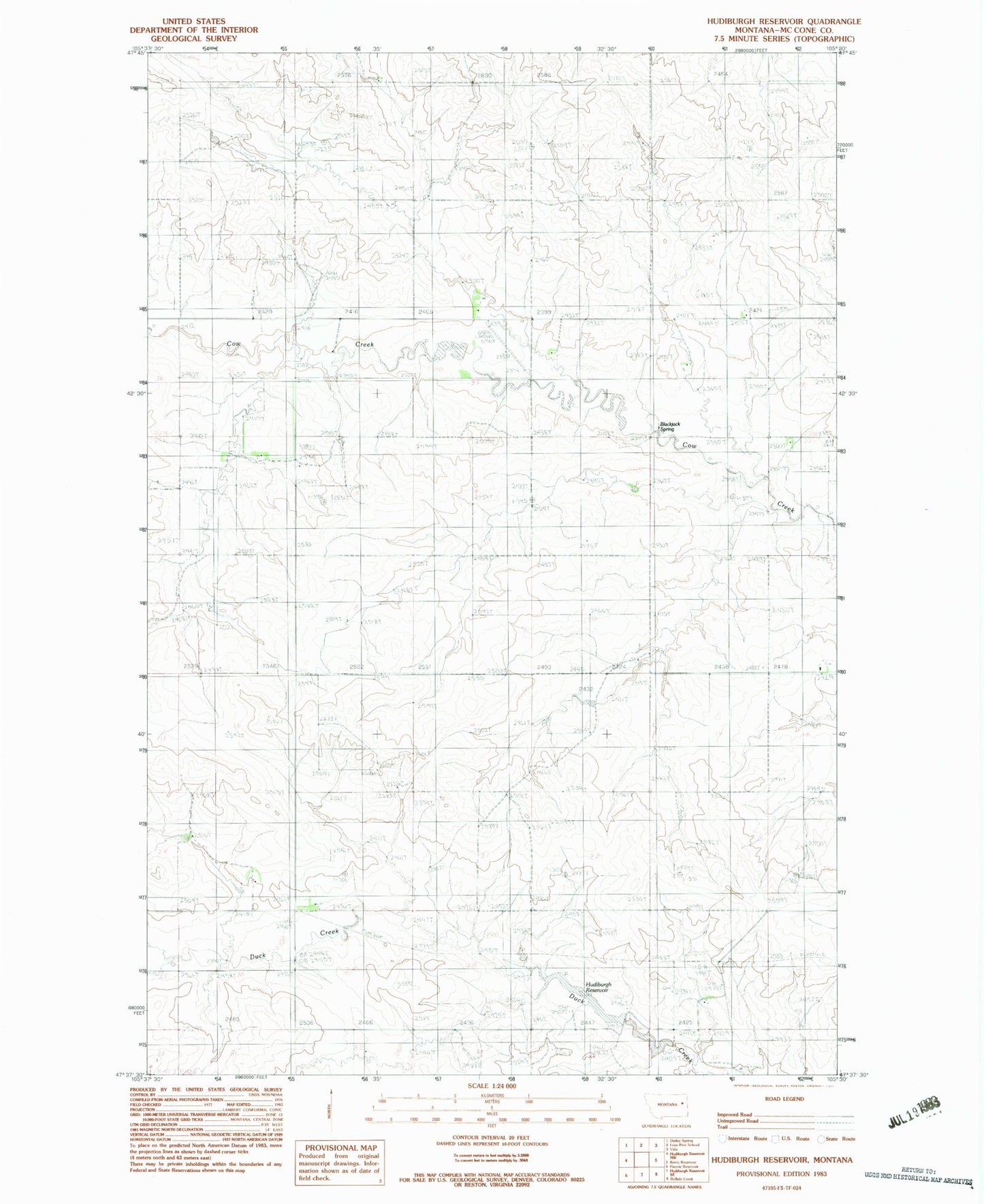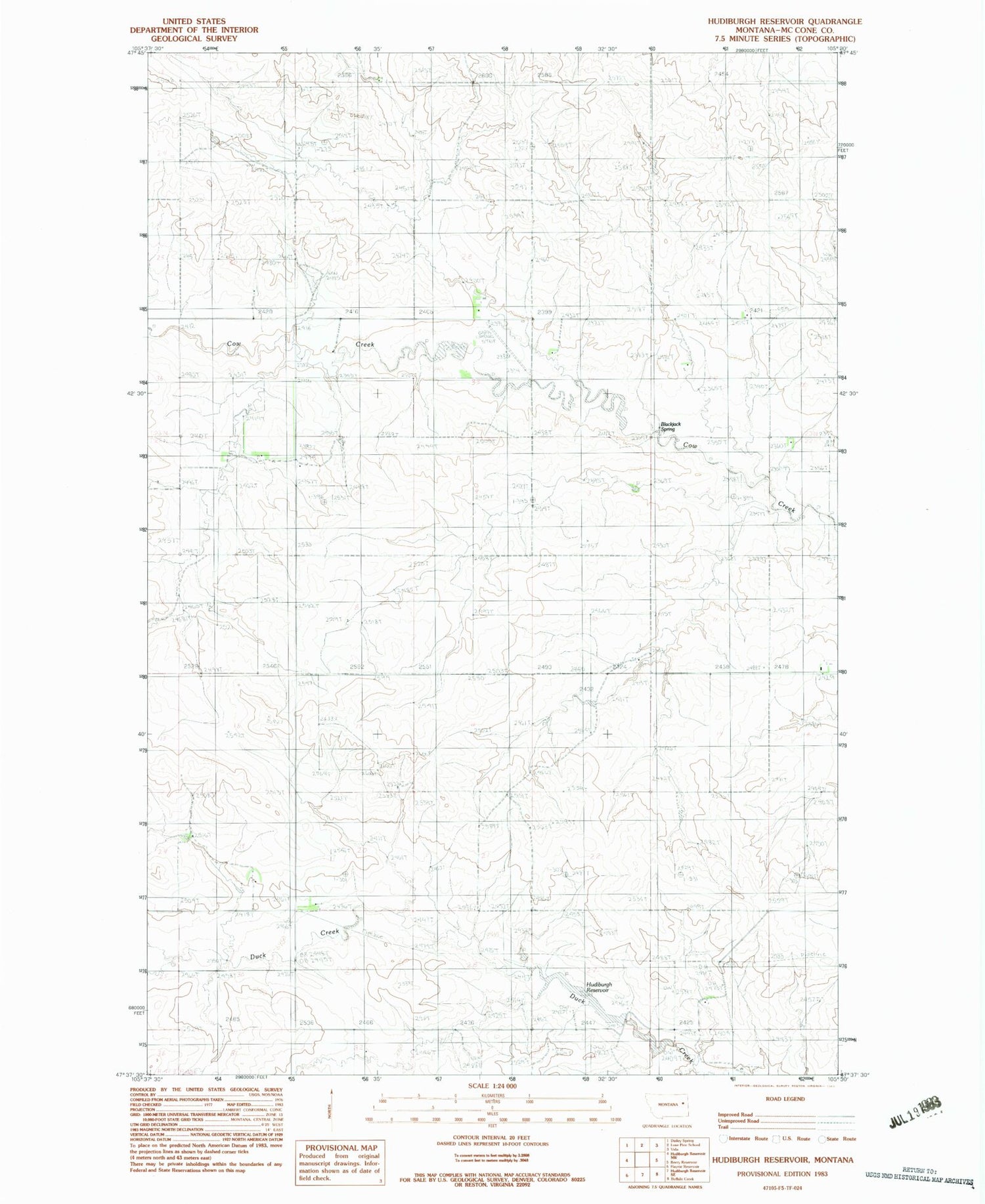
MyTopo
Classic USGS Hudiburgh Reservoir Montana 7.5'x7.5' Topo Map
Regular price
$16.95
Regular price
Sale price
$16.95
Unit price
per
Couldn't load pickup availability
Historical USGS topographic quad map of Hudiburgh Reservoir in the state of Montana. Map scale may vary for some years, but is generally around 1:24,000. Print size is approximately 24" x 27"
This quadrangle is in the following counties: McCone.
The map contains contour lines, roads, rivers, towns, and lakes. Printed on high-quality waterproof paper with UV fade-resistant inks, and shipped rolled.
Contains the following named places: 22N48E05CCBB01 Well, 22N48E06ABBC01 Well, 22N48E10DDDB01 Well, 22N48E15BCCA01 Well, 22N48E17DDCA01 Well, 22N48E18BCAD01 Well, 22N48E25BDBC01 Well, 22N48E26CDAA01 Well, 22N48E33BABD01 Well, Cow Creek Cemetery, Hudiburgh Dam, Hudiburgh Reservoir, Vine Reservoir Dam