MyTopo
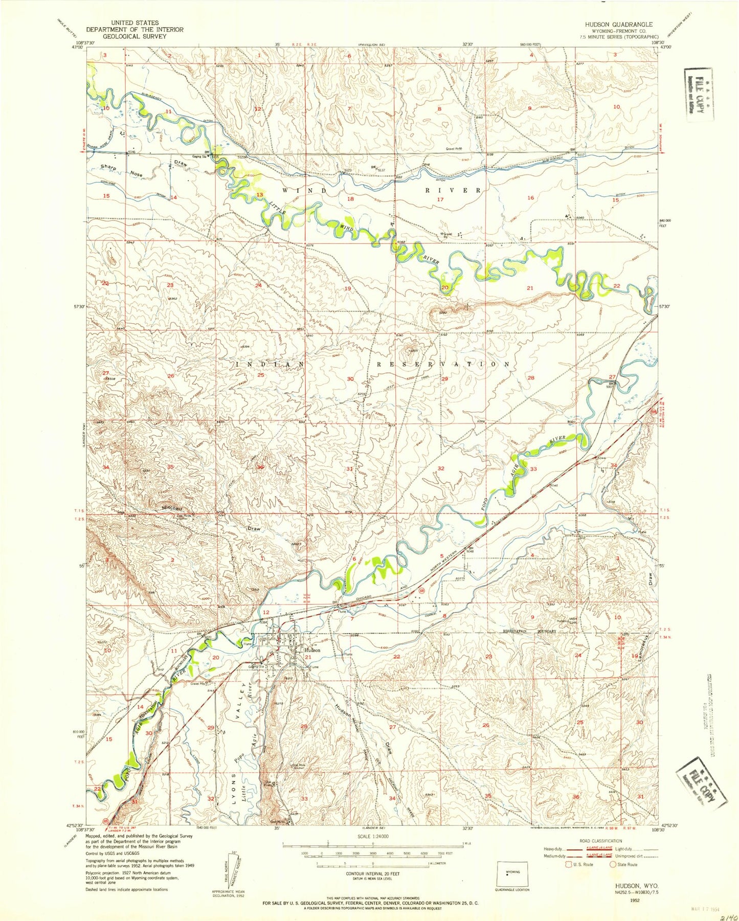
Classic USGS Hudson Wyoming 7.5'x7.5' Topo Map
Couldn't load pickup availability
Historical USGS topographic quad map of Hudson in the state of Wyoming. Map scale may vary for some years, but is generally around 1:24,000. Print size is approximately 24" x 27"
This quadrangle is in the following counties: Fremont.
The map contains contour lines, roads, rivers, towns, and lakes. Printed on high-quality waterproof paper with UV fade-resistant inks, and shipped rolled.
Contains the following named places: Alkali Draw, Big Corral Ditch, Concetta Palicichio Mine, Fremont County Fire Protection District Battalion 10 Hudson, Hudson, Hudson Cemetery, Hudson Draw, Hudson Post Office, Hudson School, Lamoreaux Draw, Little Popo Agie River, Lyons Valley, Mitchell Draw, Schroeder Mine, Sharp Nose Draw, Town of Hudson, Warren Drain, Wise Ditch, Wyoming Central Mine, ZIP Codes: 82510, 82515