MyTopo
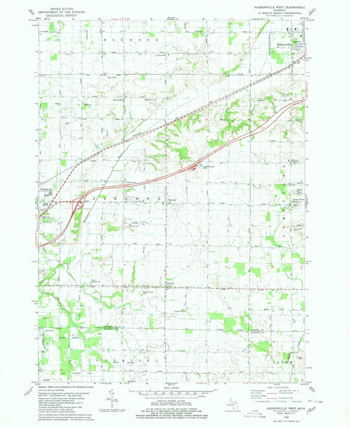
Classic USGS Hudsonville West Michigan 7.5'x7.5' Topo Map
Couldn't load pickup availability
Historical USGS topographic quad map of Hudsonville West in the state of Michigan. Map scale may vary for some years, but is generally around 1:24,000. Print size is approximately 24" x 27"
This quadrangle is in the following counties: Allegan, Ottawa.
The map contains contour lines, roads, rivers, towns, and lakes. Printed on high-quality waterproof paper with UV fade-resistant inks, and shipped rolled.
Contains the following named places: Beaverdam, Beaverdam Cemetery, Beaverdam Christian Church, Beaverdam Post Office, Beaverdam Reformed Church, Beaverdam School, Charter Township of Zeeland, Curt's Place Airport, Drenthe, Drenthe Christian Reformed Church, Drenthe Christian Reformed Church Historical Marker, Drenthe Grove Park, Drenthe Post Office, East Drenthe Cemetery, Eighteen Sixty-Nine Vriesland Reformed Church Historical Marker, Forest Grove Station, Franklin School, Gateway Community Church, Hawthorn School Number 2, Heritage Christian School, Hillside Park, Hudsonville Christian Middle School, Hudsonville Fairgrounds, Hudsonville Reformed Church, Hughes Park, Huyser School, J P's Field, Jan Rabbers Historical Marker, Logan Estates Mobile Home Park, New Groningen Historical Marker, Old Drenthe Cemetery, Old Vriesland Cemetery, Ottawa Executive Airport, Park Elementary School, Sherbourne School, Spectrum Health Zeeland Community Hospital, Van Dam Family Cemetery, Vriesland, Vriesland Cemetery, Vriesland Church, Vriesland Post Office, West Drenthe Cemetery, West Drenthe School, Winding Creek Golf Club, WJQK-FM (Zeeland), WKLQ-FM (Holland), WXYB-FM (Zeeland), Zeeland Church of God, Zeeland Rest Area, Zeeland Township Fire Department Station 1, Zeeland Township Fire Department Station Number 2, Zutphen, Zutphen Cemetery, Zutphen Christian Reformed Church, Zutphen Post Office, Zutphen School, ZIP Codes: 49426, 49464


