MyTopo
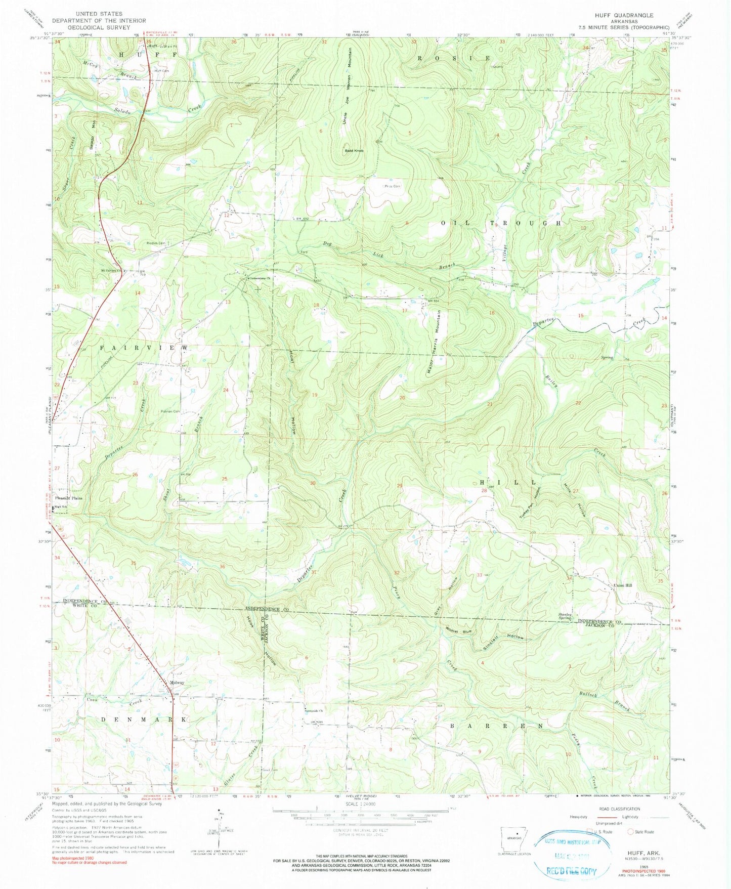
Classic USGS Huff Arkansas 7.5'x7.5' Topo Map
Couldn't load pickup availability
Historical USGS topographic quad map of Huff in the state of Arkansas. Map scale may vary for some years, but is generally around 1:24,000. Print size is approximately 24" x 27"
This quadrangle is in the following counties: Independence, Jackson, White.
The map contains contour lines, roads, rivers, towns, and lakes. Printed on high-quality waterproof paper with UV fade-resistant inks, and shipped rolled.
Contains the following named places: Bailey Creek, Bald Knob, Bullock Branch, Cornerstone United Methodist Church, Departe, Dog Lick Branch, Goad Cemetery, Gray Hollow, Hook Hollow, Howl Hollow, Huff, Huff Cemetery, Major Harris Mountain, McCoy Branch, Midland Junior / High School, Midway, Mills Hollow, Mount Calvary Church, Piney Creek, Pleasant Plains Volunteer Fire Department, Price Cemetery, Putman Cemetery, Riddles Cemetery, Salado Mountain, Shoat Branch, Sinclair Hollow, Stanley Spring, Sugar Creek, Sunnyside Church, Township of Christian, Township of Hill, Turkey Pen Hollow, Uncle Joe Warren Mountain, Union Hill, Village Creek, Wildcat Bluff, ZIP Code: 72568