MyTopo
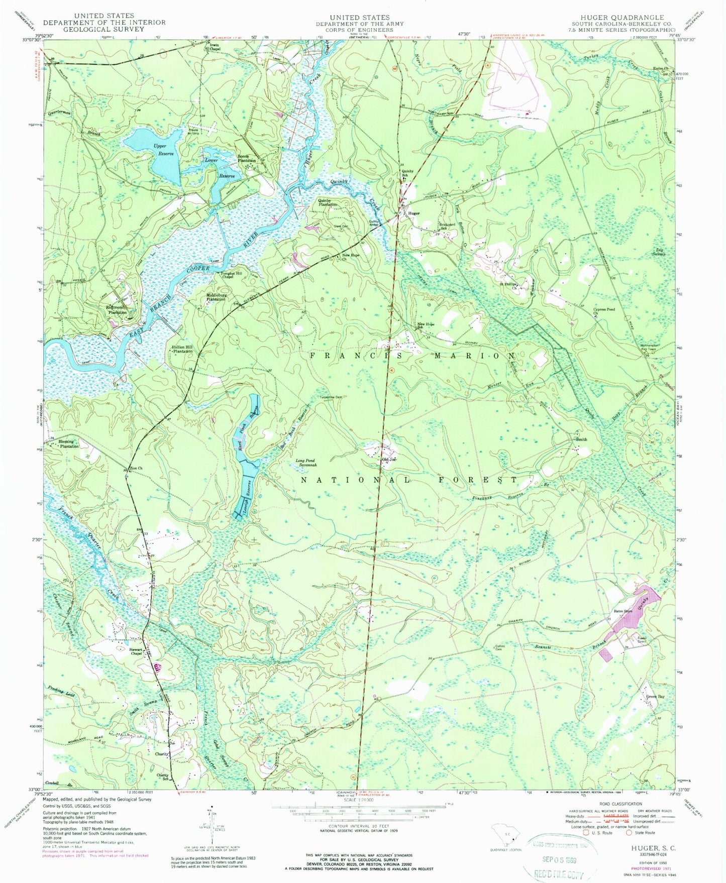
Classic USGS Huger South Carolina 7.5'x7.5' Topo Map
Couldn't load pickup availability
Historical USGS topographic quad map of Huger in the state of South Carolina. Typical map scale is 1:24,000, but may vary for certain years, if available. Print size: 24" x 27"
This quadrangle is in the following counties: Berkeley.
The map contains contour lines, roads, rivers, towns, and lakes. Printed on high-quality waterproof paper with UV fade-resistant inks, and shipped rolled.
Contains the following named places: Deep Branch, Bates Store, Bossis Plantation, Brickyard School, Charity, Charity School, Chipper Swamp, Collins Cemetery, Fowler Cemetery, Gobel Swamp, Gough Creek, Hard Pinch Reserve, Hester Canal, Huger Creek, Leneigh Reserve, Long Pond Savannah, Lower Reserve, Menzer Run, Muddy Creek, New Hope Church, New Hope School, Pinckney Reserve Branch, Quarterman Branch, Quinby Plantation, Red Bank Reserve, Richmond Plantation, Saint Phillips Church, Slave Cemetery, Smith Swamp, Stewart Chapel, Turpentine Dam, Washaw Creek, York Bottom Creek, Zion Church, Francis Marion Seed Shelter Orchard, Rice Hope Plantation, Saint Francis Church, Limerick plantation, Green Bay, Old Joe, Smith, Berefords Bounty, Bonneau Plantation (historical), Cainhoy Elementary / Middle School, Cainhoy High School, Charity Church (historical), Eccles Cemetery, Hopewell Church, Hyde Park Plantation (historical), Hyde Park Plantation Cemetery, Irvin Chapel (historical), New Hope, Pompion Hill Chapel Cemetery, Quimby Cemetery, Quimby Holiness Church, Red Hill, Richmond Plantation Cemetery, Silk Hope Plantation (historical), Silk Hope Plantation Cemetery, Spring Hill (historical), Spring Hill Plantation, South Carolina Noname 08001 D-3473 Dam, Bates Pond, South Carolina Noname 08025 D-3472 Dam, Upper Reserve, Hollion Hill Plantation, Huger, Irwin Chapel, Middleburg Plantation, Blessing Plantation, Cypress Pond Church, Eccles Church, Northampton Fire Tower, Pompion Hill Chapel, Quimby Creek, Quinby Bridge, Quinby School, WWWZ-FM (Summerville), Cainhoy Rural Volunteer Fire Department Station 4, Huger Fire Department, Northampton Fire Tower, Cainhoy Fire Department Station 1, Huger Census Designated Place