MyTopo
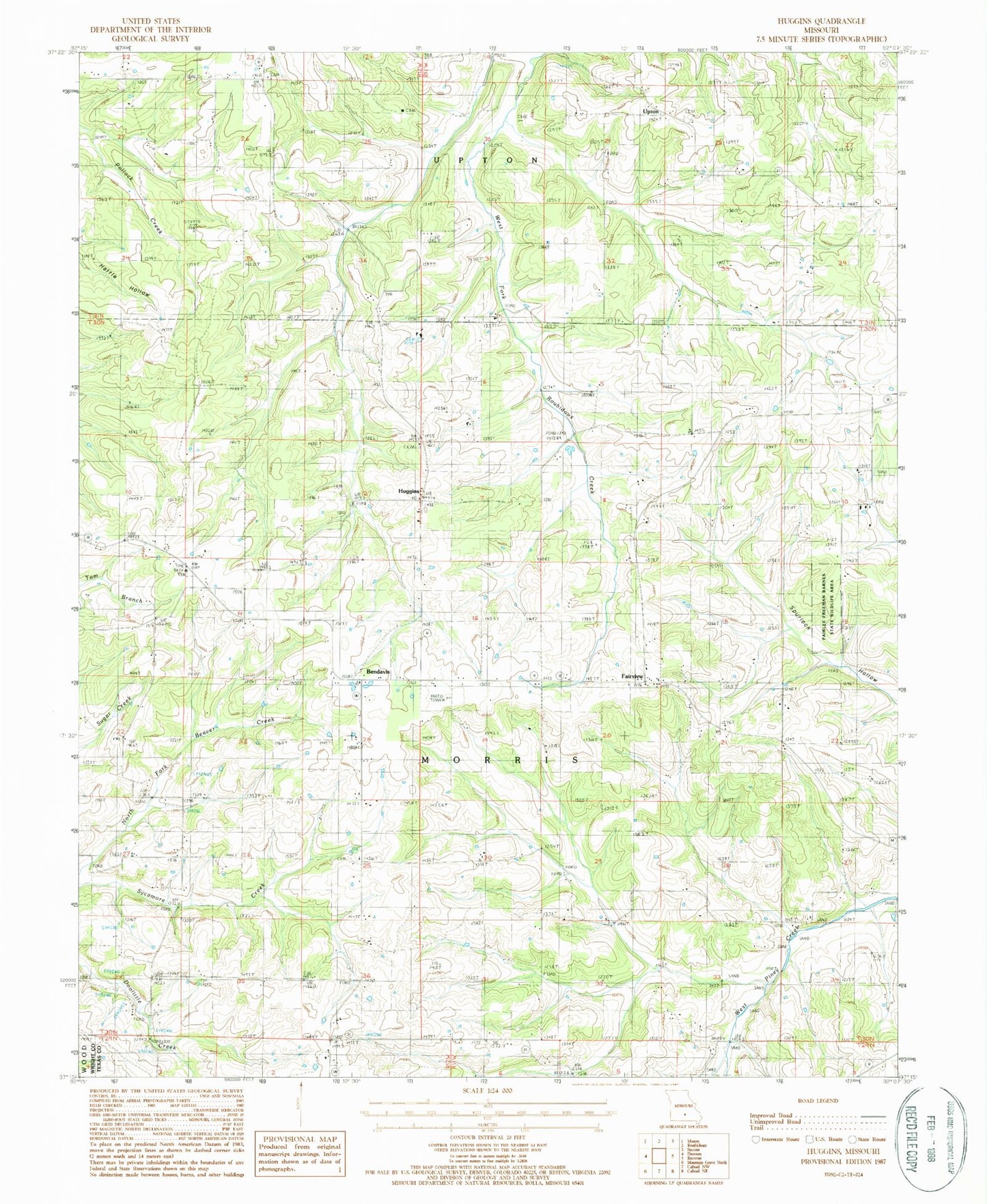
Classic USGS Huggins Missouri 7.5'x7.5' Topo Map
Couldn't load pickup availability
Historical USGS topographic quad map of Huggins in the state of Missouri. Map scale may vary for some years, but is generally around 1:24,000. Print size is approximately 24" x 27"
This quadrangle is in the following counties: Texas, Wright.
The map contains contour lines, roads, rivers, towns, and lakes. Printed on high-quality waterproof paper with UV fade-resistant inks, and shipped rolled.
Contains the following named places: Alice, Alice School, Ballard Church, Ballard School, Bendavis, Cedar Valley Church, Cedar Valley School, Dunsmore School, Fairview, Fairview Church, Flying 'E' Airport, Hickory Ridge Church, Huggins, Huggins Post Office, Huggins Volunteer Fire Department Station 1, Logan School, Lone Star School, Murr School, Oak Grove School, Pairlee Freeman Barnes State Wildlife Area, Pleasant Ridge, Pleasant Ridge School, Racket Ridge School, Rock Springs Church, Sycamore Creek, Township of Morris, Tuttle Cemetery, Upton, Watts Cemetery, ZIP Code: 65484