MyTopo
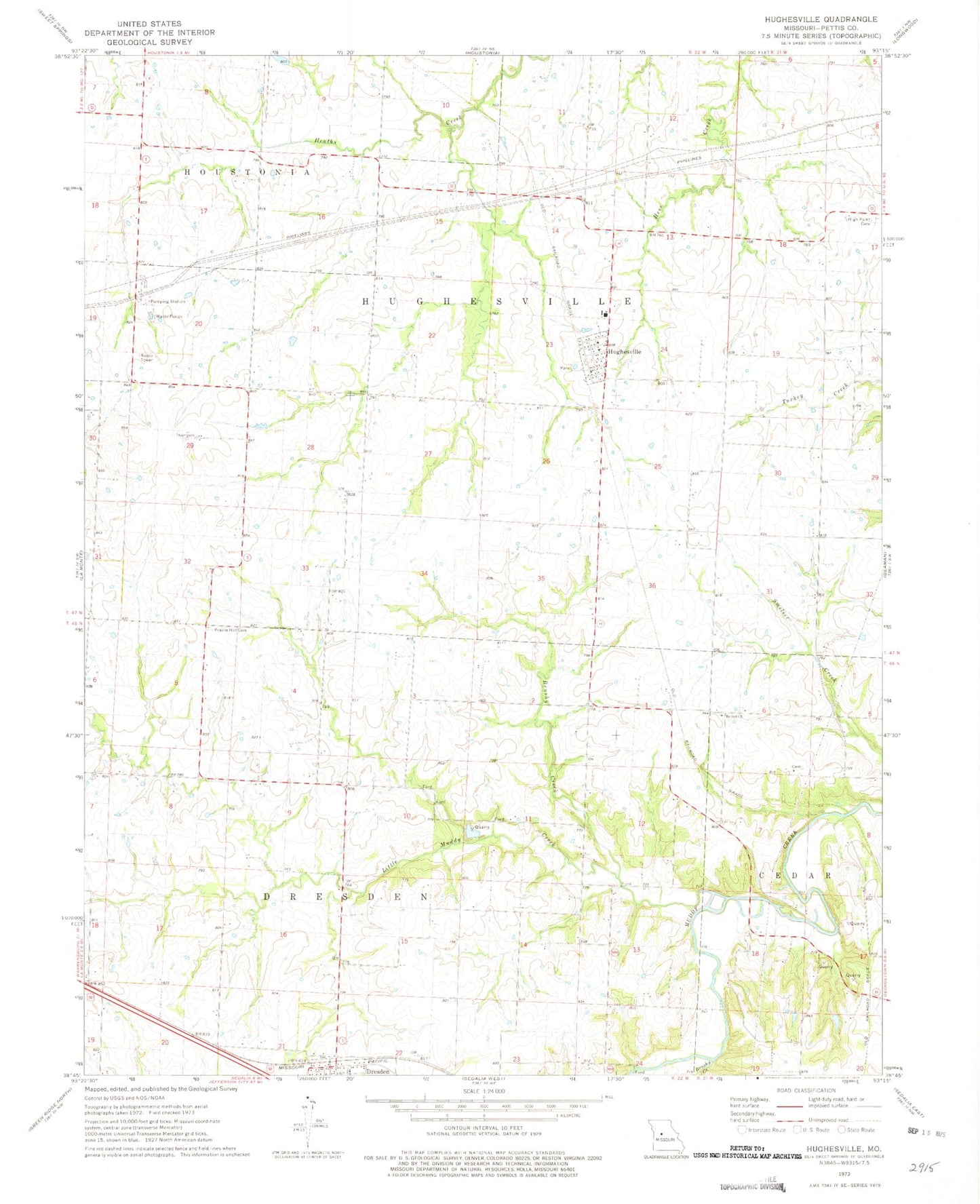
Classic USGS Hughesville Missouri 7.5'x7.5' Topo Map
Couldn't load pickup availability
Historical USGS topographic quad map of Hughesville in the state of Missouri. Map scale may vary for some years, but is generally around 1:24,000. Print size is approximately 24" x 27"
This quadrangle is in the following counties: Pettis.
The map contains contour lines, roads, rivers, towns, and lakes. Printed on high-quality waterproof paper with UV fade-resistant inks, and shipped rolled.
Contains the following named places: Bethel Church, Brushy Creek, Craft, Dresden, High Point Cemetery, Hughesville, Hughesville Community Fire Department, Hughesville Post Office, Hughesville School, Little Muddy Creek, Northwest High School, Prairie Hill Church, Prairie Hill Presbyterian Cemetery, Prairie Hill School, Smelser School, Township of Dresden, Township of Hughesville, Village of Hughesville, Walnut Grove School