MyTopo
Classic USGS Hughesville Pennsylvania 7.5'x7.5' Topo Map
Couldn't load pickup availability
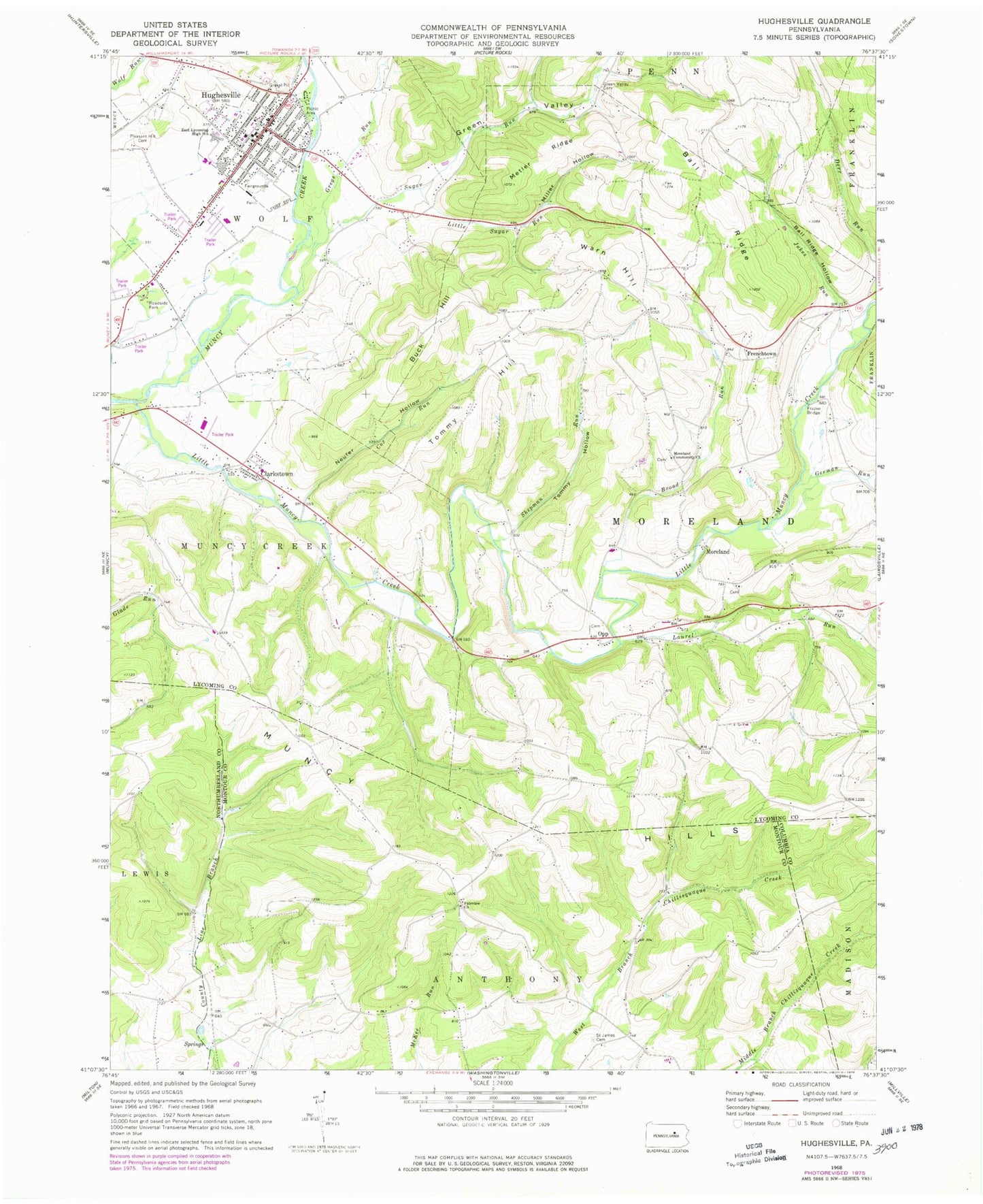
Historical USGS topographic quad map of Hughesville in the state of Pennsylvania. Map scale may vary for some years, but is generally around 1:24,000. Print size is approximately 24" x 27"
This quadrangle is in the following counties: Columbia, Lycoming, Montour, Northumberland.
The map contains contour lines, roads, rivers, towns, and lakes. Printed on high-quality waterproof paper with UV fade-resistant inks, and shipped rolled.
Contains the following named places: Ball Ridge, Ball Ridge Hollow, Borough of Hughesville, Broad Run, Buck Hill, Clark School, Clarkstown, Clayhole School, Cox Run, East Lycoming High School, Fairview Church, Frazier Bridge, Frenchtown, Frenchtown School, German Run, Green Valley, Green Valley Cemetery, Gregs Run, Hughesville, Hughesville Borough Police Department, Hughesville Post Office, Hughesville Volunteer Fire Department Station 24, Jakes Run, Laurel Run, Little Muncy Creek, Little Sugar Run, Metler Ridge, Miller Hollow, Moreland, Moreland Baptist Cemetery, Moreland Community Church, Moreland Lutheran Cemetery, Moreland Methodist Cemetery, Muncy Creek Community Fire Company Clarkstown, Muncy Hills, Neufer Hollow, Opp, Pleasant Hill Cemetery, Saint James Cemetery, Shepman Run, Sugar Run, Tommy Hill, Tommy Hollow, Township of Moreland, Warn Hill, ZIP Codes: 17756, 17772