MyTopo
Classic USGS Hugo Oklahoma 7.5'x7.5' Topo Map
Couldn't load pickup availability
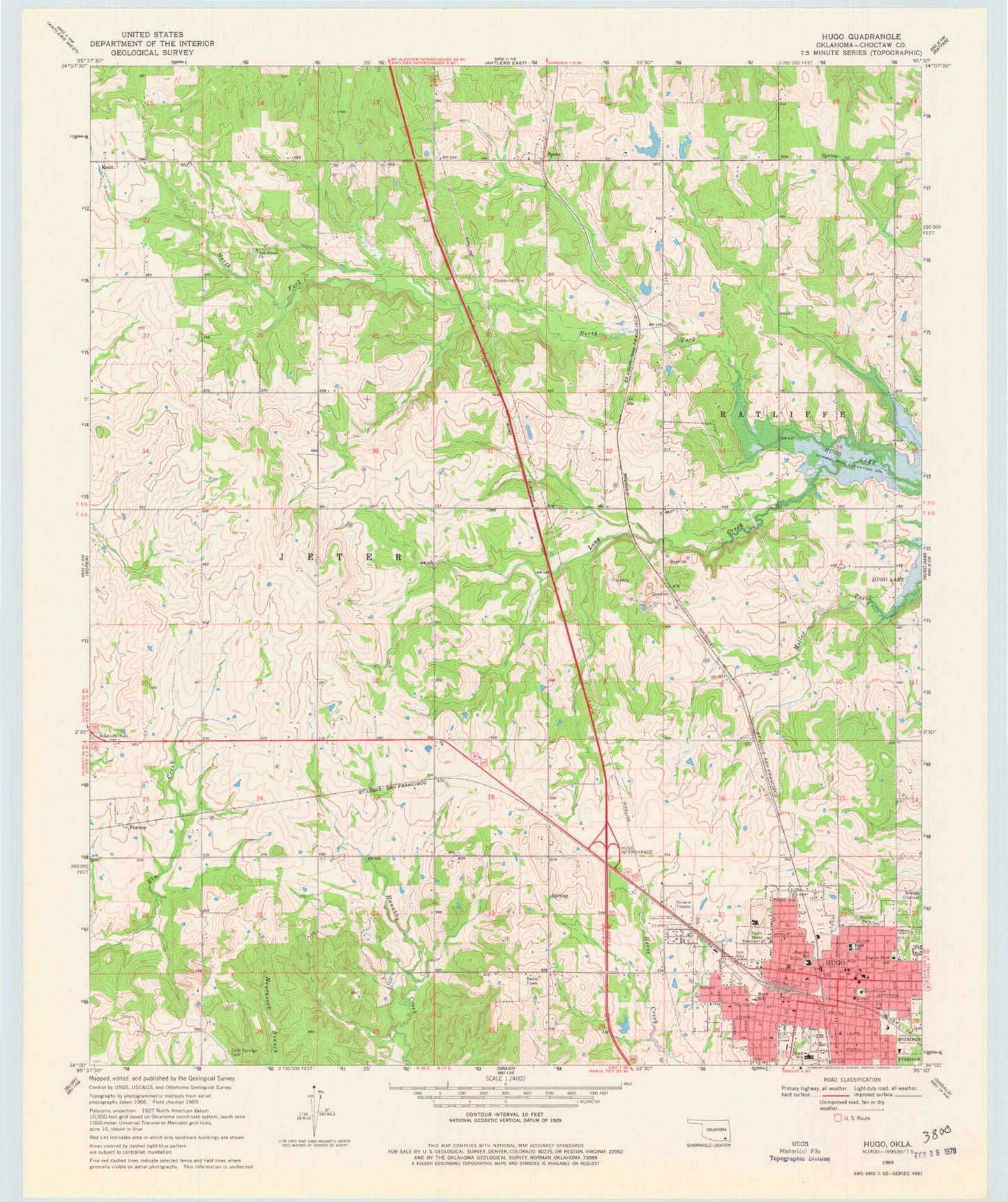
Historical USGS topographic quad map of Hugo in the state of Oklahoma. Map scale may vary for some years, but is generally around 1:24,000. Print size is approximately 24" x 27"
This quadrangle is in the following counties: Choctaw.
The map contains contour lines, roads, rivers, towns, and lakes. Printed on high-quality waterproof paper with UV fade-resistant inks, and shipped rolled.
Contains the following named places: Ansley Park, Ballard Aviation of Hugo, Choctaw County, Choctaw County Jail, Choctaw County Sheriff's Office, Choctaw Nation Law Enforcement, City of Hugo, Cold Springs Cemetery, Cooksville Cemetery, County District 8, Eugene Field School, First Baptist Church, First Christian Church, First United Methodist Church, Forney, Hugo, Hugo Division, Hugo Fire Department Station 1 Headquarters, Hugo Fire Department Station 2, Hugo High School, Hugo Intermediate School, Hugo Middle School, Hugo Police Department, Hugo Post Office, Hugo Public Schools Administration, Kent, Kingdom Hall-Jehovahs Witness, Main Shopping Center, Mann School, Mount Calvary Baptist Church, North Fork Long Creek, Oak Grove Church, Oknoname 023007 Dam, Oknoname 023007 Reservoir, Saint Marks Episcopal Church, Speer, Speer Volunteer Fire Department, Stan Stamper Municipal Airport, Township of Jeter, Wesley United Methodist Church, West Kiamichi Church