MyTopo
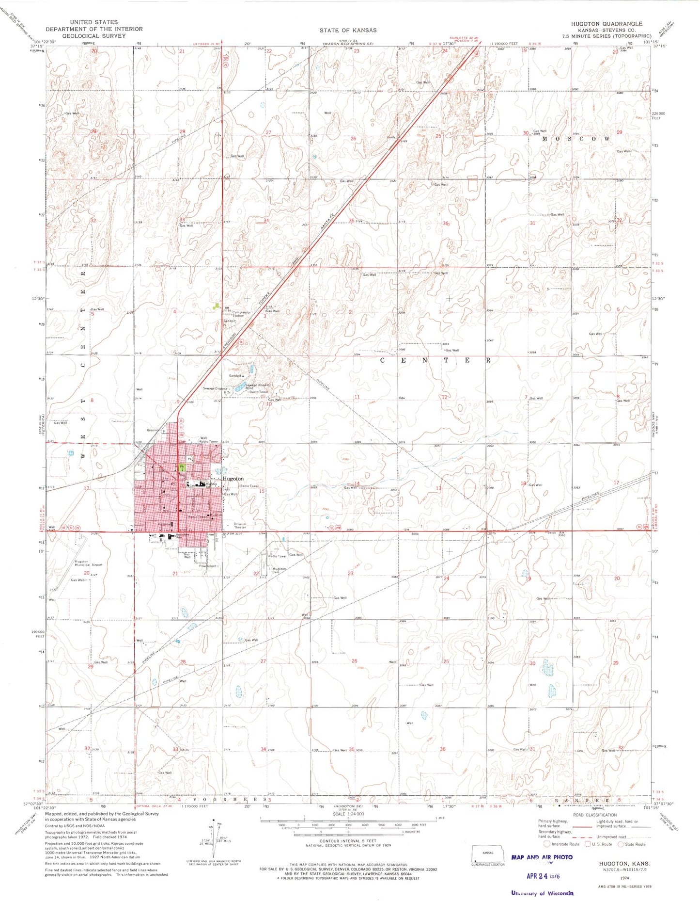
Classic USGS Hugoton Kansas 7.5'x7.5' Topo Map
Couldn't load pickup availability
Historical USGS topographic quad map of Hugoton in the state of Kansas. Map scale may vary for some years, but is generally around 1:24,000. Print size is approximately 24" x 27"
This quadrangle is in the following counties: Stevens.
The map contains contour lines, roads, rivers, towns, and lakes. Printed on high-quality waterproof paper with UV fade-resistant inks, and shipped rolled.
Contains the following named places: Bethel Friends Church, Bob Sosa Recreation Center, Church of Christ, Church of God, Church of the Nazerene, City of Hugoton, Dirtona Raceway, Faith Chapel Church of God in Christ, Faith Lutheran Church, Heritage Christian Academy, Hugoton, Hugoton Assembly of God Church, Hugoton Baptist Church, Hugoton Cemetery, Hugoton City Hall, Hugoton Elementary School, Hugoton First Christian Church, Hugoton High School, Hugoton Middle School, Hugoton Municipal Airport, Hugoton Municipal Power Plant Number 2, Hugoton Police Department, Hugoton Post Office, Hugoton Public Works, Hugoton Recreation Commission, Hugoton Senior Center, Hugoton United Methodist Church, Hugoton Wastewater Treatment Facility, Lighthouse Fellowship Church, Monte Santo Pentacostal Church, Saint Helen Catholic Church, Stevens County, Stevens County Courthouse, Stevens County Emergency Medical Services, Stevens County Fairgrounds, Stevens County Fire Department Hugoton Station, Stevens County Health Office, Stevens County Historical Museum, Stevens County Hospital, Stevens County Jail, Stevens County Library, Stevens County Road and Bridge Department, Stevens County Sheriff's Office, The Church of Jesus Christ of Latter Day Saints, Trinity Baptist Church, ZIP Code: 67951