MyTopo
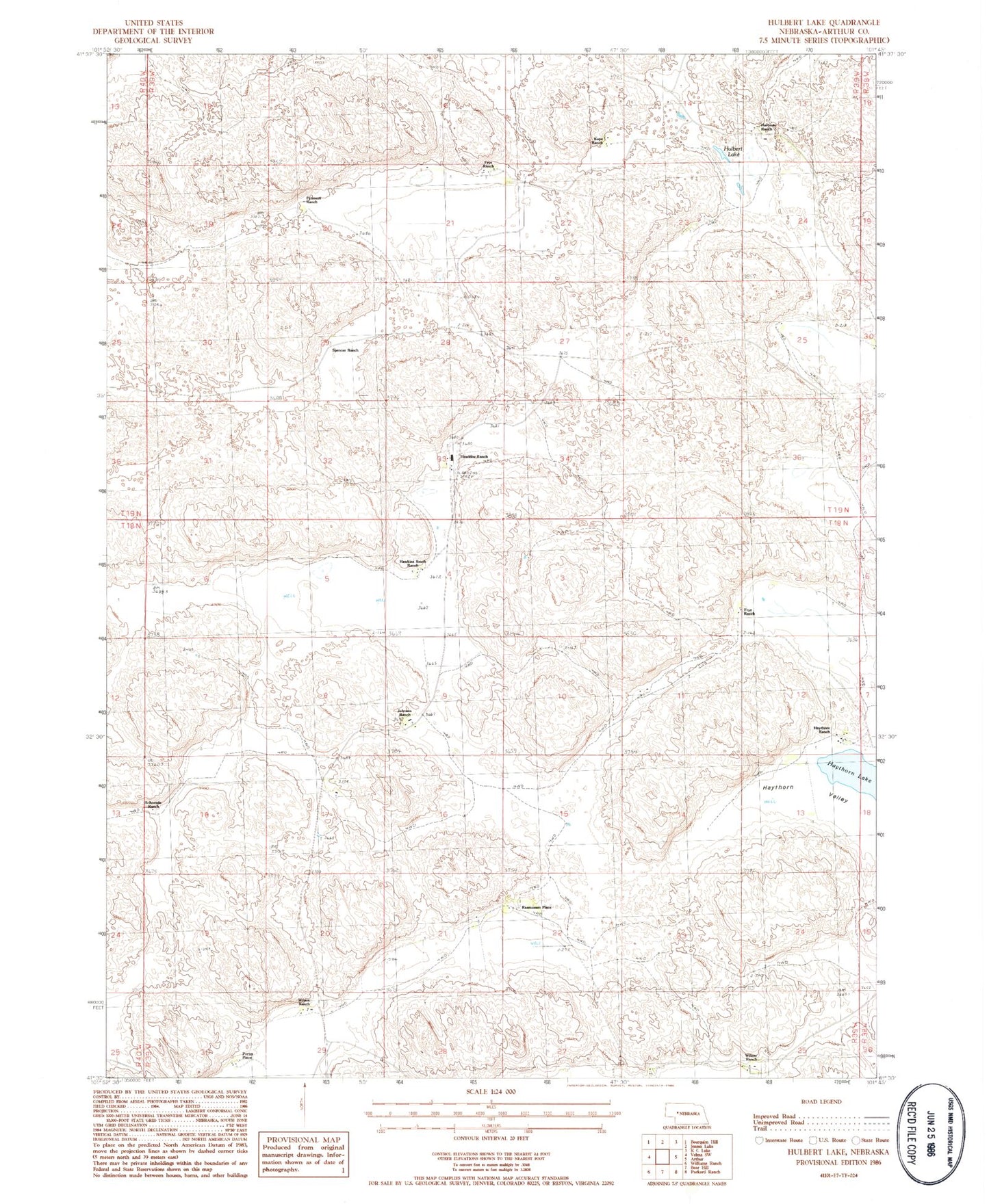
Classic USGS Hulbert Lake Nebraska 7.5'x7.5' Topo Map
Couldn't load pickup availability
Historical USGS topographic quad map of Hulbert Lake in the state of Nebraska. Map scale may vary for some years, but is generally around 1:24,000. Print size is approximately 24" x 27"
This quadrangle is in the following counties: Arthur.
The map contains contour lines, roads, rivers, towns, and lakes. Printed on high-quality waterproof paper with UV fade-resistant inks, and shipped rolled.
Contains the following named places: Cross Ranch, Frye Lake, Frye Ranch, H Orr Ranch, Hartman Ranch, Hawkins Ranch, Hawkins Ranch Airport, Hawkins South Ranch, Haythorn Lake, Haythorn Ranch, Haythorn Valley, Hulbert Lake, Johnson Ranch, Kaps Ranch, Peterson Ranch, Porter Place, Rasmussen Place, Schneede Ranch, School Number 1, School Number 7, Spencer Ranch, Wilson Ranch