MyTopo
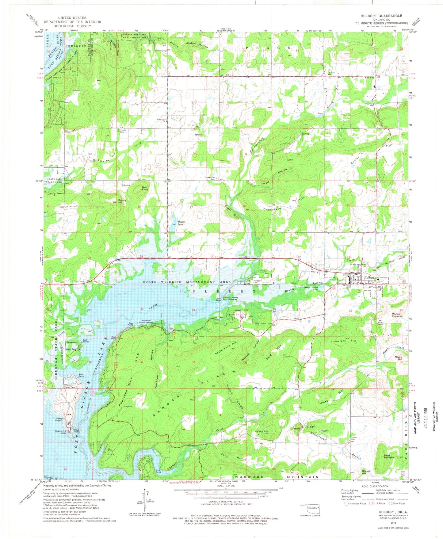
Classic USGS Hulbert Oklahoma 7.5'x7.5' Topo Map
Couldn't load pickup availability
Historical USGS topographic quad map of Hulbert in the state of Oklahoma. Map scale may vary for some years, but is generally around 1:24,000. Print size is approximately 24" x 27"
This quadrangle is in the following counties: Cherokee, Wagoner.
The map contains contour lines, roads, rivers, towns, and lakes. Printed on high-quality waterproof paper with UV fade-resistant inks, and shipped rolled.
Contains the following named places: Abidoe Hollow, Bald Hill, Bald Knob, Biscuit Hill, Brushy Hill, Butler Hill, Cedar Bluff, Chucalate Hill, Cockrum Hollow, Cockrun Hollow, Cook Hollow, Double Spring Creek, Eli, Flint Ridge, Fort Gibson Wildlife Management Area, Fourteen Mile Hills, Hare Cemetery, Hicks Hill, Hinson Cemetery, Hinton Hollow, Hulbert, Hulbert Cemetery, Hulbert Division, Hulbert Elementary School, Hulbert Fire Department, Hulbert Junior High School, Hulbert Landing Public Use Area, Hulbert Police Department, Hulbert Post Office, Hulbert Senior High School, Jim Brown Hollow, Johnny Iron Hill, Keener Cemetery, Keener Church, Limestone Hill, Linder Cemetery, Lost City, Lost City Cemetery, Lost City Elementary School, Lower Ray Cemetery, Melvin Church, Negro Hill, Nichols Hollow, Norwood Fire Department Station 2, Norwood Mountain, Pecan Creek, Peckerwood Hill, Ranger Creek, Ranger Hills, Rattlesnake Branch, Rogers Pond, Rogers Pond Dam, Sequoyah Park Airport, Short Mountain, Spring Valley Volunteer Fire Department Station 1, Spring Valley Volunteer Fire Department Station 2, Town of Hulbert, Township of Hulbert, Waford Mountain, Western Hill Lodge, Wildwood Public Use Area, Wolf Hollow, ZIP Code: 74441