MyTopo
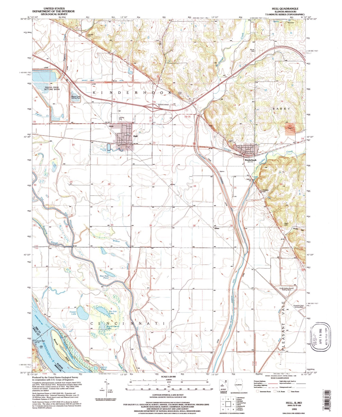
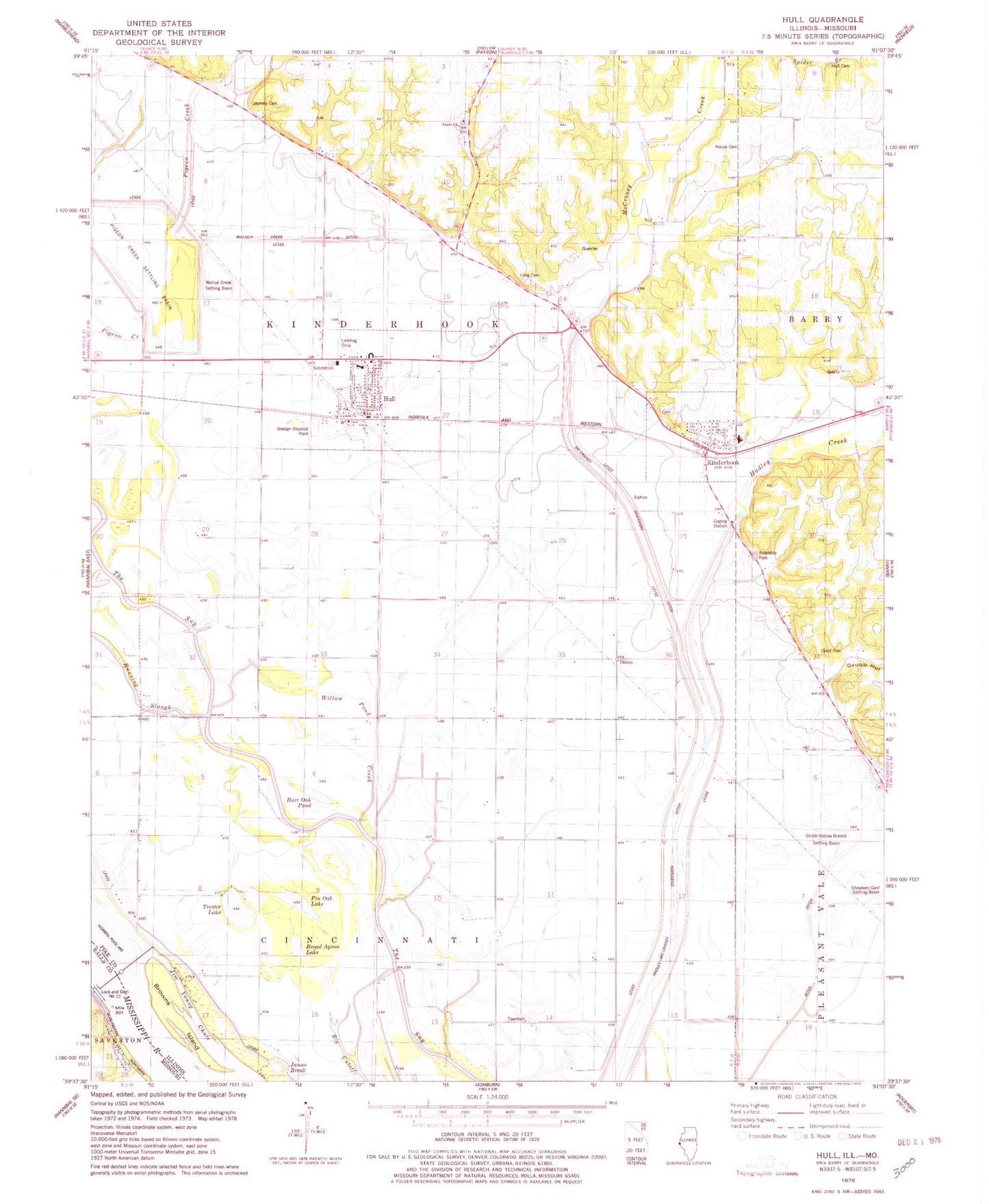
Classic USGS Hull Illinois 7.5'x7.5' Topo Map
Couldn't load pickup availability
Historical USGS topographic quad map of Hull in the states of Illinois, Missouri. Typical map scale is 1:24,000, but may vary for certain years, if available. Print size: 24" x 27"
This quadrangle is in the following counties: Pike, Ralls.
The map contains contour lines, roads, rivers, towns, and lakes. Printed on high-quality waterproof paper with UV fade-resistant inks, and shipped rolled.
Contains the following named places: Akers Church, Boyd Ditch, Broad Apron Lake, Browns Island, Burr Oak Pond, Gard Cemetery, Grubb Hollow, Grubb Hollow Branch Settling Basin, Hadley Creek, Hadley-McCraney Diversion Ditch, House Cemetery, Hull, Hull Cemetery, James Break, Jim Young Chute, Journey Cemetery, Kinderhook, Long Cemetery, McCraney Creek, McCraney Diversion Ditch, Pigeon Creek Settling Basin, Pin Oak Lake, Shewhart-Gard Settling Basin, Spider Branch, Trester Lake, Walnut Creek Ditch, Walnut Creek Settling Basin, Willow Pond Creek, Shinn, Lock and Dam 22, Hull Airport (historical), Township of Cincinnati, Township of Kinderhook, Crabapple School (historical), Eagle Pond (historical), Elm Grove School (historical), Grubb Hollow School (historical), Kennedy School (historical), Munger School (historical), Prairie School (historical), Shinn School (historical), Smith School (historical), Walnut Creek School (historical), Wike Chapel School (historical), Willow Pond, West Pike Elementary School, West Pike High School, Akers Chapel Cemetery, Kinderhook Cemetery, Grubb Hollow Prairie Nature Preserve, Village of Kinderhook, Village of Hull, Hull - Kinderhook Fire Protection District, Hull - Kinderhook Fire Protection District, Kinderhook Post Office, Hull Post Office, Lock and Dam Number Twenty-two, Lock and Dam Number 22