MyTopo
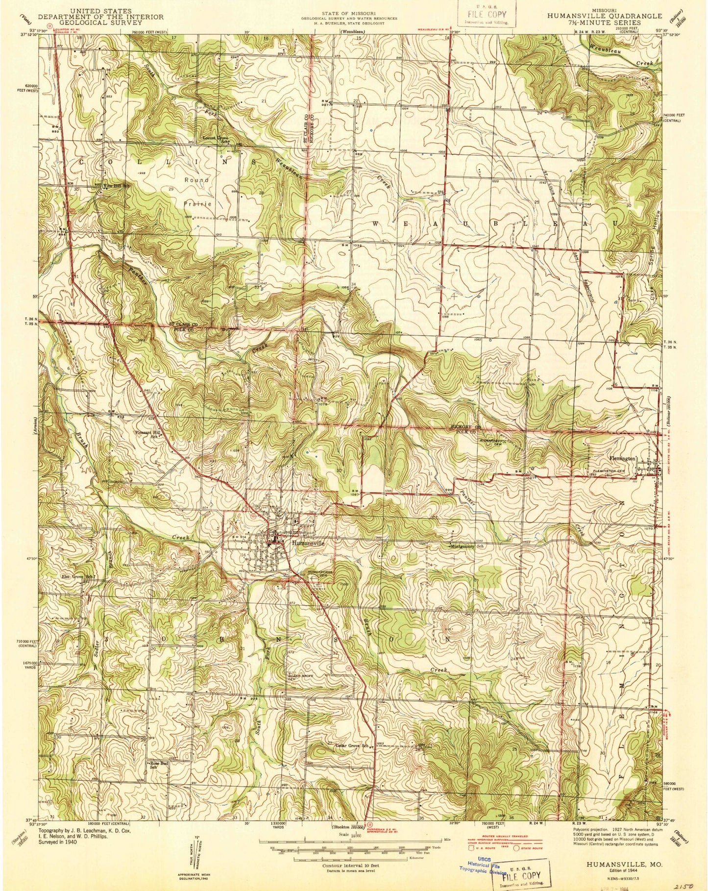
Classic USGS Humansville Missouri 7.5'x7.5' Topo Map
Couldn't load pickup availability
Historical USGS topographic quad map of Humansville in the state of Missouri. Map scale may vary for some years, but is generally around 1:24,000. Print size is approximately 24" x 27"
This quadrangle is in the following counties: Hickory, Polk, St. Clair.
The map contains contour lines, roads, rivers, towns, and lakes. Printed on high-quality waterproof paper with UV fade-resistant inks, and shipped rolled.
Contains the following named places: Alley Lake Dam, Brush College School, Cedar Grove School, City of Humansville, Elm Grove School, Flemington, Flemington Cemetery, Flemington Post Office, Humansville, Humansville Cemetery, Humansville Fire and Rescue Station 1, Humansville Police Department, Humansville Post Office, Kingdom Hall Church, Locust Grove School, Montgomery School, Number 15 Dam, Owens Lake Section 4 Dam, Pleasant Hill School, Pocomo Lake, Richardson Cemetery, Rose Bud School, Round Prairie, Rule Creek, Sadler Branch, Shady Grove Cemetery, Souders Cemetery, South Fork Brush Creek, Sprowls Dam, Tinker Cemetery, Township of Flemington, Township of Johnson, Township of Weaubleau, Vanderford Number One Dam, Village of Flemington, Vine Hill School, ZIP Code: 65674