MyTopo
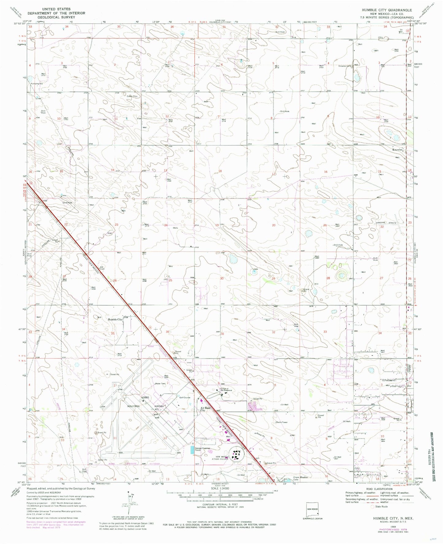
Classic USGS Humble City New Mexico 7.5'x7.5' Topo Map
Couldn't load pickup availability
Historical USGS topographic quad map of Humble City in the state of New Mexico. Map scale may vary for some years, but is generally around 1:24,000. Print size is approximately 24" x 27"
This quadrangle is in the following counties: Lea.
The map contains contour lines, roads, rivers, towns, and lakes. Printed on high-quality waterproof paper with UV fade-resistant inks, and shipped rolled.
Contains the following named places: 10217 Water Well, 10218 Water Well, 10219 Water Well, 10220 Water Well, 10221 Water Well, 10223 Water Well, 10226 Water Well, 10227 Water Well, 10228 Water Well, 10229 Water Well, 10230 Water Well, 10232 Water Well, 10233 Water Well, 10234 Water Well, 10235 Water Well, 10236 Water Well, 10244 Water Well, 10245 Water Well, 88242, Air Base City, College Lane Elementary School, Harry McAdams State Park, Hobbs Army Air Field, Humble City, Humble City Post Office, Industrial Airpark, Knowles, Knowles Cemetery, Knowles Fire Department, Knowles Post Office, KYKK-AM (Hobbs), KYKK-AM (Humble City), KZOR-FM (Hobbs), Lea County Correctional Facility, Lea County Cowboy Hall of Fame and Western Heritage Center, Lea County Road Pit, Lea County Sheriff's Office Hobbs, Lea Regional Medical Center, New Mexico Junior College, New Mexico State Police District 3 Hobbs, University of the Southwest