
MyTopo
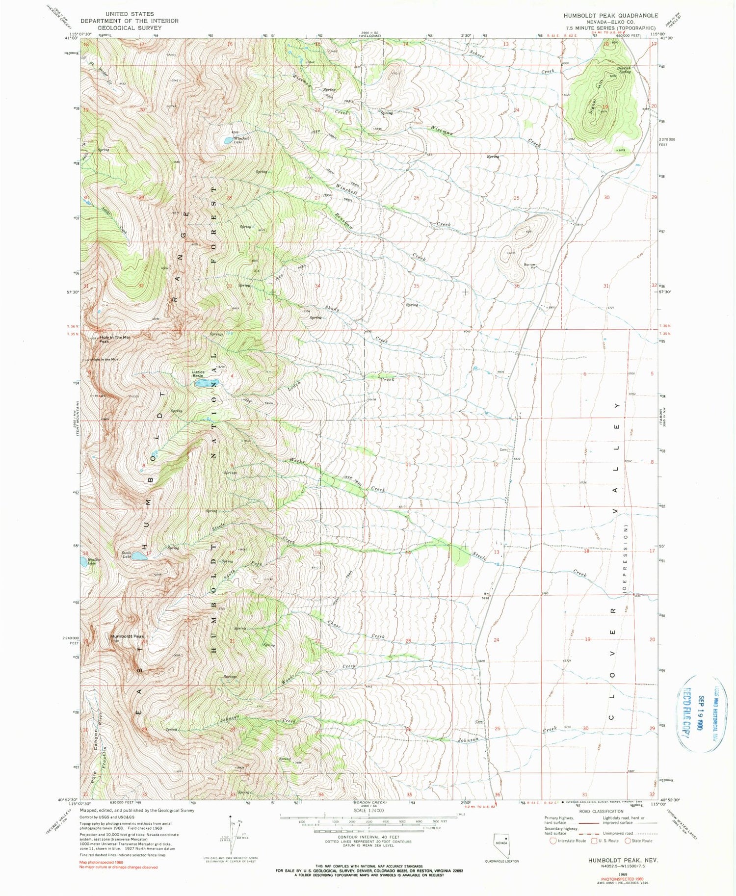
Classic USGS Humboldt Peak Nevada 7.5'x7.5' Topo Map
Couldn't load pickup availability
Historical USGS topographic quad map of Humboldt Peak in the state of Nevada. Map scale may vary for some years, but is generally around 1:24,000. Print size is approximately 24" x 27"
This quadrangle is in the following counties: Elko.
The map contains contour lines, roads, rivers, towns, and lakes. Printed on high-quality waterproof paper with UV fade-resistant inks, and shipped rolled.
Contains the following named places: Ballard Ranch, Bradish Spring, Chase Creek, Clover Valley School, East Humboldt Range, East Humboldts Wilderness, Goodwin Ranch, Hole in the Mountain, Hole in the Mountain Peak, Humboldt Peak, Humboldt School, K C Ranch, Leach Creek, Lizzies Basin, Longnecker Ranch, Ralph Fire Lane, Renshaw Creek, Schoer Creek, Schumann Ranch, Shady Creek, Signal Hill, South Fork Steele Creek, Steele Lake, Weeks Creek, Weeks Ranch, Winchell Creek, Winchell Lake, Wiseman Creek, Wood, Wood Post Office, Woods Creek, Wright Ranch


