MyTopo
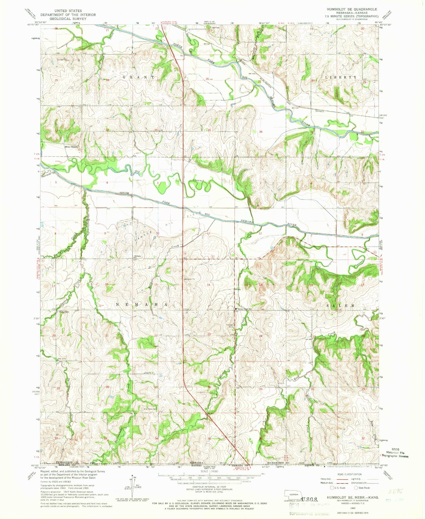
Classic USGS Humboldt SE Nebraska 7.5'x7.5' Topo Map
Couldn't load pickup availability
Historical USGS topographic quad map of Humboldt SE in the state of Nebraska. Map scale may vary for some years, but is generally around 1:24,000. Print size is approximately 24" x 27"
This quadrangle is in the following counties: Brown, Nemaha, Richardson.
The map contains contour lines, roads, rivers, towns, and lakes. Printed on high-quality waterproof paper with UV fade-resistant inks, and shipped rolled.
Contains the following named places: Barneys Branch, Bethany Church, Bradley Branch, Cottonwood Creek, Dawson Oil Field, Easly Creek, Fourmile Creek, Geer Post Office, Holy Creek, Honey Creek, Honey Creek School, Iliff Cemetery, Miles Ranch, Nemaha Election Precinct, New Salem, Nim City, Old Channel South Fork Nemaha River, Rabbit Creek, Rattlesnake Creek, Spring Creek, Township of Nemaha, Wild Rose Cemetery, Zion Church, ZIP Code: 68337