MyTopo
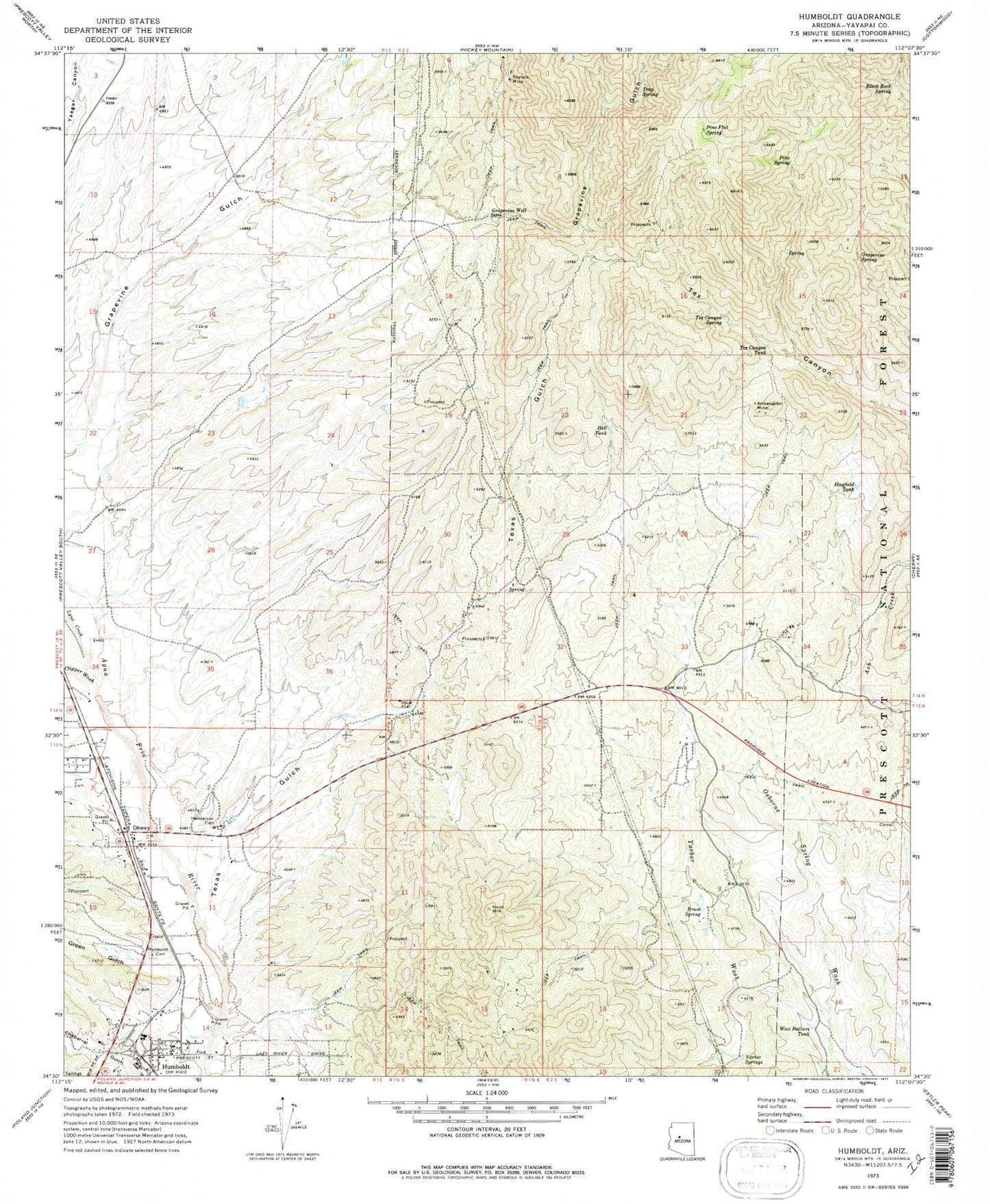
Classic USGS Humboldt Arizona 7.5'x7.5' Topo Map
Couldn't load pickup availability
Historical USGS topographic quad map of Humboldt in the state of Arizona. Typical map scale is 1:24,000, but may vary for certain years, if available. Print size: 24" x 27"
This quadrangle is in the following counties: Yavapai.
The map contains contour lines, roads, rivers, towns, and lakes. Printed on high-quality waterproof paper with UV fade-resistant inks, and shipped rolled.
Contains the following named places: Ambassador Mine, Black Rock Spring, Bruce Spring, Clipper Wash, Dewey, Grapevine Spring, Grapevine Well, Green Gulch, Hayfield Tank, Hell Tank, Henderson Cemetery, Humboldt, Humboldt Cemetery, Lower Grapevine Spring, Lynx Creek, Pine Flat Spring, Pine Spring, Shylock Mine, Tex Canyon Spring, Tex Canyon Tank, Texas Gulch, Trap Spring, West Pasture Tank, Yarber Springs, Cherry Creek Railroad Station, Humboldt Junior High School, Iron King Railroad Station, Yarber Well, Yarbo School, Trick Tank, Cement Spring, Dewey Post Office, Humboldt Post Office, Dewey-Humboldt, Town of Dewey-Humboldt, Humboldt Elementary School, Quail Wood Greens Golf Course, Dewey Faith Assembly of God, Gateway Baptist Church, Humboldt Bible Church, Humboldt Community Christian Church, Central Yavapai Fire District Station 54