MyTopo
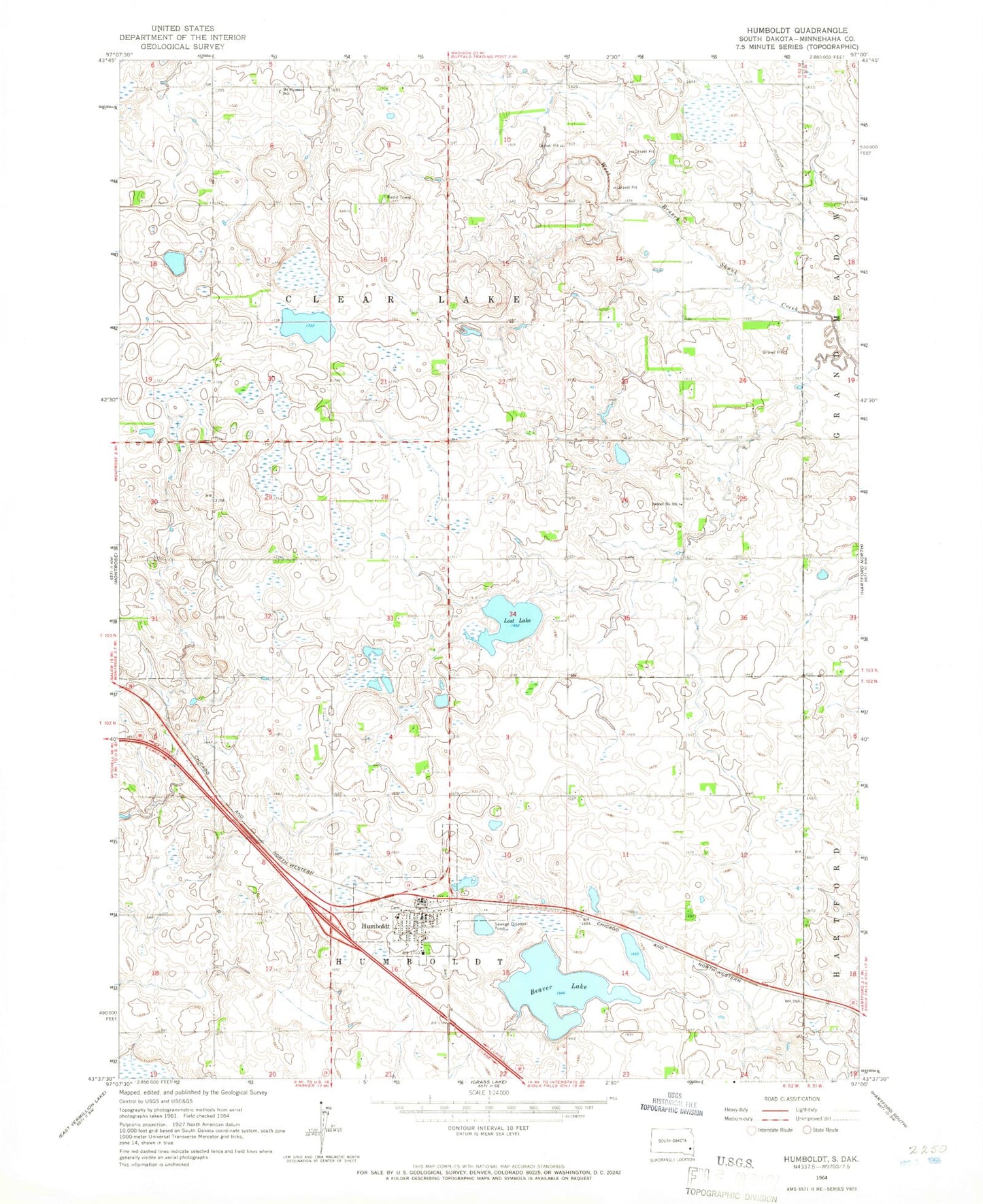
Classic USGS Humboldt South Dakota 7.5'x7.5' Topo Map
Couldn't load pickup availability
Historical USGS topographic quad map of Humboldt in the state of South Dakota. Map scale may vary for some years, but is generally around 1:24,000. Print size is approximately 24" x 27"
This quadrangle is in the following counties: Minnehaha.
The map contains contour lines, roads, rivers, towns, and lakes. Printed on high-quality waterproof paper with UV fade-resistant inks, and shipped rolled.
Contains the following named places: Beaver Lake, Humboldt, Humboldt Branch Library, Humboldt City Hall, Humboldt Elementary School, Humboldt Fire and Ambulance Service, Humboldt Post Office, Humboldt Public Cemetery, KIOV-FM (Sioux Falls), Lost Lake, Mount Pleasant School, Our Lady of Lourdes Cemetery, Saint Ann's Cemetery, Saint Paul Lutheran Cemetery, School Number 103, Town of Humboldt, Township of Clear Lake, Township of Humboldt, Western Mall, ZIP Code: 57035