MyTopo
Classic USGS Humdinger Spring Texas 7.5'x7.5' Topo Map
Couldn't load pickup availability
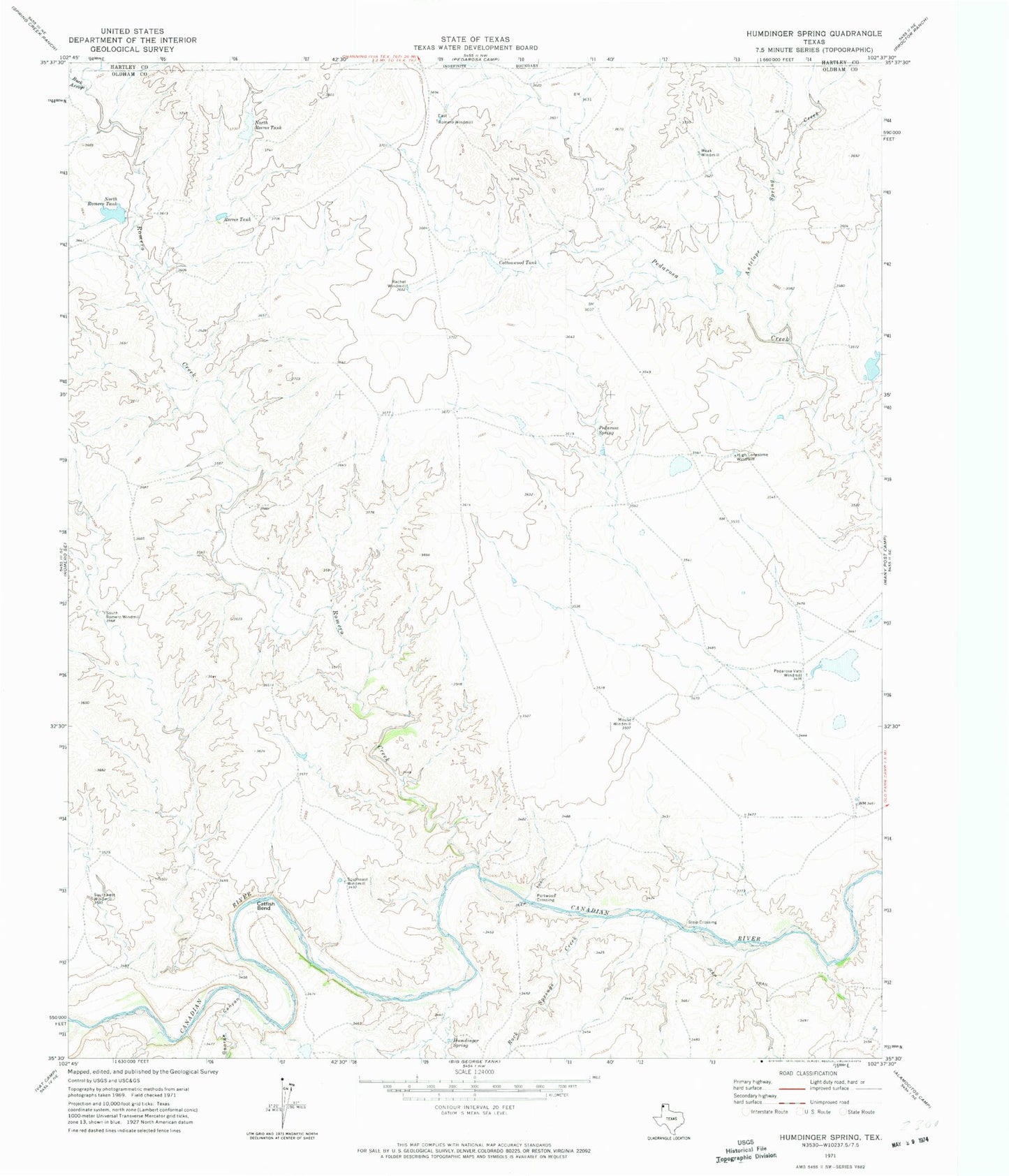
Historical USGS topographic quad map of Humdinger Spring in the state of Texas. Map scale may vary for some years, but is generally around 1:24,000. Print size is approximately 24" x 27"
This quadrangle is in the following counties: Hartley, Oldham.
The map contains contour lines, roads, rivers, towns, and lakes. Printed on high-quality waterproof paper with UV fade-resistant inks, and shipped rolled.
Contains the following named places: Antelope Spring Creek, Buck Arroyo, Catfish Bend, Cottonwood Tank, East Romero Windmill, George Canyon, High Lonesome Windmill, Humdinger Spring, Las Arches Creek, Martha Houghton Lake Number 5 Dam, Mouse Windmill, North Reeves Tank, North Romero Tank, Partwood Crossing, Pedarosa Spring, Pedarosa Springs, Pedarosa Vats Windmill, Rachel Windmill, Reeves Tank, Rock Springs Creek, Romero Creek, South Romero Windmill, Southeast Windmill, Southwest Windmill, Strip Crossing, Weak Windmill