MyTopo
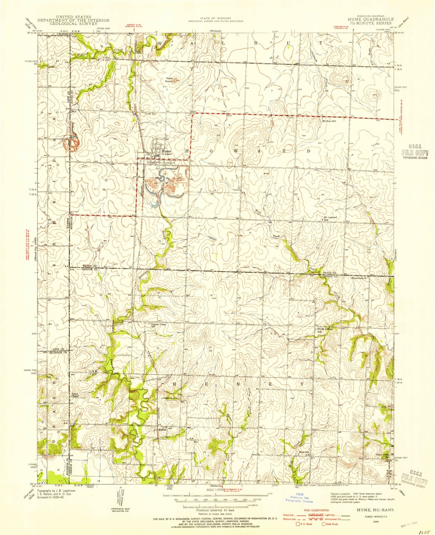
Classic USGS Hume Missouri 7.5'x7.5' Topo Map
Couldn't load pickup availability
Historical USGS topographic quad map of Hume in the state of Missouri. Map scale may vary for some years, but is generally around 1:24,000. Print size is approximately 24" x 27"
This quadrangle is in the following counties: Bates, Bourbon, Linn, Vernon.
The map contains contour lines, roads, rivers, towns, and lakes. Printed on high-quality waterproof paper with UV fade-resistant inks, and shipped rolled.
Contains the following named places: Amos, Amos School, Brush College School, Centerview Church, Clark Cemetery, Hume, Hume Cemetery, Hume Elementary School, Hume Fire Department, Hume High School, Hume Post Office, Lawrence Cemetery, Mount Leonard School, Mount Rose School, New Home Junction, Prairie Union School, Rainey Lake, Rock, Rock Post Office, Rocky Mound, Rose-Leonard School, Stony Point School, Tolley Creek, Town of Hume, Township of Henry, Township of Howard, Underwood Cemetery, Union Chapel, Wolf School, Wolfe, Wolfe Post Office, ZIP Code: 64752