MyTopo
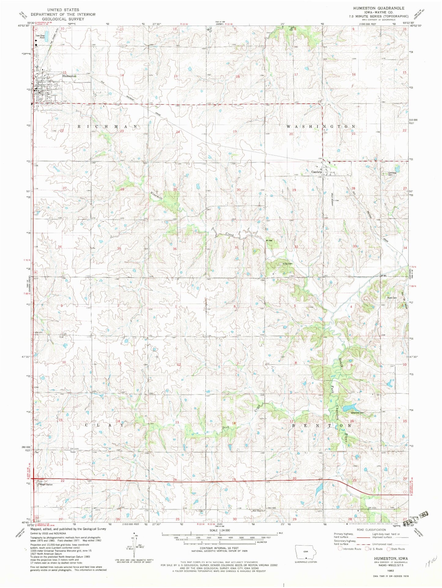
Classic USGS Humeston Iowa 7.5'x7.5' Topo Map
Couldn't load pickup availability
Historical USGS topographic quad map of Humeston in the state of Iowa. Map scale may vary for some years, but is generally around 1:24,000. Print size is approximately 24" x 27"
This quadrangle is in the following counties: Wayne.
The map contains contour lines, roads, rivers, towns, and lakes. Printed on high-quality waterproof paper with UV fade-resistant inks, and shipped rolled.
Contains the following named places: Benton Center School, Brown Jug School, Cambria, Cambria Cemetery, Cambria Post Office, Christian United Methodist Church, City of Humeston, Clay Center School, Dick Creek, Fairyview School, First Baptist Church, First Presbyterian Church, Greenlee Cemetery, Humeston, Humeston Fire Department, Humeston First Responders, Humeston Library, Humeston Medical Clinic, Humeston Post Office, Kirby Cemetery, Locust Grove School, Lucerne, Lucerne Post Office, Lucerne School, Maple Grove School, New Zion Church, Ninemile Creek, Orlando Post Office, Railroad right-of-way Public Hunting Area, Rush Cemetery, Saxon, Saxon Post Office, Township of Benton, Township of Clay, Township of Richman, Township of Washington, Wells Field, Willow Grove School, Wolf Hollow Wildlife Area