MyTopo
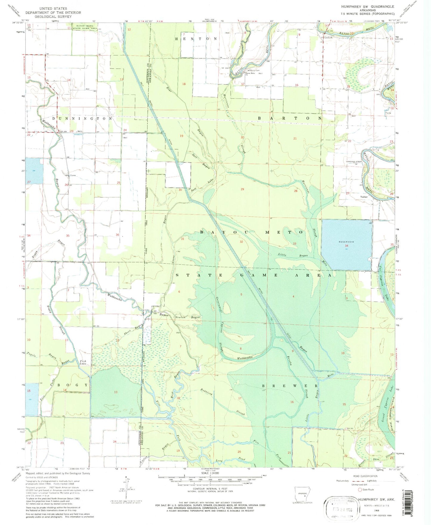
Classic USGS Humphrey SW Arkansas 7.5'x7.5' Topo Map
Couldn't load pickup availability
Historical USGS topographic quad map of Humphrey SW in the state of Arkansas. Map scale may vary for some years, but is generally around 1:24,000. Print size is approximately 24" x 27"
This quadrangle is in the following counties: Arkansas, Jefferson.
The map contains contour lines, roads, rivers, towns, and lakes. Printed on high-quality waterproof paper with UV fade-resistant inks, and shipped rolled.
Contains the following named places: Alcorn Fire Station, Alcorn School, Bayou Meto Church, Bayou Meto State Game Area, Bear Bayou, Boggy Bayou, Boggy Slough, Brushy Slough, Bubbling Slough, Castor Bayou, Corinth Church, Cox Cypress Lake, Cross Bayou, Fish Lake, Five Forks Bayou, Government Cypress Slough, Grand Cypress Lake, Halowell Reservoir, Hurricane Slough, Lateral Number 1, Lateral Number 2, Lockhart School, Main Canal, Mulberry Grove Church, Mulberry Grove School, Newton Bayou, Salt Bayou, Salt Lake, Short Bayou, Star View School, Township of Barton, Township of Brewer, Tupelo Bayou, Union Grove Church, Vallier, Vallier School, Wabbaseka Bayou, West Bayou, Williams Cemetery, Williams Church