MyTopo
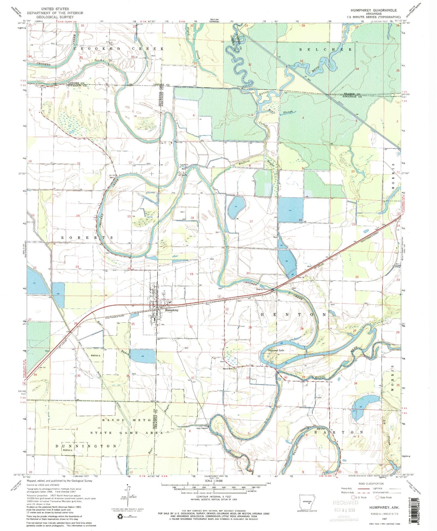
Classic USGS Humphrey Arkansas 7.5'x7.5' Topo Map
Couldn't load pickup availability
Historical USGS topographic quad map of Humphrey in the state of Arkansas. Map scale may vary for some years, but is generally around 1:24,000. Print size is approximately 24" x 27"
This quadrangle is in the following counties: Arkansas, Jefferson, Lonoke, Prairie.
The map contains contour lines, roads, rivers, towns, and lakes. Printed on high-quality waterproof paper with UV fade-resistant inks, and shipped rolled.
Contains the following named places: Argo Chapel, Bayou Meto Cemetery, Bayou Meto Church, Bear Slough, Big Slough, City of Humphrey, Crooked Creek, Cutoff, Cutoff Church, Cut-Off School, Flynn Cemetery, Flynn Church, Flynn School, Flynn Slough, Gill School, Glenwood Lake, Hufford Brake, Humphrey, Humphrey Elementary School, Humphrey Fire Department, Humphrey High School, Humphrey Municipal Fire Department Substation 1, Humphrey Police Department, Humphrey Post Office, Kratnek, Lateral Number 3, Lateral Number 5, Lateral Number 7, Pleasant Valley Church, Randolph Reservoir, Randolph Reservoir Dam, Roberts, Salt Bayou Drainage Ditch, Township of Henton, Turner Store, ZIP Code: 72073