MyTopo
Classic USGS Humphrey New York 7.5'x7.5' Topo Map
Couldn't load pickup availability
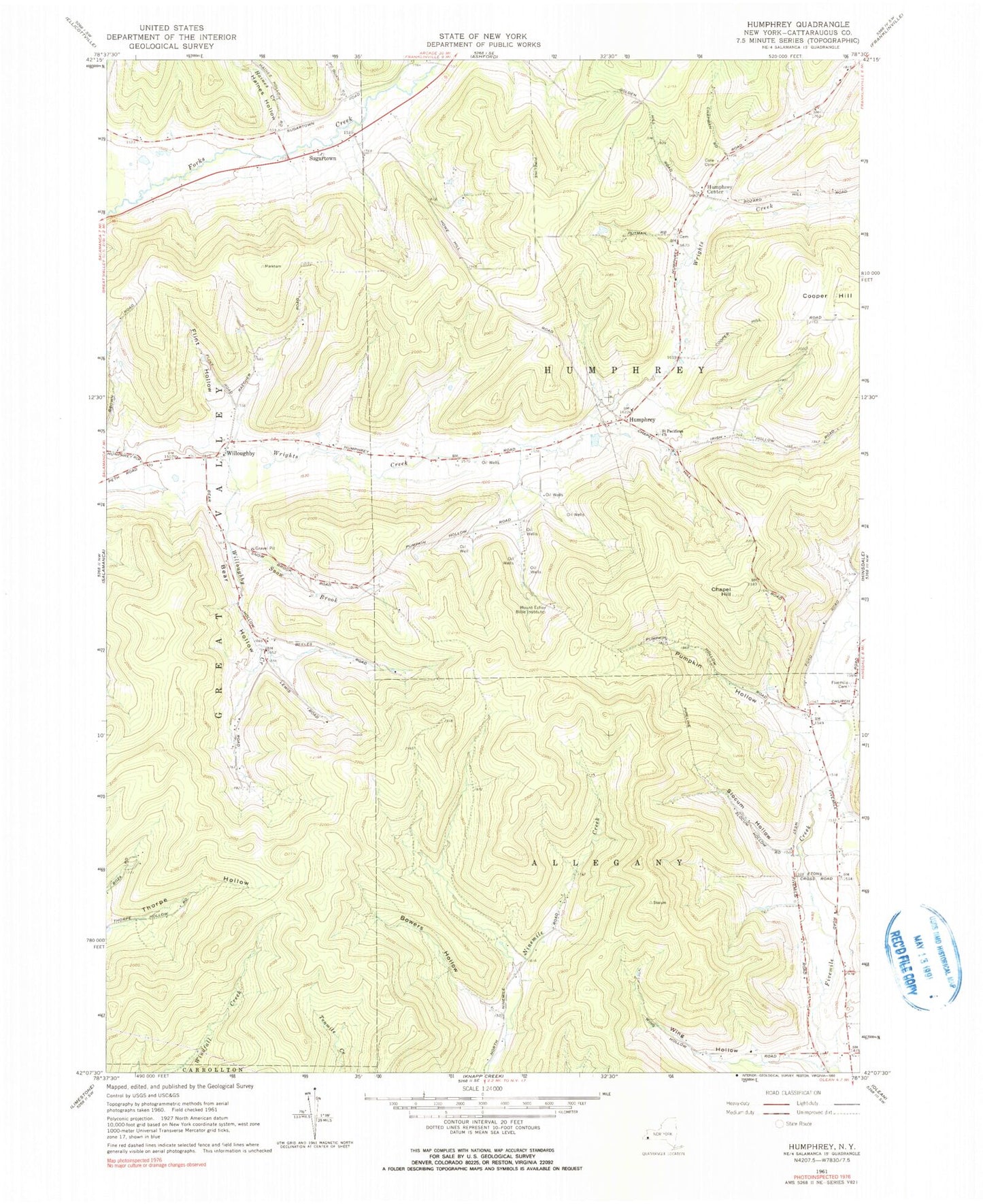
Historical USGS topographic quad map of Humphrey in the state of New York. Typical map scale is 1:24,000, but may vary for certain years, if available. Print size: 24" x 27"
This quadrangle is in the following counties: Cattaraugus.
The map contains contour lines, roads, rivers, towns, and lakes. Printed on high-quality waterproof paper with UV fade-resistant inks, and shipped rolled.
Contains the following named places: Bear Hollow, Bowers Hollow, Chapell Hill, Cole Cemetery, Cooper Hill, Fivemile Cemetery, Flint Hollow, Haines Creek, Haines Hollow, Humphrey, Humphrey Center, McGuan Hollow, Morgan Hollow, Mount Echo Bible Institute, North Hollow, Pumpkin Hollow, Saint Pacificus Church, Slocum Hollow, Snow Brook, Sugartown, Clare Creek, Willoughby, Willoughby Creek, Wing Hollow, Town of Humphrey, Great Valley Berry Patch, Sugartown Cemetery, Saint Pacificus Catholic Cemetery, Allegany - Limestone Middle School, Five Mile Baptist Church, Humphrey Baptist Church