MyTopo
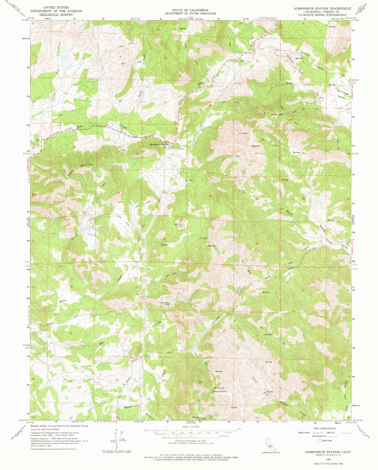
Classic USGS Humphreys Station California 7.5'x7.5' Topo Map
Couldn't load pickup availability
Historical USGS topographic quad map of Humphreys Station in the state of California. Map scale may vary for some years, but is generally around 1:24,000. Print size is approximately 24" x 27"
This quadrangle is in the following counties: Fresno.
The map contains contour lines, roads, rivers, towns, and lakes. Printed on high-quality waterproof paper with UV fade-resistant inks, and shipped rolled.
Contains the following named places: Blasingame Fire Control Station, CAL FIRE / Fresno County Fire Protection District Blasingame Station, Clara H Mine, Copper King Mine, Green Mountain, Hawkins School, Humphreys Station, Jack Thorn Mine, Keys Mountain, KJFX-FM (Fresno), Mechanicsville School, Red Mountain, Sand Creek, Sentinel, Wildcat Mountain