MyTopo
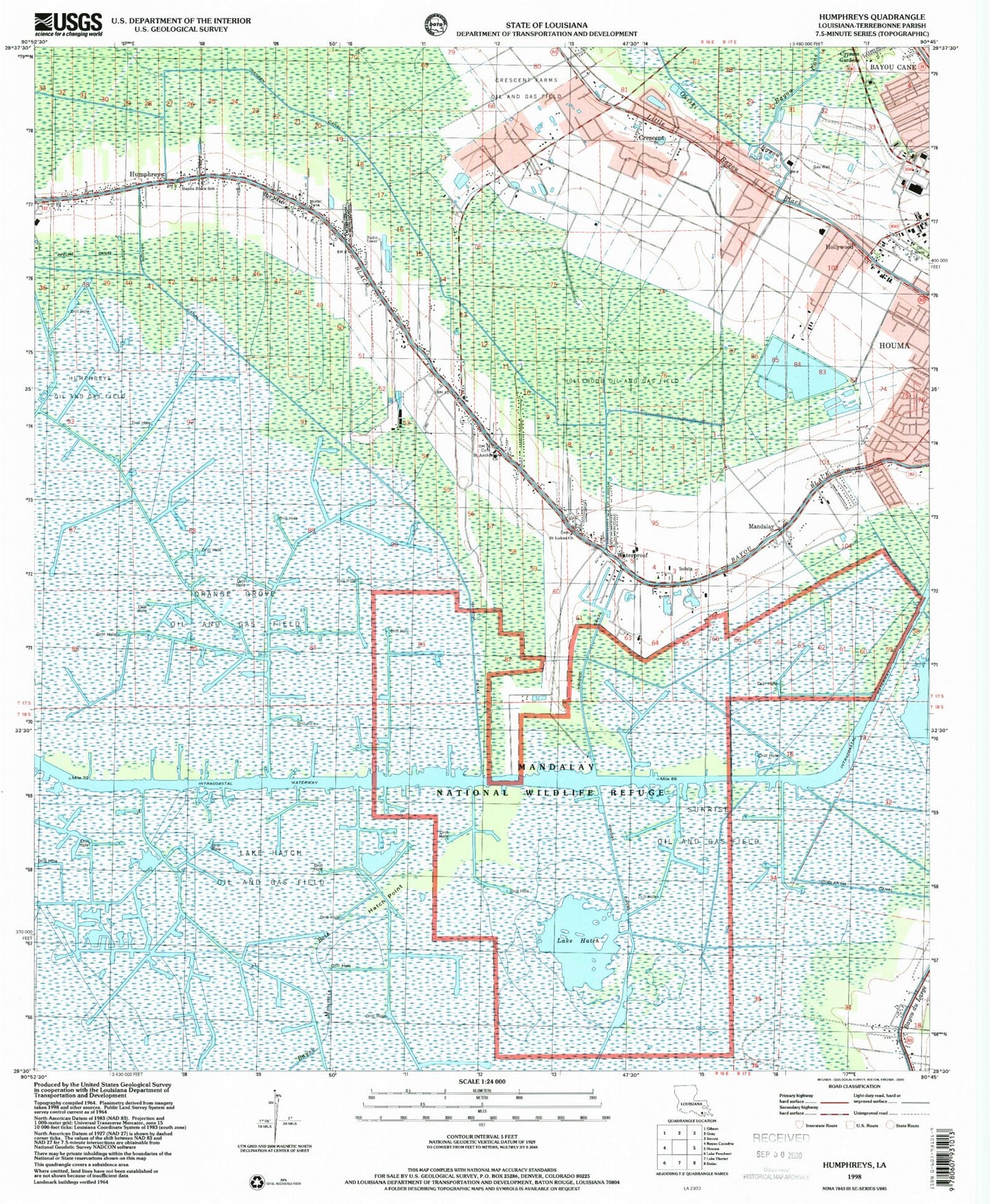
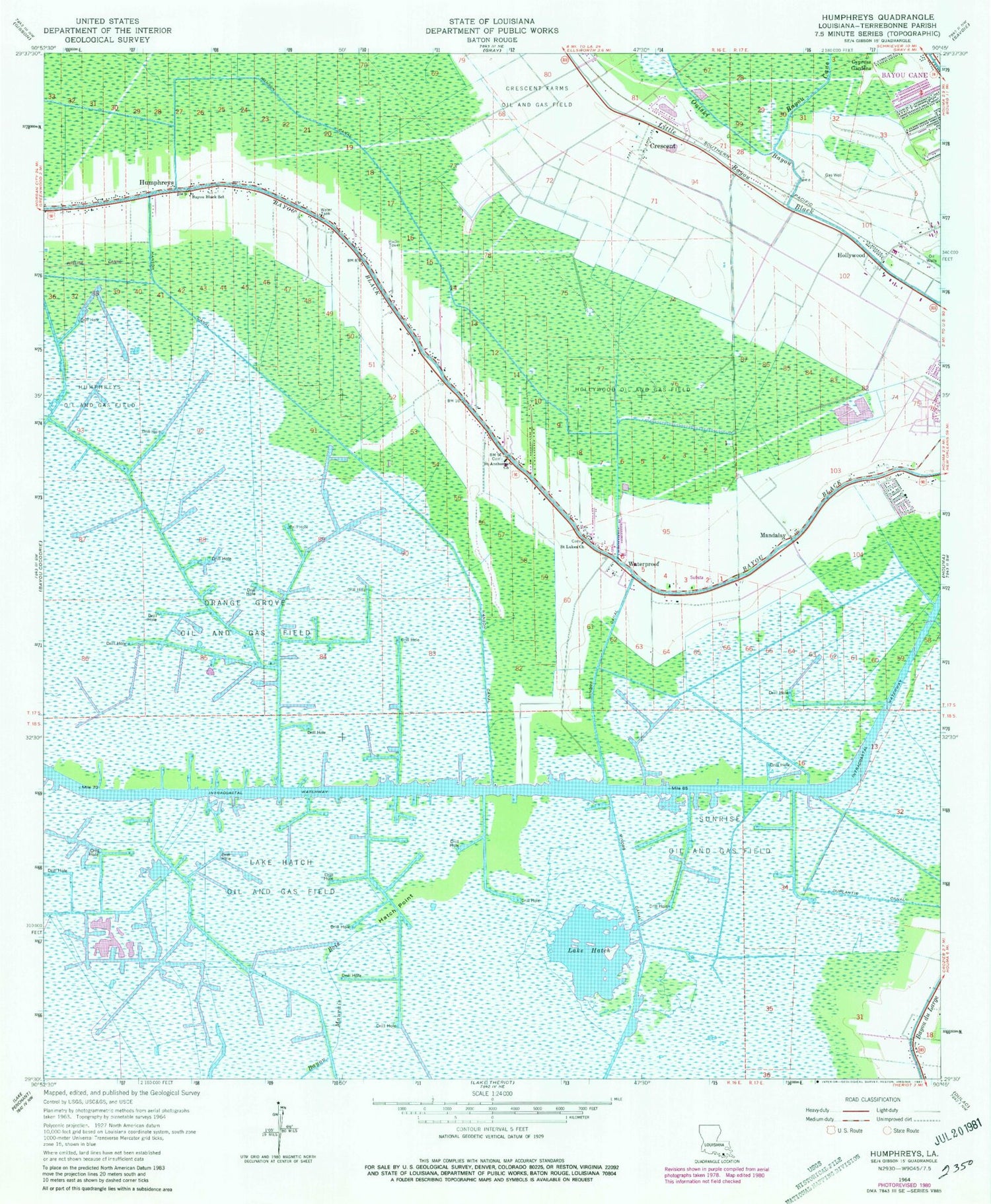
Classic USGS Humphreys Louisiana 7.5'x7.5' Topo Map
Couldn't load pickup availability
Historical USGS topographic quad map of Humphreys in the state of Louisiana. Map scale may vary for some years, but is generally around 1:24,000. Print size is approximately 24" x 27"
This quadrangle is in the following counties: Terrebonne.
The map contains contour lines, roads, rivers, towns, and lakes. Printed on high-quality waterproof paper with UV fade-resistant inks, and shipped rolled.
Contains the following named places: Bayou Black Elementary School, Bayou Black Volunteer Fire Department, Bayou Cane, Bayou Cane Census Designated Place, Crescent, Crescent Farms Oil and Gas Field, Daneco Landing Strip, Duplantis Canal, Hanson Canal, Hatch Point, Hollywood, Hollywood Oil and Gas Field, Huffaker Field, Humphreys, Humphreys Oil and Gas Field, Lake Hatch, Lake Hatch Oil and Gas Field, Mandalay, Mandalay National Wildlife Refuge, Maria Immacolata Church, Orange Grove Oil and Gas Field, Ouiski Bayou, Parish Governing Authority District J, Saint Anthonys Church, Saint Lukes Church, Sunrise Oil and Gas Field, The Church of Jesus Christ of Latter Day Saints, United Houma Nation State Designated Tribal Statistical Area, Ward Nine, Ward Two, Waterproof, ZIP Code: 70360