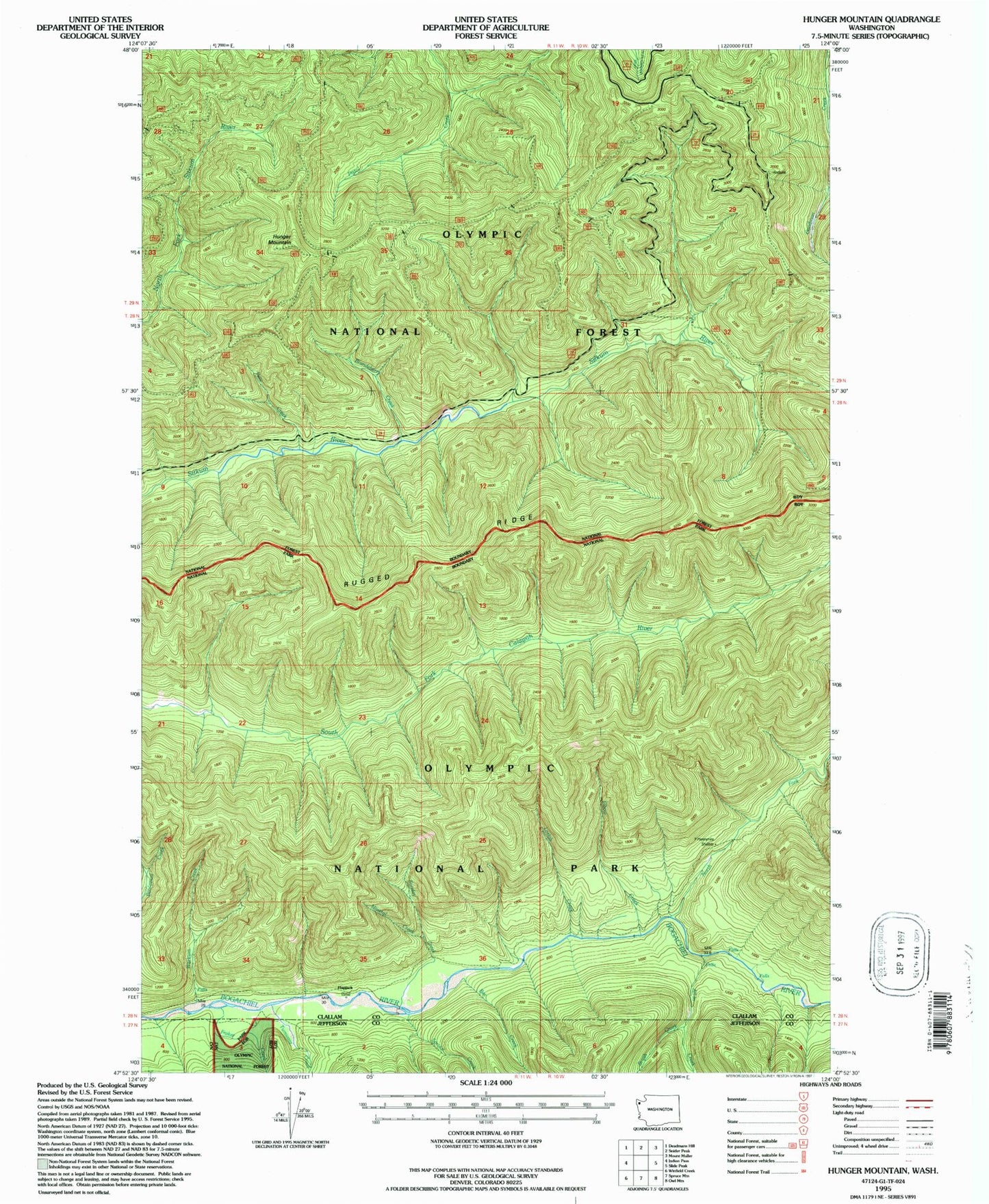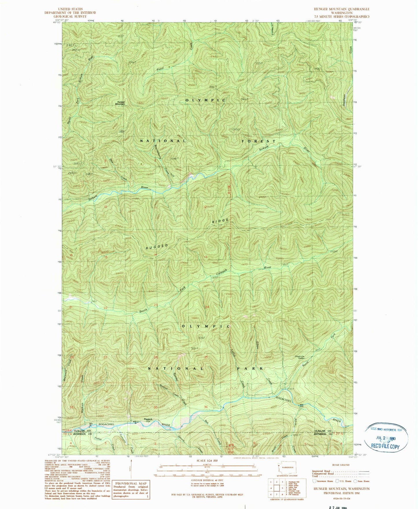

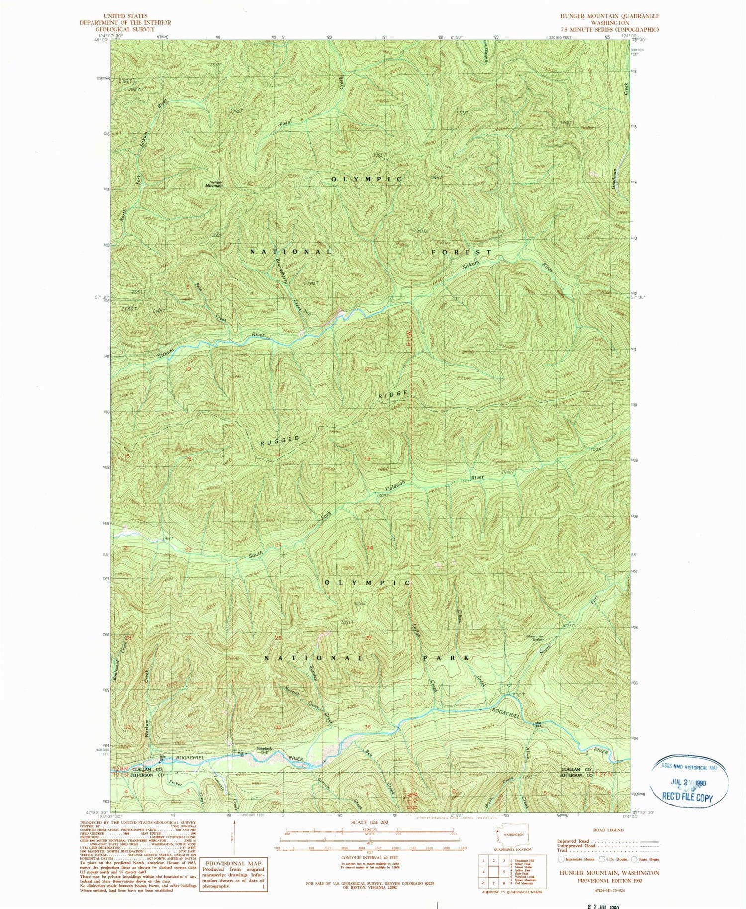
MyTopo
Classic USGS Hunger Mountain Washington 7.5'x7.5' Topo Map
Couldn't load pickup availability
Historical USGS topographic quad map of Hunger Mountain in the state of Washington. Map scale may vary for some years, but is generally around 1:24,000. Print size is approximately 24" x 27"
This quadrangle is in the following counties: Clallam, Jefferson.
The map contains contour lines, roads, rivers, towns, and lakes. Printed on high-quality waterproof paper with UV fade-resistant inks, and shipped rolled.
Contains the following named places: All-In Creek, Bee Creek, Brandeberry Creek, Brush Creek, Elbow Creek, Fifteenmile Shelter, Flapjack Shelter, Fraker Creek, Hunger Mountain, Lotloh Creek, Mineral Creek, North Fork Bogachiel River, Pete Creek, Rugged Ridge, Spruce Creek, Sunday Creek, Tumwata Creek, Vast Creek, Warkum Creek