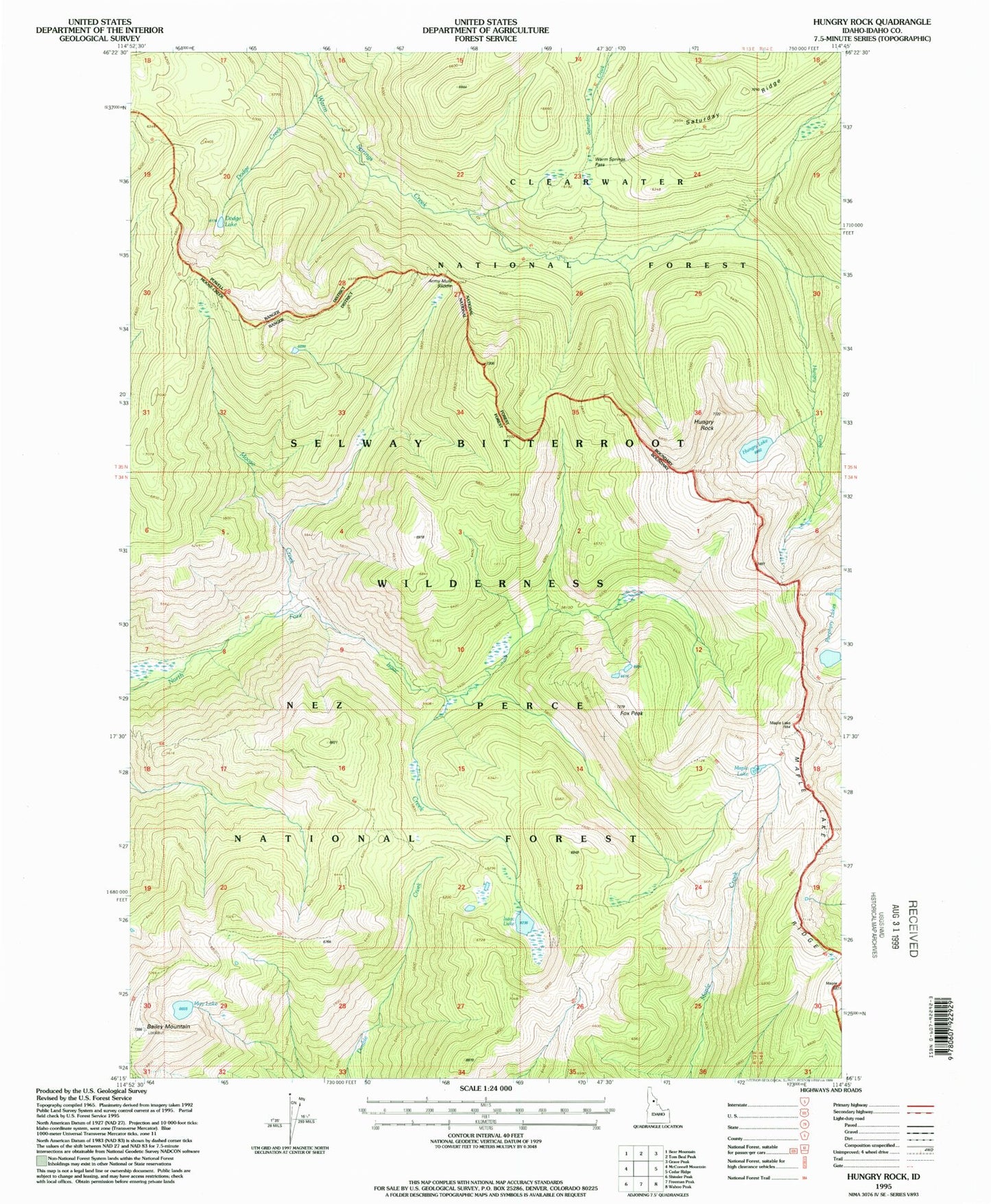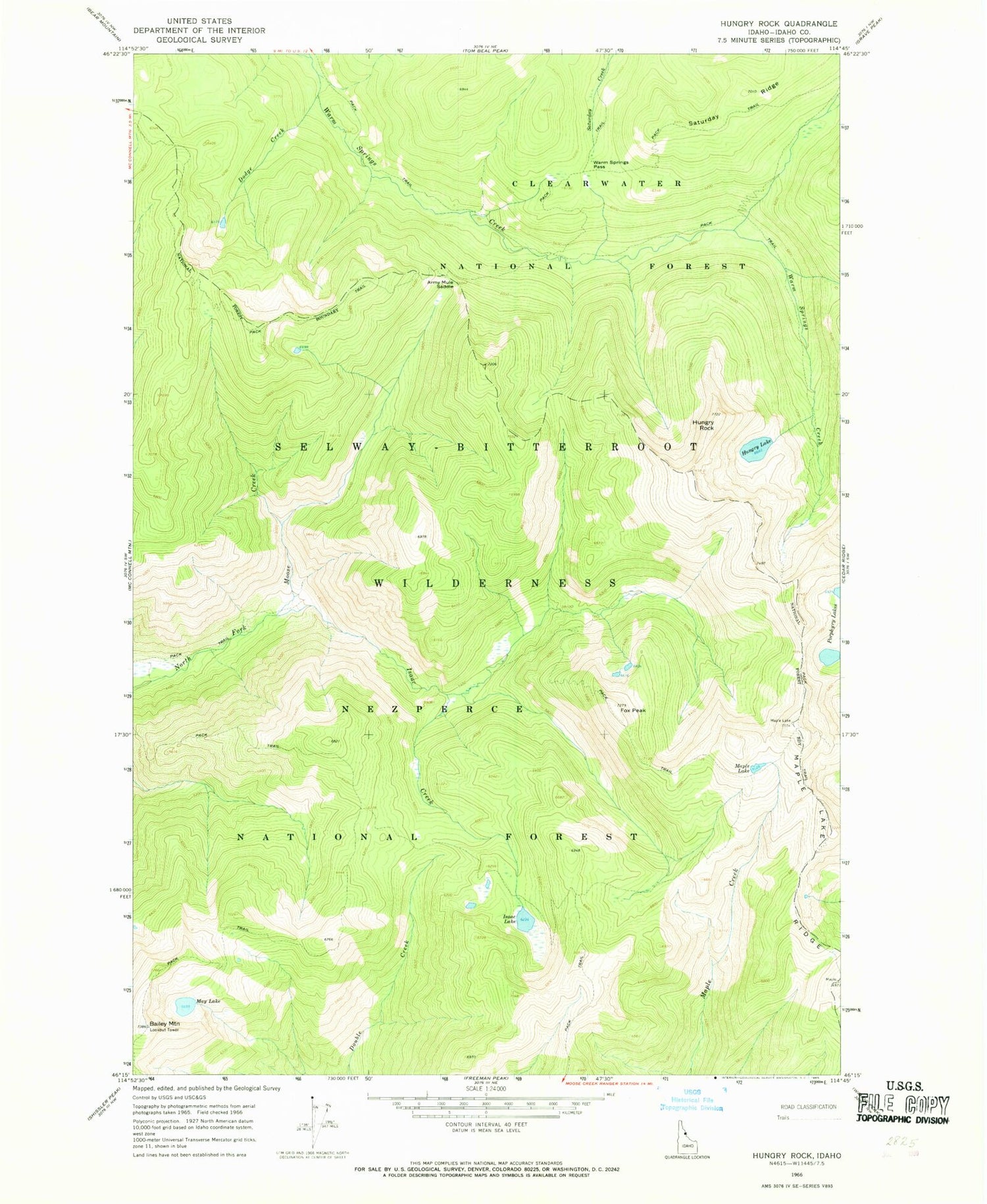
MyTopo
Classic USGS Hungry Rock Idaho 7.5'x7.5' Topo Map
Regular price
$16.95
Regular price
Sale price
$16.95
Unit price
per
Couldn't load pickup availability
Historical USGS topographic quad map of Hungry Rock in the state of Idaho. Map scale may vary for some years, but is generally around 1:24,000. Print size is approximately 24" x 27"
This quadrangle is in the following counties: Idaho.
The map contains contour lines, roads, rivers, towns, and lakes. Printed on high-quality waterproof paper with UV fade-resistant inks, and shipped rolled.
Contains the following named places: Bailey Mountain, Dodge Creek, Dodge Lake, Fox Peak, Hungry Lake, Hungry Rock, Isaac Creek, Isaac Lake, Maple Lake, Maple Lake Ridge, May Lake, Porphyry Lake, Saturday Ridge, Warm Springs Pass