MyTopo
Classic USGS Hunt Arkansas 7.5'x7.5' Topo Map
Couldn't load pickup availability
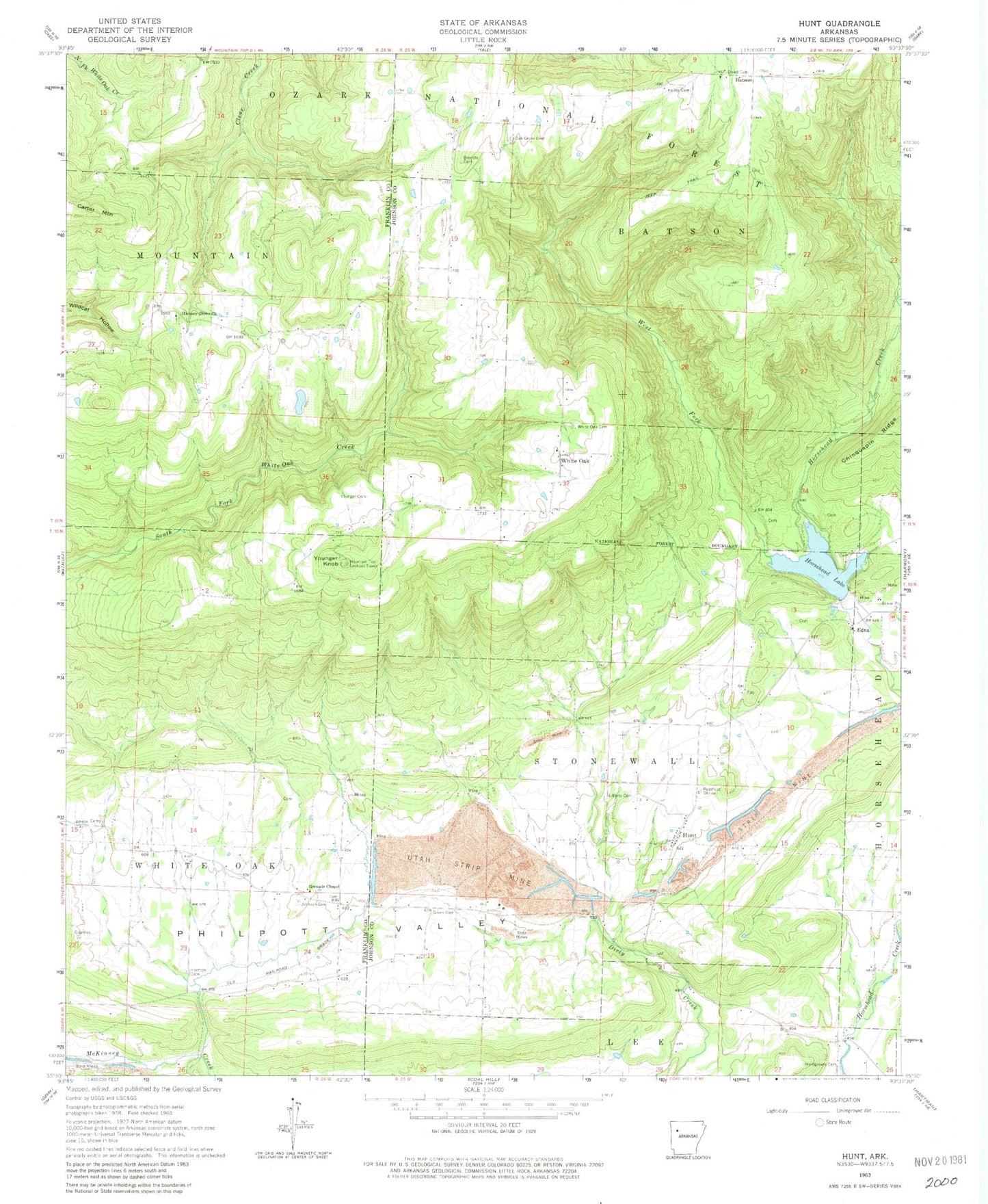
Historical USGS topographic quad map of Hunt in the state of Arkansas. Map scale may vary for some years, but is generally around 1:24,000. Print size is approximately 24" x 27"
This quadrangle is in the following counties: Franklin, Johnson.
The map contains contour lines, roads, rivers, towns, and lakes. Printed on high-quality waterproof paper with UV fade-resistant inks, and shipped rolled.
Contains the following named places: Batson, Brendle Cemetery, Buddhist Shrine, Dowd Cemetery, Edna, Green Cemetery, Grenades Chapel United Methodist Church, Hailey Cemetery, Hardgraves Cemetery, Harmon Cemetery, Hickory Grove Church, Horsehead Lake, Horsehead Lake Campground and Picnic Area, Horsehead Lake Dam, Horsehead Lake Recreation Area, Hunt, Hunt Post Office, Jackson Cemetery, Johnson County Rural Fire Department Station 11, Johnson County Rural Fire Department Station 8 Hunt, Liberty Cemetery, Linville, Mountain Lookout Tower, Mountain Top, Oak Grove, Oak Grove Cemetery, Philpott Valley, Smeadley, Township of Batson, Township of Mountain, Township of Stonewall, Utah Strip Mine, West Fork Horsehead Creek, White Oak, White Oak Cemetery, Younger Cemetery, Younger Knob