MyTopo
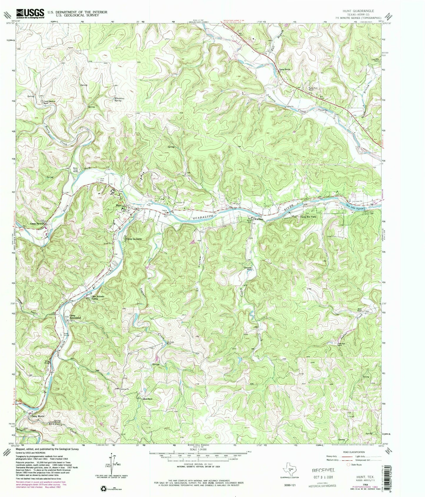
Classic USGS Hunt Texas 7.5'x7.5' Topo Map
Couldn't load pickup availability
Historical USGS topographic quad map of Hunt in the state of Texas. Map scale may vary for some years, but is generally around 1:24,000. Print size is approximately 24" x 27"
This quadrangle is in the following counties: Kerr.
The map contains contour lines, roads, rivers, towns, and lakes. Printed on high-quality waterproof paper with UV fade-resistant inks, and shipped rolled.
Contains the following named places: Baldwin Cemetery, Bittle Ranch, Blackburn Dam, Camp Arrowhead, Camp LaJunta, Camp Mystic, Camp Rio Vista, Camp Scenic, Camp Stewart, Conrad Meadows Ranch, Crider - Moore Cemetery, Cypress Creek, Dam J Lake, Domingues Ranch, Edmunson Creek, Fall Branch, Henderson Branch, Henderson Springs, Honey Creek, Honey Creek Ranch, Horsman Dam, Hunt, Hunt Cemetery, Hunt Post Office, Hunt Volunteer Fire Department, Indian Springs, Ingram Lake Dam, Kelley Creek, Kelly Springs, Kerr County, La Hacienda Treatment Center, Lake New Ingram, Lange Ravine, Lazy Hills Ranch, Lazy Lane Ranch, Moore Ranch, North Fork Guadalupe River, Ox Hollow, Rocky Ford Ranch, San Antonio Camp, South Fork Guadalupe River, Tegener Creek, Tegener Springs, Trails End Ranch, Waltonia, Whetstone Spring, Willis Lake, Willis Lake Dam, ZIP Code: 78025